
MyTopo
Palmdale Florida US Topo Map
Couldn't load pickup availability
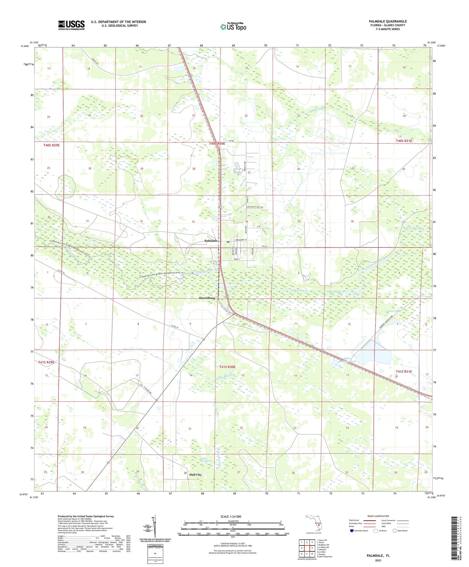
2024 topographic map quadrangle Palmdale in the state of Florida. Scale: 1:24000. Based on the newly updated USGS 7.5' US Topo map series, this map is in the following counties: Glades. The map contains contour data, water features, and other items you are used to seeing on USGS maps, but also has updated roads and other features. This is the next generation of topographic maps. Printed on high-quality waterproof paper with UV fade-resistant inks.
Quads adjacent to this one:
West: La Belle NW
Northwest: Venus SW
North: Venus
Northeast: Brighton SW
East: Lakeport
Southeast: Lake Hicpochee
South: Goodno
Southwest: La Belle
This map covers the same area as the classic USGS quad with code o26081h3.
Contains the following named places: Hall City, Harrisburg, Lykes Brothers Pond, Lykes Palmdale Airport, Marco Christian Fellowship Church, Palmdale, Palmdale Lookout Tower, Palmdale Post Office, Palmdale Volunteer Fire Department, Picnic Lake, Rock Lake, Southwest Glades Division, Tom Lykes Park, ZIP Code: 33944


