MyTopo
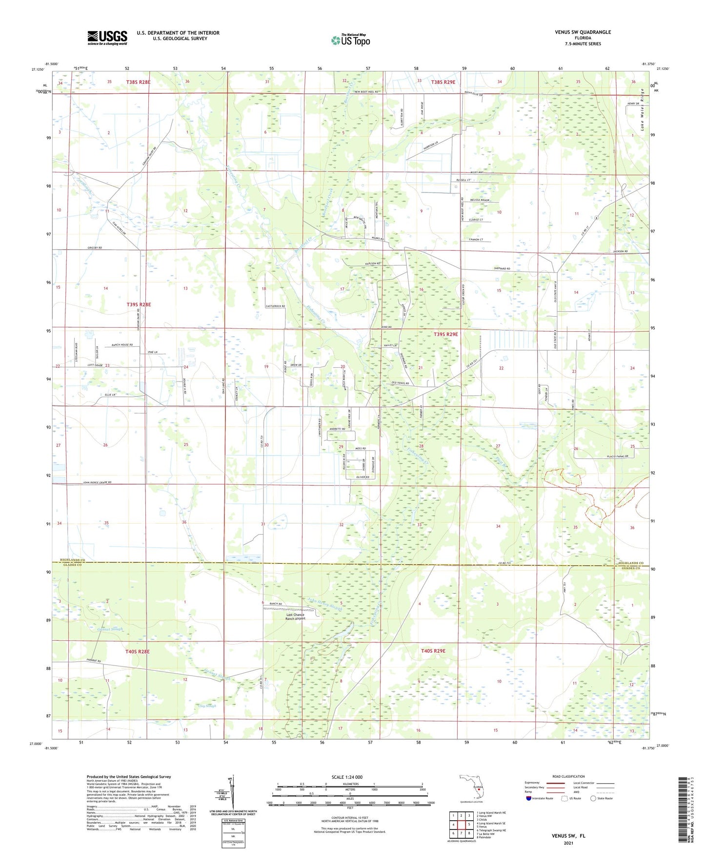
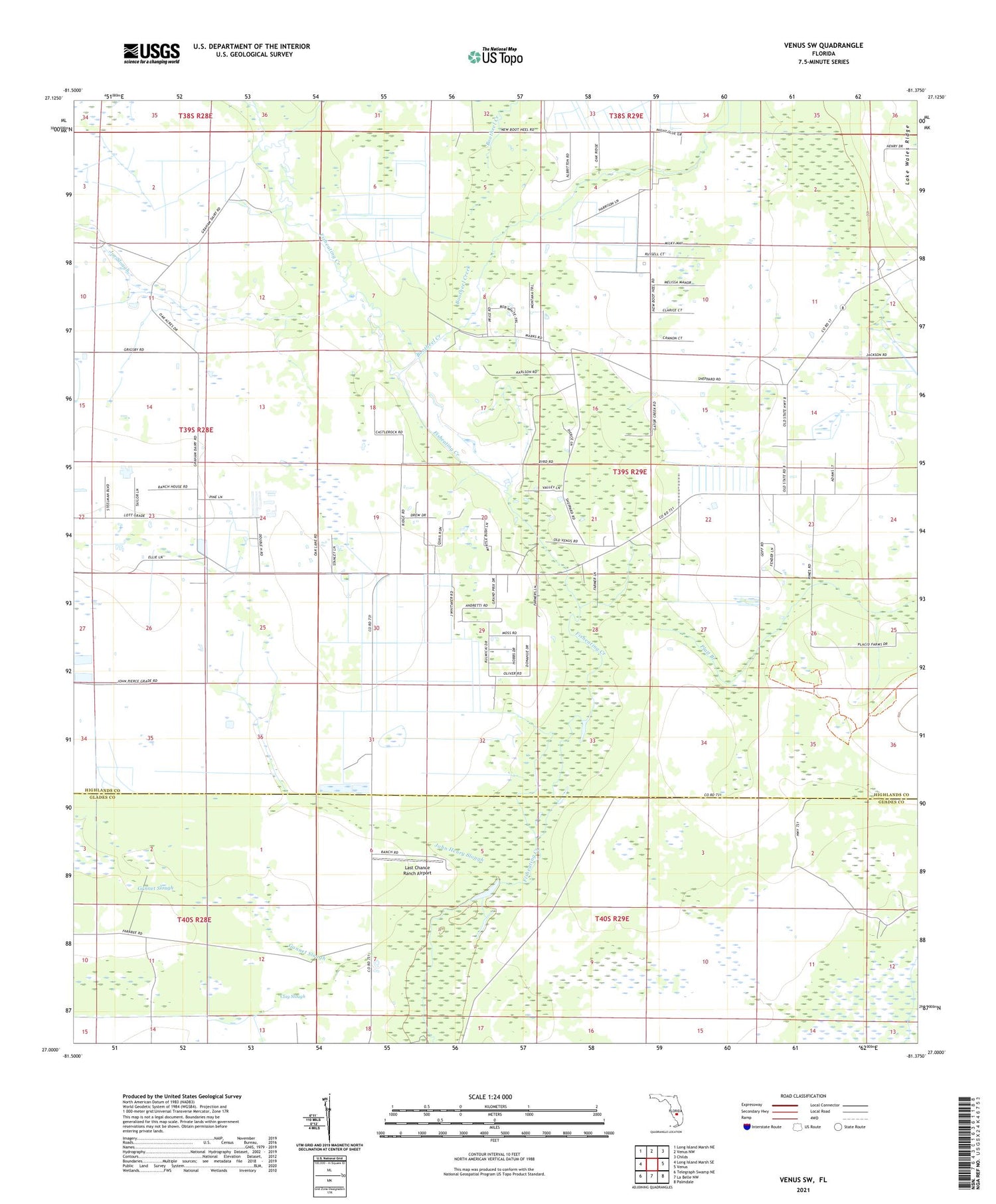
Venus SW Florida US Topo Map
Couldn't load pickup availability
2024 topographic map quadrangle Venus SW in the state of Florida. Scale: 1:24000. Based on the newly updated USGS 7.5' US Topo map series, this map is in the following counties: Highlands, Glades. The map contains contour data, water features, and other items you are used to seeing on USGS maps, but also has updated roads and other features. This is the next generation of topographic maps. Printed on high-quality waterproof paper with UV fade-resistant inks.
Quads adjacent to this one:
West: Long Island Marsh SE
Northwest: Long Island Marsh NE
North: Venus NW
Northeast: Childs
East: Venus
Southeast: Palmdale
South: La Belle NW
Southwest: Telegraph Swamp NE
This map covers the same area as the classic USGS quad with code o27081a4.
Contains the following named places: Bootheel Creek, Clay Slough, Joe Slough, John Henry Slough, Last Chance Ranch Airport, Old Venus, Platt Branch, ZIP Code: 33960