
MyTopo
Sugarloaf Key Florida US Topo Map
Couldn't load pickup availability
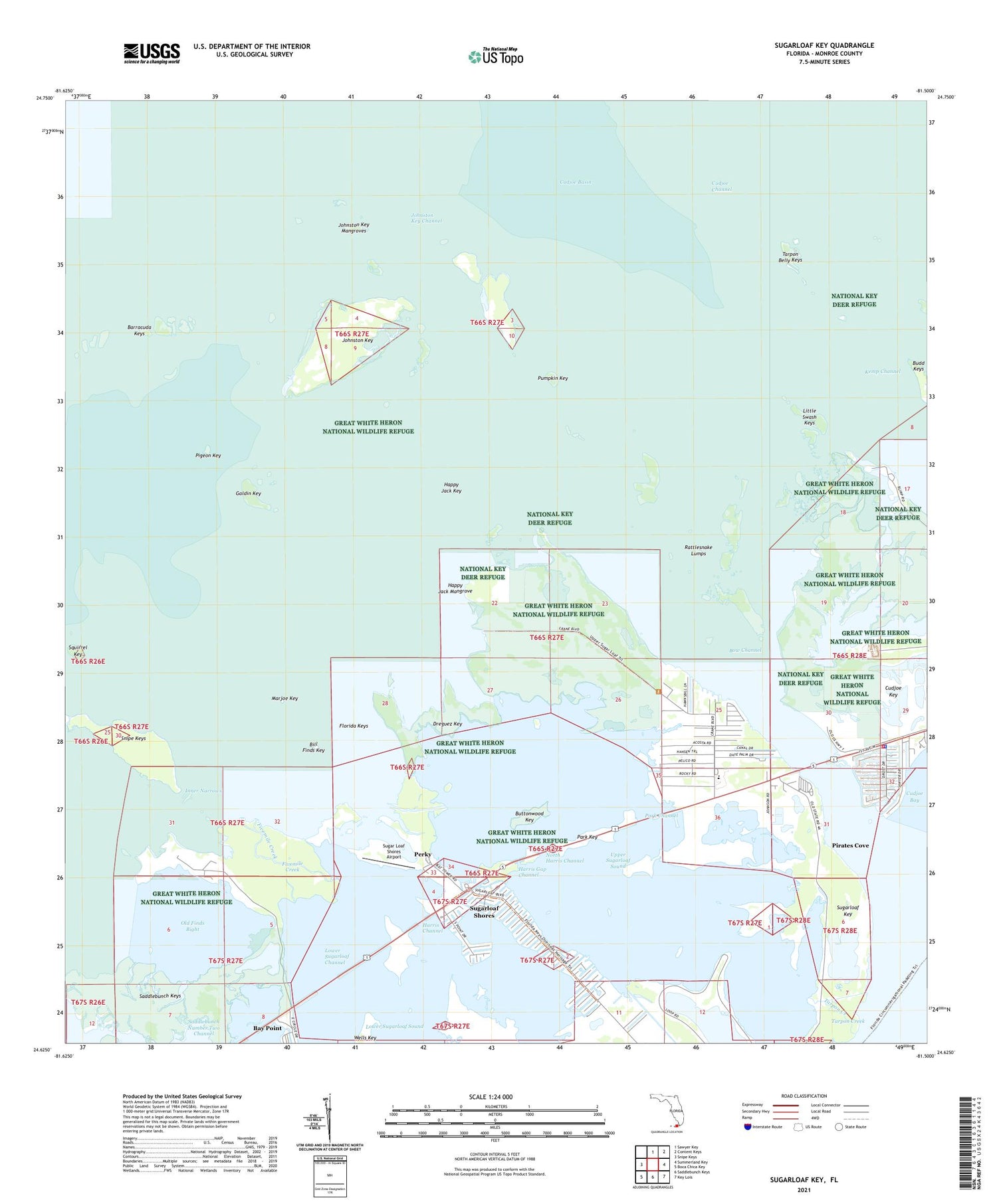
2025 topographic map quadrangle Sugarloaf Key in the state of Florida. Scale: 1:24000. Based on the newly updated USGS 7.5' US Topo map series, this map is in the following counties: Monroe. The map contains contour data, water features, and other items you are used to seeing on USGS maps, but also has updated roads and other features. This is the next generation of topographic maps. Printed on high-quality waterproof paper with UV fade-resistant inks.
Quads adjacent to this one:
West: Snipe Keys
North: Sawyer Key
Northeast: Content Keys
East: Summerland Key
Southeast: Key Lois
South: Saddlebunch Keys
Southwest: Boca Chica Key
This map covers the same area as the classic USGS quad with code o24081f5.
Contains the following named places: Bay Point, Bill Finds Key, Bow Channel, Budd Keys, Buttonwood Key, Cudjoe Basin, Cudjoe Channel, Dreguez Key, Fivemile Creek, Florida Keys, Galdin Key, Great White Heron National Wildlife Refuge, Happy Jack Key, Happy Jack Mangrove, Harris Channel, Harris Gap Channel, Inner Narrows, Johnston Key, Johnston Key Channel, Johnston Key Mangroves, Little Swash Keys, Lower Sugarloaf Channel, Lower Sugarloaf Sound, Marjoe Key, Monroe County Fire Department Station 11 Cudjoe, Monroe County Sheriff's Office Freeman Substation, North Harris Channel, Old Finds Bight, Park Channel, Park Key, Perky, Perky Post Office, Pigeon Key, Pirates Cove, Pumpkin Key, Rattlesnake Lumps, Saddlebunch Number Two Channel, Squirrel Key, Sugar Loaf Shores Airport, Sugarloaf Key, Sugarloaf Key Volunteer Fire Department, Sugarloaf Key Volunteer Fire Department Station 10, Sugarloaf School, Sugarloaf Shores, Tarpon Belly Keys, Tarpon Creek, Turkey Basin, Upper Sugarloaf Sound, WAIL-FM (Key West), Wells Key, WEOW-FM (Key West), WETV-TV (Key West), WEYS-TV (Key West), WPIK-FM (Summerland Key), WWFT-FM (Key West), ZIP Code: 33042


