MyTopo
Axson Georgia US Topo Map
Couldn't load pickup availability
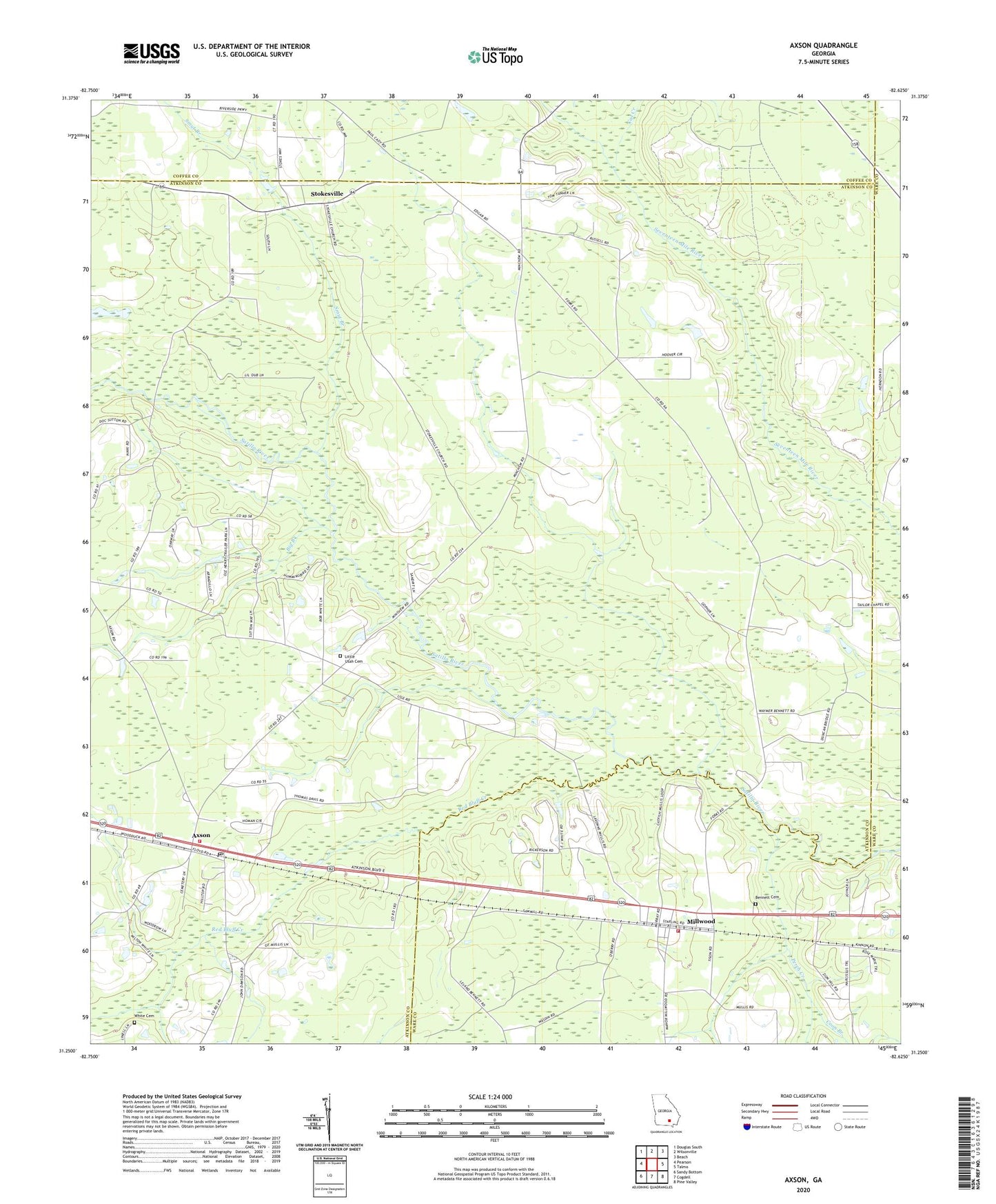
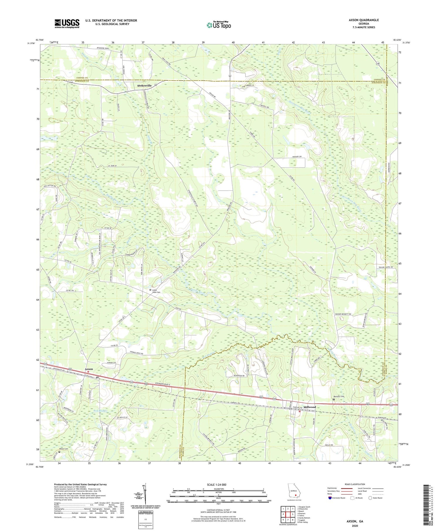
2024 topographic map quadrangle Axson in the state of Georgia. Scale: 1:24000. Based on the newly updated USGS 7.5' US Topo map series, this map is in the following counties: Atkinson, Ware, Coffee. The map contains contour data, water features, and other items you are used to seeing on USGS maps, but also has updated roads and other features. This is the next generation of topographic maps. Printed on high-quality waterproof paper with UV fade-resistant inks.
Quads adjacent to this one:
West: Pearson
Northwest: Douglas South
North: Wilsonville
Northeast: Beach
East: Talmo
Southeast: Pine Valley
South: Cogdell
Southwest: Sandy Bottom
This map covers the same area as the classic USGS quad with code o31082c6.
Contains the following named places: Atkinson County Volunteer Fire Department Station 1, Axson, Axson Cemetery, Axson Census Designated Place, Axson Church, Axson Community Cemetery, Axson Division, Axson Post Office, Bennett Cemetery, Big Branch, Cat Creek, Coon Branch, First Born Church, Little Red Bluff Creek, Little Utah Cemetery, Millwood, Millwood Census Designated Place, Millwood Church, Millwood Village Post Office, Mount Zion Church, Perch Creek, Red Bluff Creek, Smut Branch, Stokesville, Stokesville Church, Stokesville Church Cemetery, Utah Church, Ware County Fire Rescue Station 7 Millwood, White Cemetery, ZIP Code: 31624