
MyTopo
Pearson Georgia US Topo Map
Couldn't load pickup availability
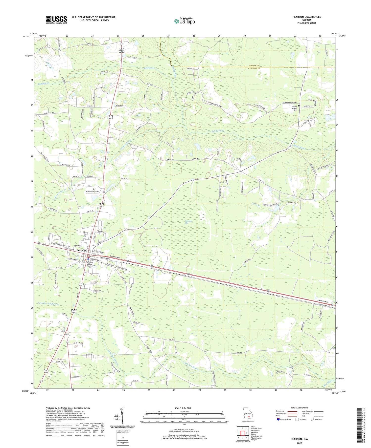
2024 topographic map quadrangle Pearson in the state of Georgia. Scale: 1:24000. Based on the newly updated USGS 7.5' US Topo map series, this map is in the following counties: Atkinson, Coffee. The map contains contour data, water features, and other items you are used to seeing on USGS maps, but also has updated roads and other features. This is the next generation of topographic maps. Printed on high-quality waterproof paper with UV fade-resistant inks.
Quads adjacent to this one:
West: Kirkland
Northwest: Mora
North: Douglas South
Northeast: Wilsonville
East: Axson
Southeast: Cogdell
South: Sandy Bottom
Southwest: Henderson Still
This map covers the same area as the classic USGS quad with code o31082c7.
Contains the following named places: Atkinson County Courthouse, Atkinson County Jail, Atkinson County Junior High School, Atkinson County Sheriff's Office, Atkinson Volunteer Fire Department Station 2, City of Pearson, Fales Church, Jowers Chapel Cemetery, Mount Pleasant Church, Mount Pleasant Missionary Baptist Church Cemetery, Mount Zion Baptist Church Cemetery, Mount Zion Church, Pearson, Pearson Cemetery, Pearson Elementary School, Pearson Police Dept, Pearson Post Office, Pudding Creek, Refuge Church, Ricketson Bay, Sweetwater Church, Sweetwater Creek, Sweetwater United Methodist Church Cemetery, Union Hill Cemetery, Union Hill Church


