MyTopo
Bolingbroke Georgia US Topo Map
Couldn't load pickup availability
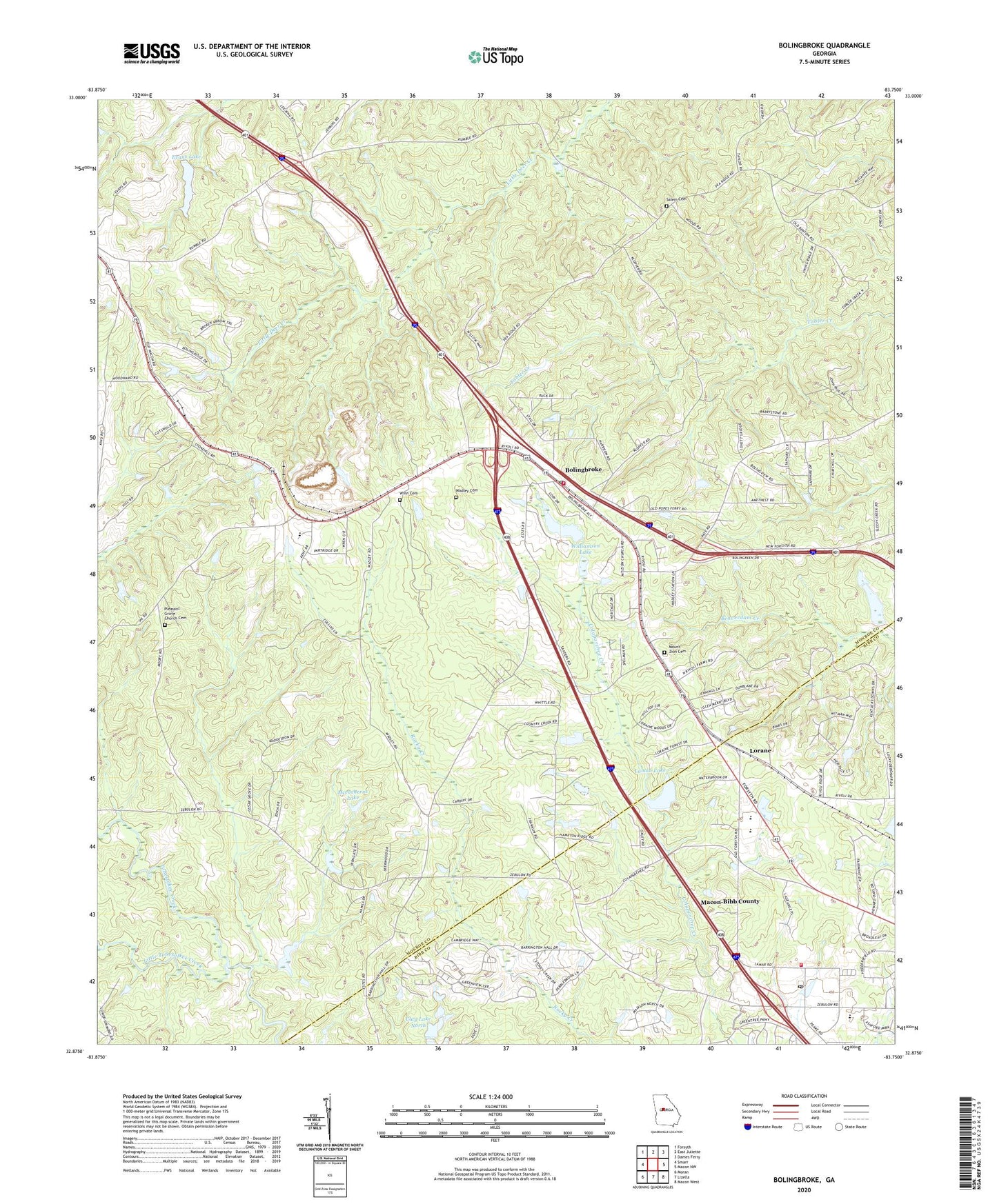
2024 topographic map quadrangle Bolingbroke in the state of Georgia. Scale: 1:24000. Based on the newly updated USGS 7.5' US Topo map series, this map is in the following counties: Monroe, Bibb. The map contains contour data, water features, and other items you are used to seeing on USGS maps, but also has updated roads and other features. This is the next generation of topographic maps. Printed on high-quality waterproof paper with UV fade-resistant inks.
Quads adjacent to this one:
West: Smarr
Northwest: Forsyth
North: East Juliette
Northeast: Dames Ferry
East: Macon NW
Southeast: Macon West
South: Lizella
Southwest: Moran
This map covers the same area as the classic USGS quad with code o32083h7.
Contains the following named places: Bolingbroke, Bolingbroke Census Designated Place, Bolingbroke Methodist Church, Bolingbroke Post Office, Clay Lake North, Clay Lake North Dam, Colaparchee Church, Colaparchee Creek, Deerlick Academy, Evans Lake, Evans Lake Dam, First South Church, Howard Chapel, Jobes Chapel, Lamon Lake, Lamon Lake Dam, Little Tobesofkee Creek, Lorane, Macon - Bibb County Fire Department Station 108, Mceacherns Lake, Mceacherns Lake Dam, Midway School, Monroe County Fire Department Station 4, Mount Zion Academy, Mount Zion Cemetery, Mount Zion Church, Pleasant Grove Church, Pleasant Grove Church Cemetery, Rivoli Plantation, Rosenwall School, Saint Paul Church, Salem Cemetery, Salem Church, Union Church, United Church, Wadley Cemetery, WFXM-FM (Forsyth), William Chapel, Williamson Lake, Winn Cemetery, Zebulon Branch Post Office