
MyTopo
Smarr Georgia US Topo Map
Couldn't load pickup availability
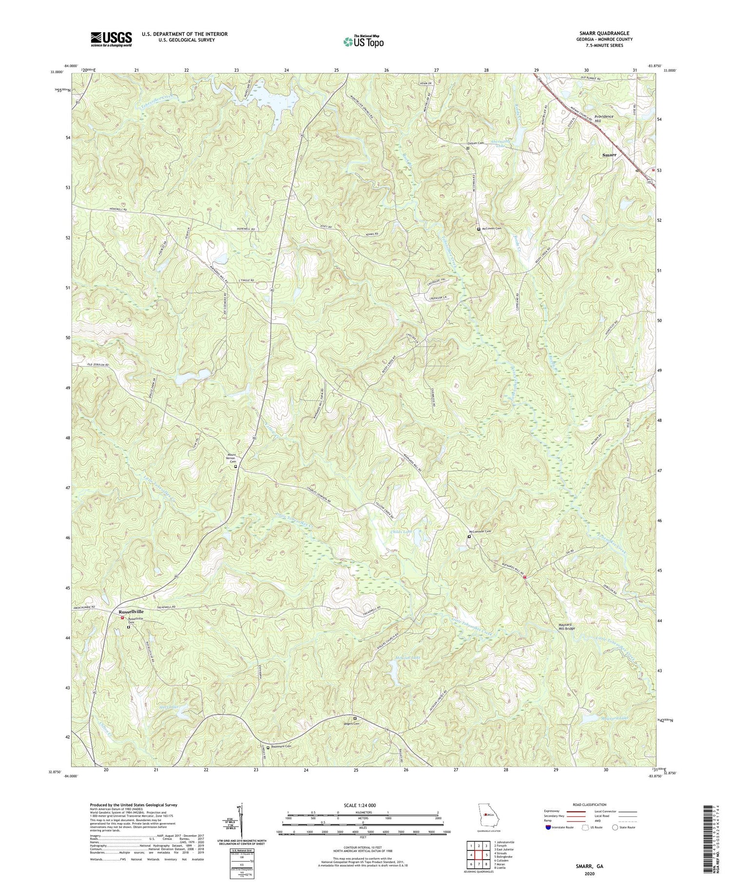
2024 topographic map quadrangle Smarr in the state of Georgia. Scale: 1:24000. Based on the newly updated USGS 7.5' US Topo map series, this map is in the following counties: Monroe. The map contains contour data, water features, and other items you are used to seeing on USGS maps, but also has updated roads and other features. This is the next generation of topographic maps. Printed on high-quality waterproof paper with UV fade-resistant inks.
Quads adjacent to this one:
West: Strouds
Northwest: Johnstonville
North: Forsyth
Northeast: East Juliette
East: Bolingbroke
Southeast: Lizella
South: Moran
Southwest: Culloden
This map covers the same area as the classic USGS quad with code o32083h8.
Contains the following named places: Abernathy Dam, Abernathy Lake, Bamah, Bazemore Cemetery, Bethlehem Church, Central Georgia Technical College - Monroe County Center, Childs Lake, Childs Lake Dam, Church of Christ, Culloden-Bolingbroke Division, Ebenezer Church, Hart Dam, Hart Lake, Hopewell Church, Hopewell School, Maynard Lake, Maynard Lake Dam, Maynard Mill Bridge, McCommon Cemetery, McCook Dam, McCook Lake, McCowen Cemetery, Midway Church, Midway Church Cemetery, Midway School, Monroe County Fire Department Station 10, Monroe County Fire Department Station 11, Monroe County Fire Department Station 9, Mount Pleasant Church, Mount Vernon Cemetery, Mount Vernon Church, Mount Zion Church, New Pine Grove Church, New Providence Church, Providence Hill, Reedy Creek, Rock Branch, Rogers Cemetery, Rogers Methodist Church, Russellville, Russellville Baptist Church, Russellville Cemetery, School Number 27, Smarr, Smarr Census Designated Place, Smarr Post Office, Spring Hill, Todd Creek, WFXM-FM (Forsyth), Yellow Creek, Zellner Cemetery


