MyTopo
Bowdens Pond Georgia US Topo Map
Couldn't load pickup availability
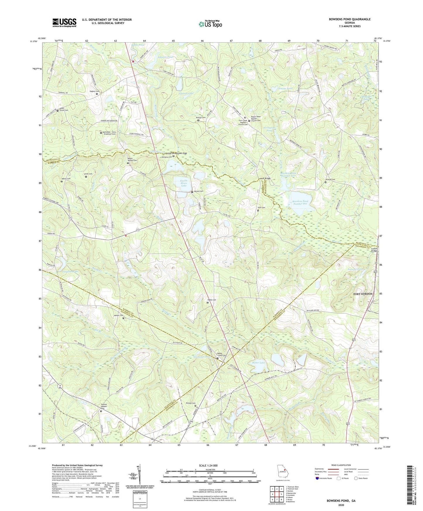
2024 topographic map quadrangle Bowdens Pond in the state of Georgia. Scale: 1:24000. Based on the newly updated USGS 7.5' US Topo map series, this map is in the following counties: McDuffie, Warren, Jefferson, Glascock. The map contains contour data, water features, and other items you are used to seeing on USGS maps, but also has updated roads and other features. This is the next generation of topographic maps. Printed on high-quality waterproof paper with UV fade-resistant inks.
Quads adjacent to this one:
West: Bastonville
Northwest: Thomson West
North: Thomson East
Northeast: Harlem
East: Avondale
Southeast: Matthews
South: Wrens
Southwest: Gibson
This map covers the same area as the classic USGS quad with code o33082c4.
Contains the following named places: Adkins Cemetery, Alleluia Community Cemetery, Arrington Mill, Arrington Pond, Arringtons Pond, Autney, Barksdale - Story - Bradshaw Cemetery, Bowdens Pond, Bowdens Pond Dam Number One, Bowdens Pond Dam Number Two, Bowdens Pond Number One, Bowdens Pond Number Two, Bradshaw Lake, Calvary Church, David, Davis School, Fort Creek, Fort Creek Baptist Church Cemetery, Fort Creek Church, Fort Creek School, Gin Branch, Guy Branch, Hadden, Happy Valley, Harrison School, Hobbs Cemetery, Hobbs Mill, Hobbs Pond, Howard Branch, Huber Lake, Huber Lake Dam, Huff Bridge, Huff Cemetery, Hughes Cemetery, Johnson Dam, Johnson Lake, Johnson Pond, Johnson Pond Dam, Jones Grove Cemetery, Jones Grove Church, Kaolin Lake Dam, Kaolin Mines Lake, Kaolin Mines Lake Dam, Langham Dam, Langham Lake, Little Brasstown Gap, Little Brier Creek, Luckie Bridge, Magahee Ponds, McDuffie County Fire Department Station 5, McLain Cemetery, McNair Cemetery, Mill Branch, Mount Aldred Cemetery, Mount Aldrich Church, Mount Beulah Baptist Church, Newsomes Pond, Panhandle Division, Phillips Cemetery, Poplar Head Baptist Church Cemetery, Poplar Head Church and School, Prescott Pond, Printup Cemetery, Purvis School, Rayburn Branch, Reedy Creek Cemetery, Reedy Creek Church, Rodgers Church, Shady Grove School, Simons Pond, Simons Pond Dam, Smith Cemetery, Steep Hollow School, Sweetwater Creek, Tabernacle School, Thomas Hadden Cemetery, Thompson Branch, Thomson Ford Branch, Warren County Fire Department Panhandle Station, Williams Cemetery, WRDW-FM (Wrens), Zoar United Methodist Church