
MyTopo
Matthews Georgia US Topo Map
Couldn't load pickup availability
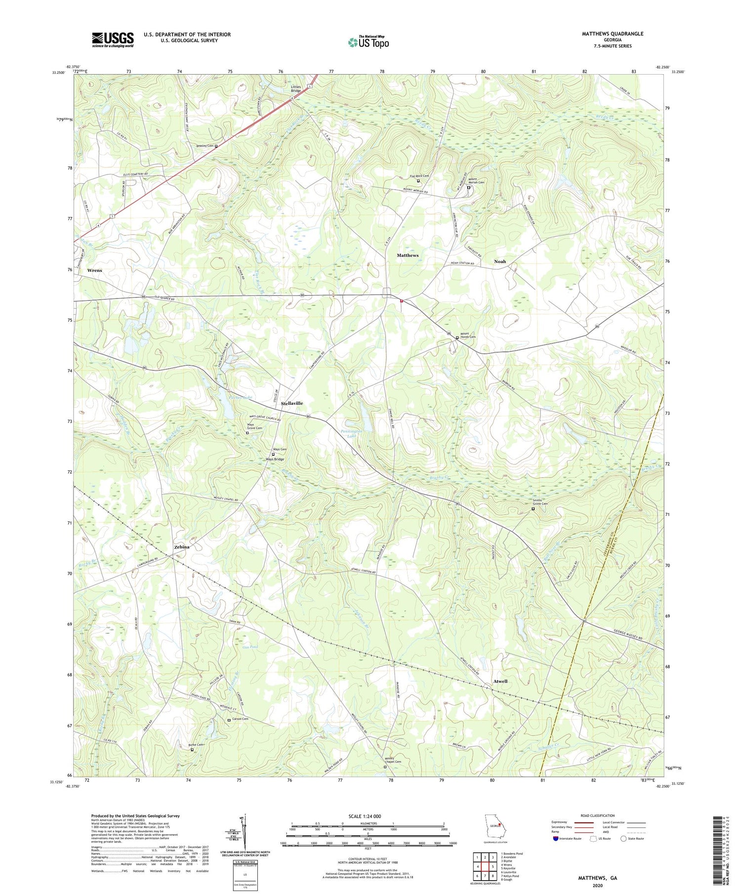
2024 topographic map quadrangle Matthews in the state of Georgia. Scale: 1:24000. Based on the newly updated USGS 7.5' US Topo map series, this map is in the following counties: Jefferson, Burke. The map contains contour data, water features, and other items you are used to seeing on USGS maps, but also has updated roads and other features. This is the next generation of topographic maps. Printed on high-quality waterproof paper with UV fade-resistant inks.
Quads adjacent to this one:
West: Wrens
Northwest: Bowdens Pond
North: Avondale
Northeast: Blythe
East: Keysville
Southeast: Gough
South: Kellys Pond
Southwest: Louisville
This map covers the same area as the classic USGS quad with code o33082b3.
Contains the following named places: Atwell, Atwell School, Beasley Cemetery, Brinson Crossing, Bull Nose Branch, Burke Cemetery, Carson Cemetery, Eliott Barrow Airport, Flat Rock Branch, Flat Rock Cemetery, Flat Rock Church, Goodins Pond, Gun Pond, Hadden Branch, Harmony Church, Johnson Branch, Jordan Branch, Littles Bridge, Matthews, Matthews Census Designated Place, Matthews Community Fire Department, Matthews Junior High School, Moses Chapel Church, Mosley Chapel Cemetery, Mount Horeb Cemetery, Mount Horeb Church, Mount Moriah Campgrounds, Mount Moriah Cemetery, Mount Moriah Church, Noah, Nortons Millrace, Ocala School, Oliphant Pond, Padgett Crossing, Pennington Lake, Pennington Lake Dam, Pilcher Lake, Pilcher Lake Dam, Smiths Grove Cemetery, Smiths Grove Church, Stellaville, Stellaville Junior High School, Thomas Spring Hill School, Thomason Spring Hill Church, Ways Bridge, Ways Cemetery, Ways Church, Ways Grove Cemetery, Ways Grove Church, Wrens Division, Zebina, ZIP Code: 30833


