MyTopo
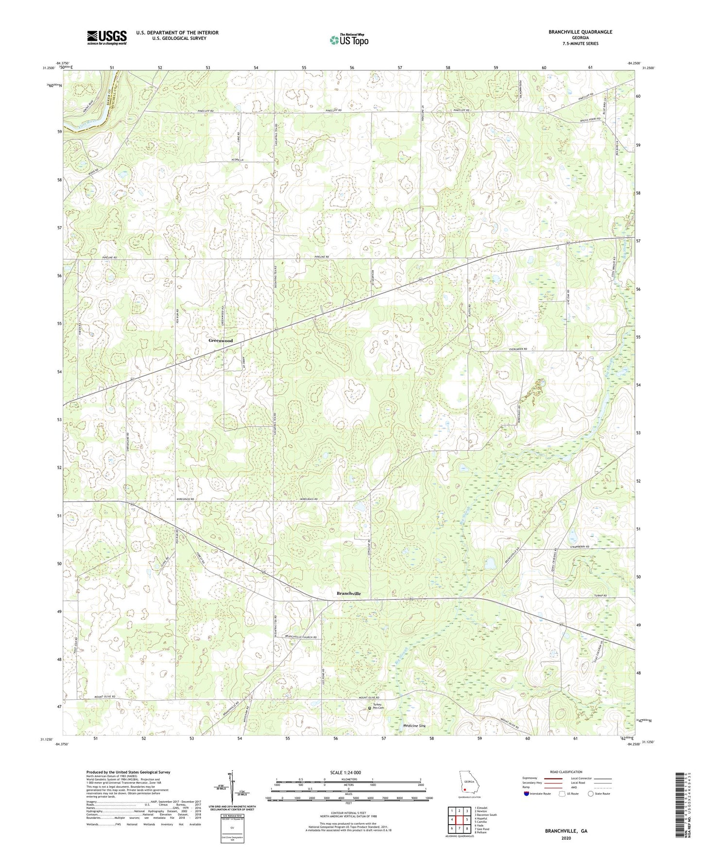
Branchville Georgia US Topo Map
Couldn't load pickup availability
2024 topographic map quadrangle Branchville in the state of Georgia. Scale: 1:24000. Based on the newly updated USGS 7.5' US Topo map series, this map is in the following counties: Mitchell, Baker. The map contains contour data, water features, and other items you are used to seeing on USGS maps, but also has updated roads and other features. This is the next generation of topographic maps. Printed on high-quality waterproof paper with UV fade-resistant inks.
Quads adjacent to this one:
West: Hopeful
Northwest: Elmodel
North: Newton
Northeast: Baconton South
East: Camilla
Southeast: Pelham
South: Gee Pond
Southwest: Vada
This map covers the same area as the classic USGS quad with code o31084b3.
Contains the following named places: Antioch Church, Big Slough, Branchville, Branchville Church, Evergreen Church, Greenwood, Greenwood Freewill Baptist Church, Medicine Sink, Mount Zion Church, Mount Zion Missionary Baptist Church Cemetery, Oak Grove Church, Pine Cliff Church, Turkey Pen Cemetery, ZIP Code: 31730