MyTopo
Gee Pond Georgia US Topo Map
Couldn't load pickup availability
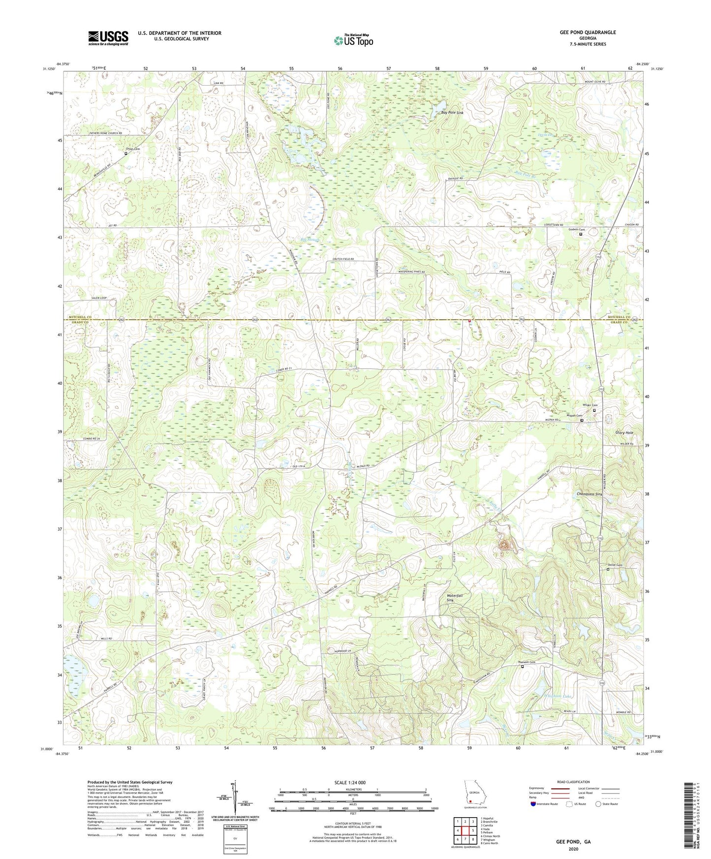
2024 topographic map quadrangle Gee Pond in the state of Georgia. Scale: 1:24000. Based on the newly updated USGS 7.5' US Topo map series, this map is in the following counties: Grady, Mitchell. The map contains contour data, water features, and other items you are used to seeing on USGS maps, but also has updated roads and other features. This is the next generation of topographic maps. Printed on high-quality waterproof paper with UV fade-resistant inks.
Quads adjacent to this one:
West: Vada
Northwest: Hopeful
North: Branchville
Northeast: Camilla
East: Pelham
Southeast: Cairo North
South: Whigham
Southwest: Climax North
This map covers the same area as the classic USGS quad with code o31084a3.
Contains the following named places: Allen Chapel, Barrow Plantation, Bay Pole Branch, Bay Pole Sink, Beauty Grove Church, Bethel Church, Chambless Sink, County Line Church, County Line School, Devils Den, Dollar Cemetery, Freewill Church, Gee Pond, Glory Hole, Godwin Cemetery, Grady County Volunteer Fire Department County Line Station, Harrells Still, Hawthorne Trail Lookout Tower, Kelly Creek, Maxwell Cemetery, Mizpah Cemetery, Mizpah Church, Mount Vernon Church, Northwest Grady Division, Pawnee, Pine Hill Church, Saint Paul Church, Union Cemetery, Union Church, Waterfall Sink, Whigham Lake, Whigham Lake Dam, Wilder Cemetery