MyTopo
Burtons Ferry Landing Georgia US Topo Map
Couldn't load pickup availability
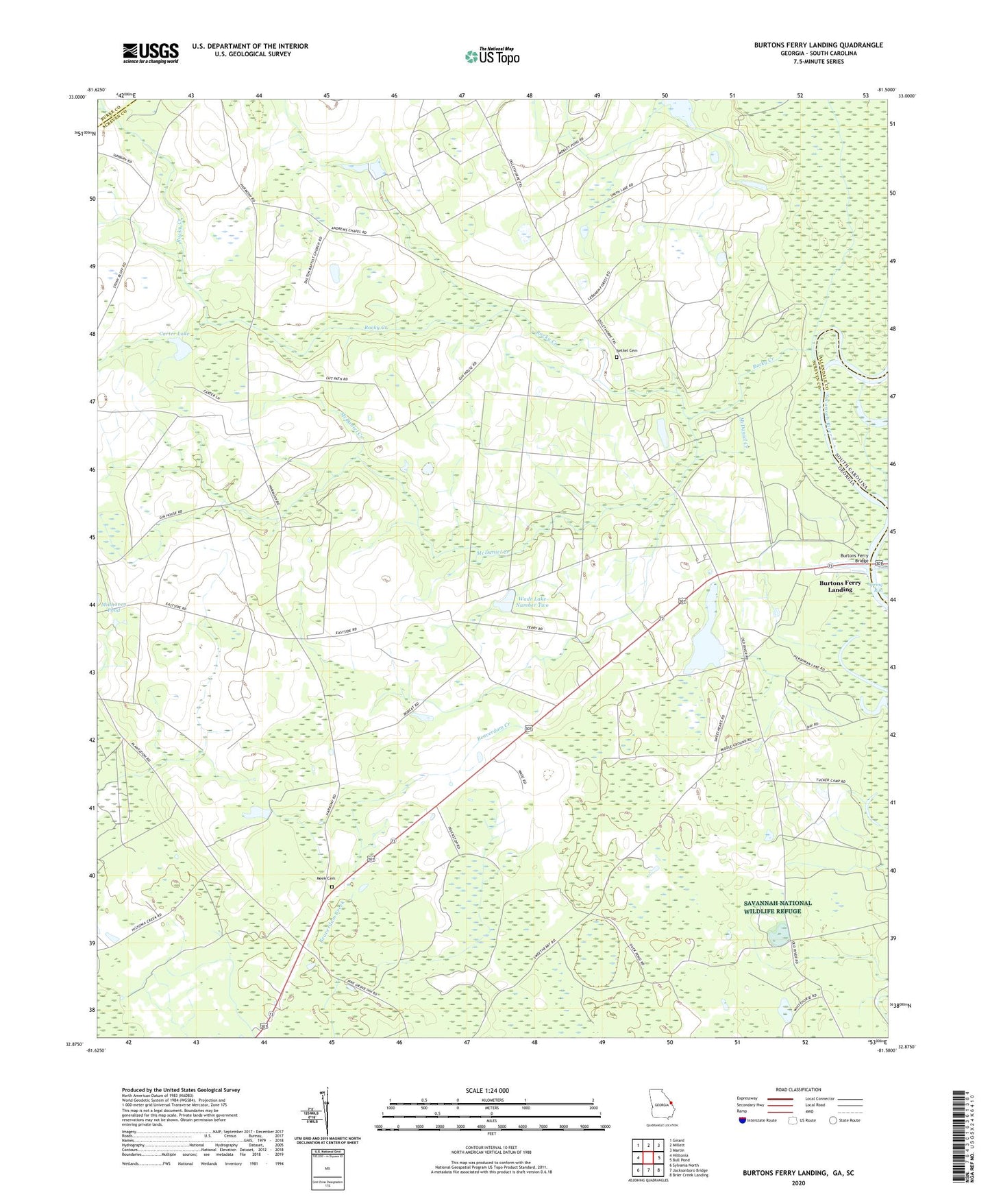
2024 topographic map quadrangle Burtons Ferry Landing in the state of Georgia. Scale: 1:24000. Based on the newly updated USGS 7.5' US Topo map series, this map is in the following counties: Screven, Allendale, Burke. The map contains contour data, water features, and other items you are used to seeing on USGS maps, but also has updated roads and other features. This is the next generation of topographic maps. Printed on high-quality waterproof paper with UV fade-resistant inks.
Quads adjacent to this one:
West: Hilltonia
Northwest: Girard
North: Millett
Northeast: Martin
East: Bull Pond
Southeast: Brier Creek Landing
South: Jacksonboro Bridge
Southwest: Sylvania North
Contains the following named places: Bethel Brick Church, Bethel Cemetery, Burtons Ferry, Burtons Ferry Bridge, Burtons Ferry Landing, Canes Store, Carter Lake, Carter Lake Dam, Dalton Church, Harmony Church, Hershman Lake, Joe Ditch, Lovett Temple, McDaniel Creek, Meek Cemetery, Middle Branch Church, Millhaven Division, Millhaven School, Rocky Creek, Saint Andrews Chapel, Wade Lake Number One, Wade Lake Number One Dam, Wade Lake Number Two, Wade Lake Number Two Dam, Wade Plantation Airport, Wesley Chapel, Zion Church