MyTopo
Sylvania North Georgia US Topo Map
Couldn't load pickup availability
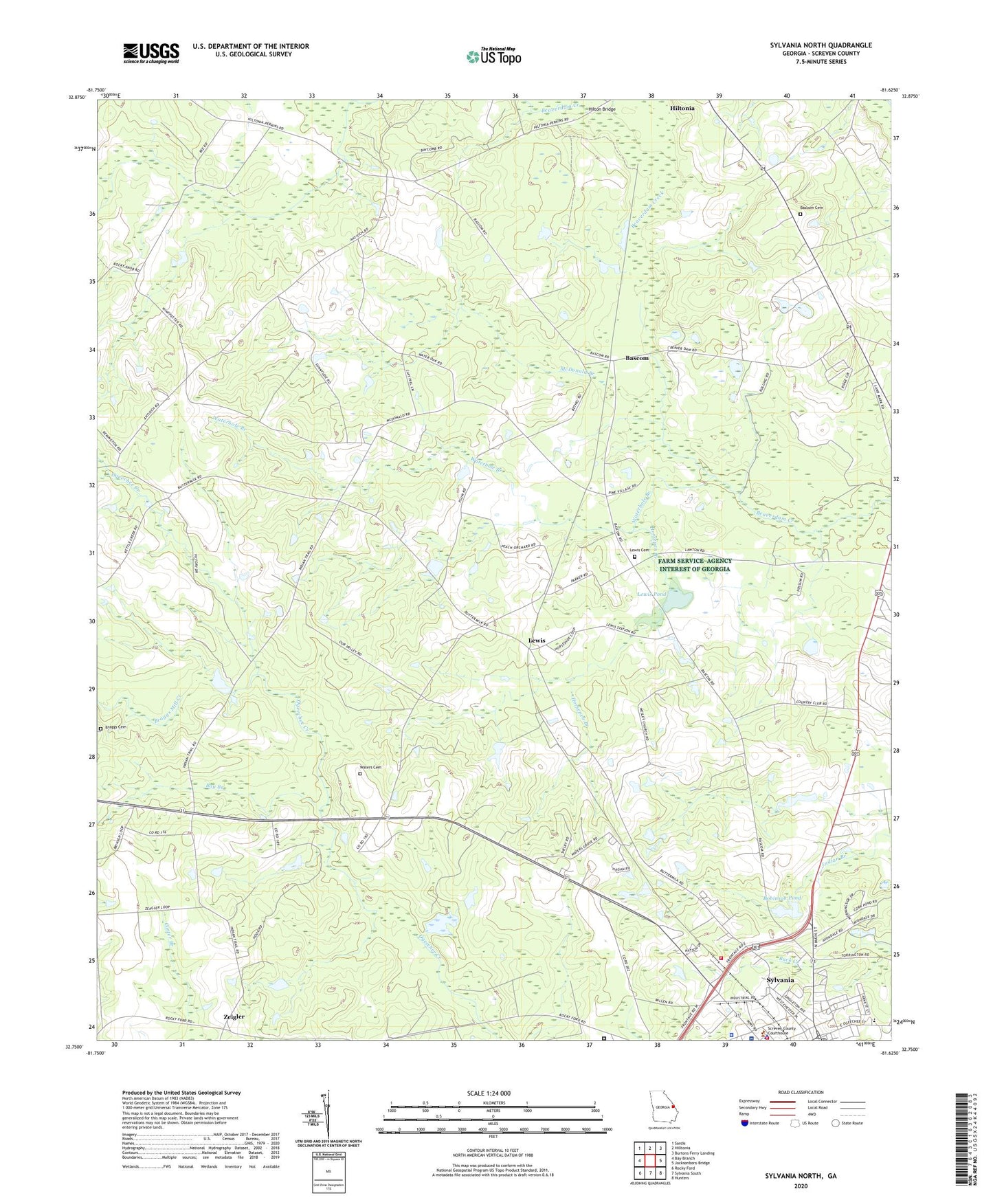
2024 topographic map quadrangle Sylvania North in the state of Georgia. Scale: 1:24000. Based on the newly updated USGS 7.5' US Topo map series, this map is in the following counties: Screven. The map contains contour data, water features, and other items you are used to seeing on USGS maps, but also has updated roads and other features. This is the next generation of topographic maps. Printed on high-quality waterproof paper with UV fade-resistant inks.
Quads adjacent to this one:
West: Bay Branch
Northwest: Sardis
North: Hilltonia
Northeast: Burtons Ferry Landing
East: Jacksonboro Bridge
Southeast: Hunters
South: Sylvania South
Southwest: Rocky Ford
This map covers the same area as the classic USGS quad with code o32081g6.
Contains the following named places: Antioch Church, Bargeron Church, Bascom, Bascom Cemetery, Bascom Church, Bascom School, Bay Branch, Braggs Cemetery, Braggs Mill Creek, Brantley Plaza Shopping Center, Brier Creek Country Club, First Methodist Church, Friendship Memorial Church, Hilton Bridge, Hiltonia Division, Hook School, Horsepen Branch, Lariscy Grove Church, Lewis, Lewis Cemetery, Lewis Pond, Lewis Pond Dam, Little Bethel Church, Louis Chapel, McDonald Branch, McDonald Church, New Home Welcome Church, Optim Medical Center - Screven, Our Lady of the Assumption Church, Robinson Pond, Robinson Pond Dam, Rock Hill Church, Rock Hill School, Saint Andrews Methodist Episcopal Church, Screven County Correctional Institution, Screven County Courthouse, Screven County Fire Department Station 1, Screven County Jail, Screven County Library, Screven County Sheriff's Office, Sylvania, Sylvania City Hall, Sylvania Fire Department, Sylvania Police Department, Sylvania Post Office, Walker School, Waterhole Branch, Waters, Waters Cemetery, Waters Grove Church, Wesley Church, Wesley School, Zeigler