MyTopo
Chesser Island Georgia US Topo Map
Couldn't load pickup availability
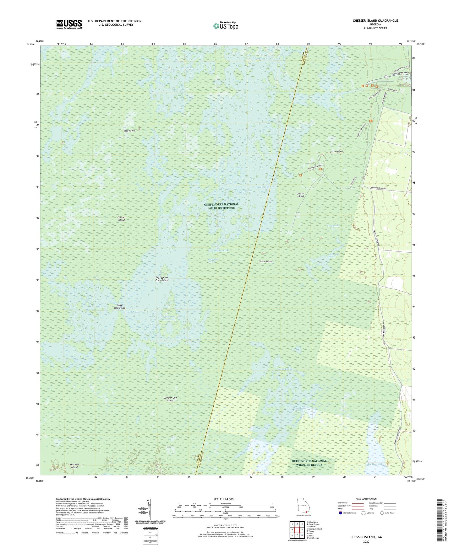
2024 topographic map quadrangle Chesser Island in the state of Georgia. Scale: 1:24000. Based on the newly updated USGS 7.5' US Topo map series, this map is in the following counties: Ware, Charlton. The map contains contour data, water features, and other items you are used to seeing on USGS maps, but also has updated roads and other features. This is the next generation of topographic maps. Printed on high-quality waterproof paper with UV fade-resistant inks.
Quads adjacent to this one:
West: Blackjack Island
Northwest: Billys Island
North: Chase Prairie
Northeast: Folkston
East: Toledo
Southeast: Saint George
South: Moniac
Southwest: Eddy
This map covers the same area as the classic USGS quad with code o30082f2.
Contains the following named places: Big Cypress Camp Island, Big Cypress Lake, Blackjack Lake, Buck Lake, Buck Prairie, Burnett Lake, Buzzards Roost Lake, Camp Cornelia, Charles Island, Chesser Island, Chesser Prairie, Chesser School, Cooter Lake, Coward Lake, Coward Lake Prairie, Double Lake, Gannet Lake, Goose House Gap, Grand Prairie, Hog Island, Horse Island, Little Cooter Lake, Little Island, Mitchell Island, Monkey Lake, Number One Island, Seagrove Lake, Stump Lake, Suwannee Canal Recreation Area, Tar Lake, Trout Lake, Trout Lake Prairie