MyTopo
Saint George Georgia US Topo Map
Couldn't load pickup availability
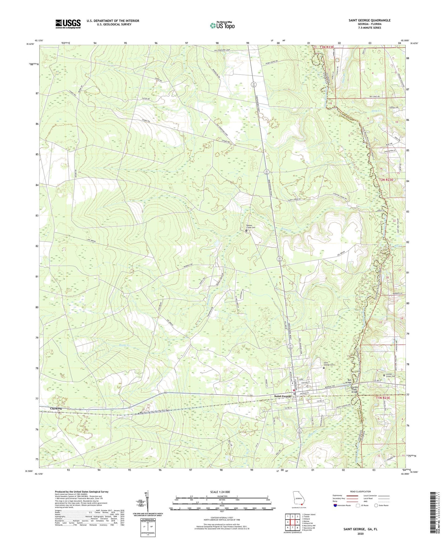
2024 topographic map quadrangle Saint George in the states of Georgia, Florida. Scale: 1:24000. Based on the newly updated USGS 7.5' US Topo map series, this map is in the following counties: Charlton, Nassau. The map contains contour data, water features, and other items you are used to seeing on USGS maps, but also has updated roads and other features. This is the next generation of topographic maps. Printed on high-quality waterproof paper with UV fade-resistant inks.
Quads adjacent to this one:
West: Moniac
Northwest: Chesser Island
North: Toledo
Northeast: Hilliard
East: Hilliard SW
Southeast: Bryceville
South: Macclenny NE
Southwest: Macclenny NW
This map covers the same area as the classic USGS quad with code o30082e1.
Contains the following named places: Bell Bridge, Boone Creek, Boone Creek Church, Boones Creek Cemetery, Boones Creek School, Charlton County Fire Department Station 2, Clarking, Conner - Green Cemetery, Deep Creek, Earnest A Bell Bridge, Mill Creek, Mims Creek, New Life Church, Pine Grove Church, Saint George, Saint George Cemetery, Saint George Division, Saint George Elementary School, Saint George Post Office, Stave Branch, Williams School