MyTopo
Danielsville South Georgia US Topo Map
Couldn't load pickup availability
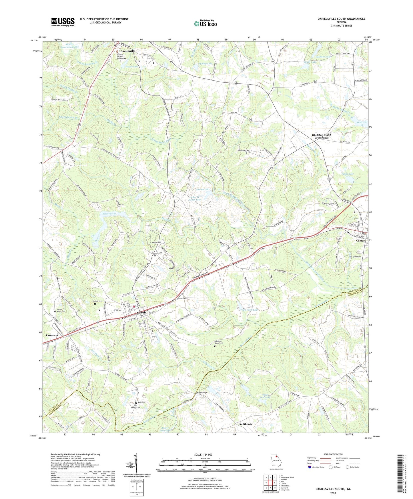
2024 topographic map quadrangle Danielsville South in the state of Georgia. Scale: 1:24000. Based on the newly updated USGS 7.5' US Topo map series, this map is in the following counties: Madison, Oglethorpe. The map contains contour data, water features, and other items you are used to seeing on USGS maps, but also has updated roads and other features. This is the next generation of topographic maps. Printed on high-quality waterproof paper with UV fade-resistant inks.
Quads adjacent to this one:
West: Hull
Northwest: Ila
North: Danielsville North
Northeast: Bowman
East: Carlton
Southeast: Sandy Cross
South: Crawford
Southwest: Athens East
This map covers the same area as the classic USGS quad with code o34083a2.
Contains the following named places: Baptist Association Lake, Barnett Branch, Beaverdam Creek, Biger Creek, Brush Creek, Carithers School, City of Colbert, City of Comer, City of Danielsville, Colbert, Colbert Baptist Church, Colbert Elementary School, Colbert Grove Church, Colbert High School, Colbert Mill, Colbert Post Office, Colbert School, Colbert Volunteer Fire Department, Collier Church, Comer, Comer Elementary School, Comer Police Department, Comer Post Office, Danielsville, Danielsville Elementary School, Danielsville High School, Danielsville Post Office, Double Branch, Duluth School, Gholston Church, Gholston Lake, Gholston Stand Crossroads, Kidd Cemetery, Kidd Family Cemetery, Kincaid Cemetery, Long Branch, Lystria Church, Madison County Courthouse, Madison County High School, Madison County Middle School, Meadow Cemetery, Meadow Church, Mill Shoal Creek, Moriah Church, Morrison Dam, Morrison Lake, Mount Airy Church, Mount Zion Church, North Fork Double Branch, O'Kelley Dam, O'Kelley Lake, Oliver Lear Dam, Oliver Lear Lake, Patterson, Patterson School, Payne Dam, Payne Lake, Pleasant Hill Volunteer Fire Department, Porterfield, Reservoir 29, Reservoir 64, S Bar W Ranch Pond, S Bar W Ranch Pond Dam, Sasnett Dam, Sasnett Lake, Smith Bridge, Smithonia, Sorrow - Mann Cemetery, South Fork Double Branch, South Madison Middle School, South River Methodist Church, Stoehr Dam, Stoehr Lake, Thompson Cemetery, Waggoner Grove Cemetery, Wagner Grove Church, Woods Lake, Woods Lake Dam, Word of Life Church, ZIP Code: 30628