MyTopo
Dewy Rose Georgia US Topo Map
Couldn't load pickup availability
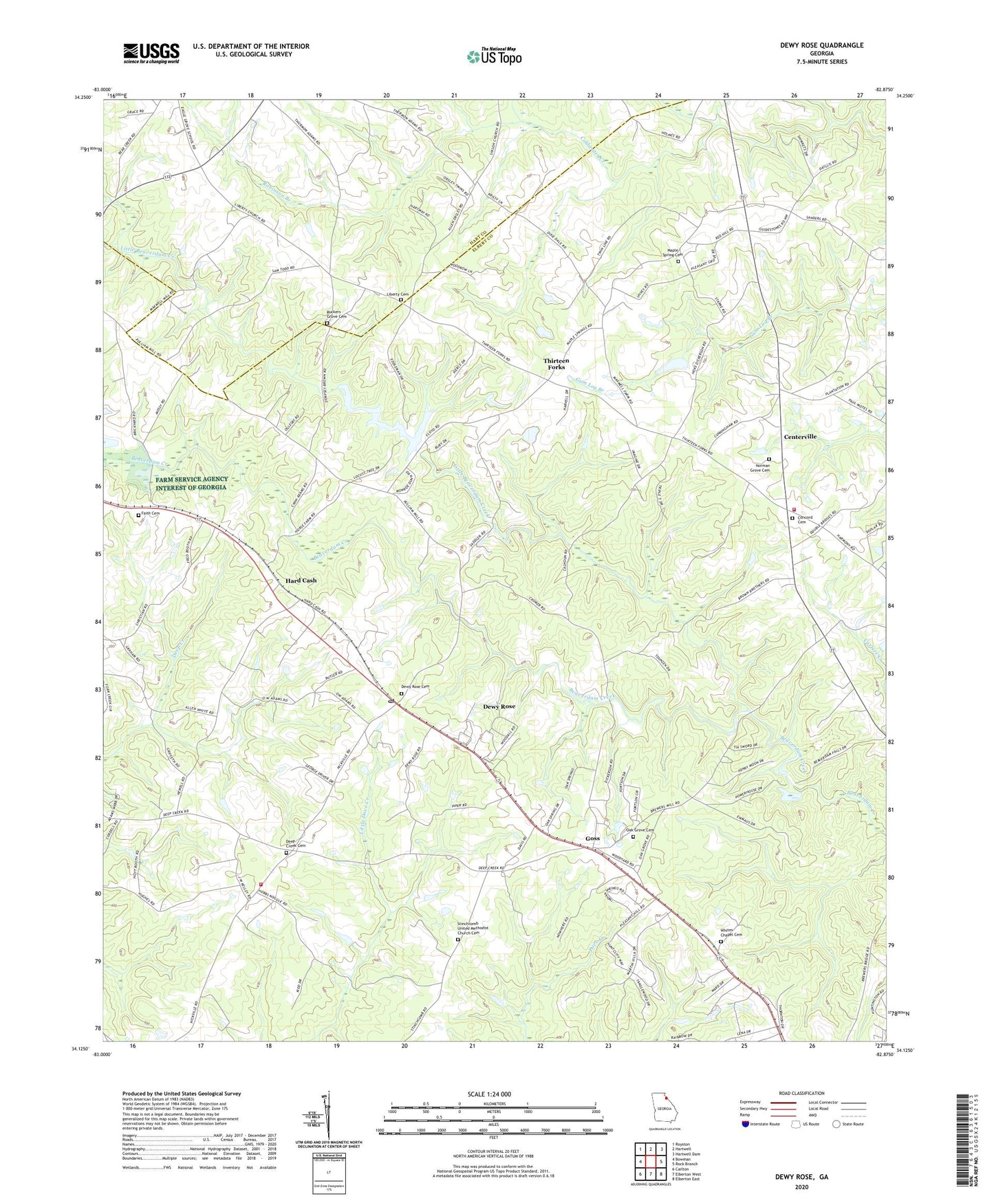
2024 topographic map quadrangle Dewy Rose in the state of Georgia. Scale: 1:24000. Based on the newly updated USGS 7.5' US Topo map series, this map is in the following counties: Elbert, Hart. The map contains contour data, water features, and other items you are used to seeing on USGS maps, but also has updated roads and other features. This is the next generation of topographic maps. Printed on high-quality waterproof paper with UV fade-resistant inks.
Quads adjacent to this one:
West: Bowman
Northwest: Royston
North: Hartwell
Northeast: Hartwell Dam
East: Rock Branch
Southeast: Elberton East
South: Elberton West
Southwest: Carlton
This map covers the same area as the classic USGS quad with code o34082b8.
Contains the following named places: Amandaville, Beaverdam Creek Structure Number 30 Dam, Brewers Mill, Centerville, Centerville School, Church of Christ, Concord Cemetery, Concord Church, Deep Creek Cemetery, Deep Creek Church, Dewy Rose, Dewy Rose Baptist Church, Dewy Rose Cemetery, Dewy Rose Census Designated Place, Dewy Rose Post Office, Elbert County Fire Department Centerville Station, Elbert County Fire Department Deep Creek Station, Elberton Powerplant, Faith Baptist Church, Faith Cemetery, Goss, Hard Cash, Harper, Liberty Cemetery, Liberty Church, Little Beaverdam Creek, Maple Spring Cemetery, Maple Spring Church, Maple Spring School, Norman Grove Cemetery, Norman Grove Church, Oak Grove Baptist Church, Oak Grove Cemetery, Pulliam Mill, Reservoir 30, Robinson Branch, Ruckers Grove Cemetery, Ruckers Grove Church, Saint Philip's Parish, Stinchcomb Church, Stinchcomb United Methodist Church Cemetery, Thirteen Forks, Victory Church, Wesley Chapel, Whites Chapel, Whites Chapel Cemetery, ZIP Code: 30634