MyTopo
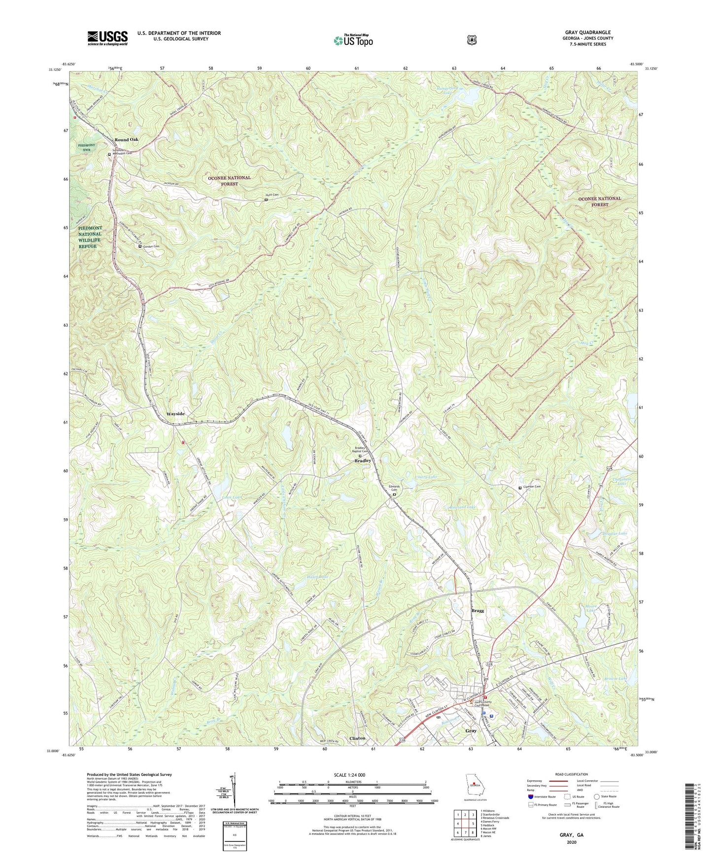
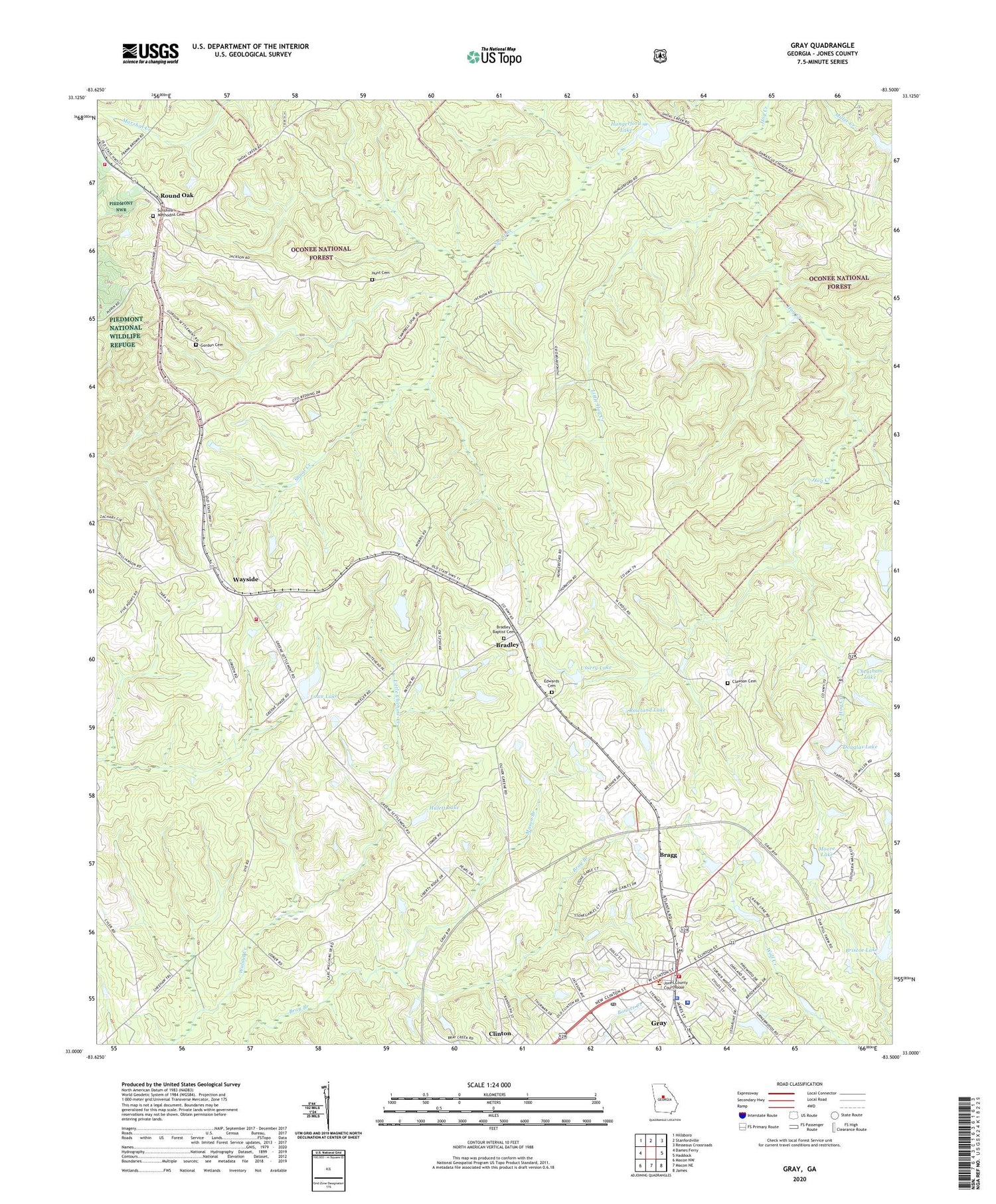
Gray Georgia US Topo Map
Couldn't load pickup availability
Also explore the Gray Forest Service Topo of this same quad for updated USFS data
2024 topographic map quadrangle Gray in the state of Georgia. Scale: 1:24000. Based on the newly updated USGS 7.5' US Topo map series, this map is in the following counties: Jones. The map contains contour data, water features, and other items you are used to seeing on USGS maps, but also has updated roads and other features. This is the next generation of topographic maps. Printed on high-quality waterproof paper with UV fade-resistant inks.
Quads adjacent to this one:
West: Dames Ferry
Northwest: Hillsboro
North: Stanfordville
Northeast: Resseaus Crossroads
East: Haddock
Southeast: James
South: Macon NE
Southwest: Macon NW
This map covers the same area as the classic USGS quad with code o33083a5.
Contains the following named places: Bradley, Bradley Baptist Cemetery, Bradley Baptist Church, Bradley-Wayside School, Bragg, Briscoe Dam, Briscoe Lake, Campbell, Central Georgia Technical College - Jones County Center, Cheatham Dam, Cheatham Lake, City of Gray, Clawson Cemetery, Douglas Lake, Douglas Lake Dam, Edwards Cemetery, Gordon Cemetery, Gray, Gray Fire Department, Gray Police Department, Gray Post Office, Higview Cemetery, Hulett Dam, Hulett Lake, Hungerford Lake, Hungerford Lake Dam, Hunt Cemetery, Jones County, Jones County Fire Department Station 5A, Jones County Fire Department Station 5B, Jones County Fire Department Station 7, Jones County Jail, Jones County Sheriff's Office, Jones County Station 5A, Jones County Station 7B, Little Chehaw Creek, Little Hog Creek, Lowe Lake, Lowe Lake Dam, Maggie Califf Learning Complex, Mason Branch, Miller Creek Lake, Miller Creek Lake Dam, Moore Lake, Moore Lake Dam, Round Oak, Round Oak Division, Round Oak Lookout, Round Tree Methodist Church, Rowland Dam, Rowland Lake, Saint James Church, Saint Pauls Church, Stewart Chapel, Sunshine Methodist Cemetery, Ussery Lake, Ussery Lake Dam, Wayside, Wayside Presbyterian Church, ZIP Code: 31032