MyTopo
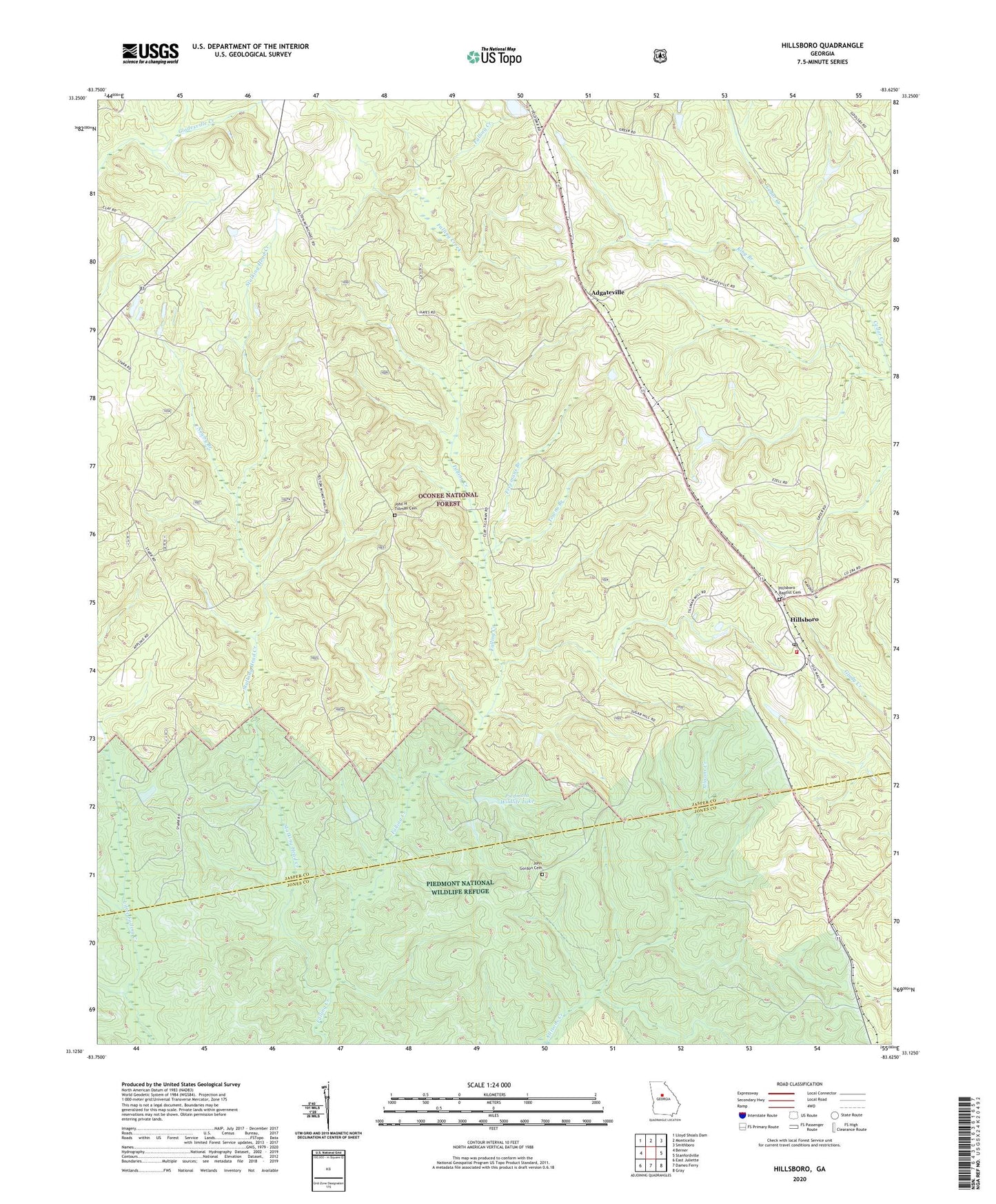
Hillsboro Georgia US Topo Map
Couldn't load pickup availability
Also explore the Hillsboro Forest Service Topo of this same quad for updated USFS data
2024 topographic map quadrangle Hillsboro in the state of Georgia. Scale: 1:24000. Based on the newly updated USGS 7.5' US Topo map series, this map is in the following counties: Jasper, Jones. The map contains contour data, water features, and other items you are used to seeing on USGS maps, but also has updated roads and other features. This is the next generation of topographic maps. Printed on high-quality waterproof paper with UV fade-resistant inks.
Quads adjacent to this one:
West: Berner
Northwest: Lloyd Shoals Dam
North: Monticello
Northeast: Smithboro
East: Stanfordville
Southeast: Gray
South: Dames Ferry
Southwest: East Juliette
This map covers the same area as the classic USGS quad with code o33083b6.
Contains the following named places: Adgateville, Adgateville Baptist Church, Camp Six Hunt Camp, Crossroad Church, Deep Well Hunt Camp, Freemans Branch, Gladesville Creek, Hardin School, Hay House Church, Hillsboro, Hillsboro Baptist Cemetery, Hillsboro Baptist Church, Hillsboro Division, Hillsboro Hunt Camp, Hillsboro Post Office, Hillsboro United Methodist Church, Jasper County Emergency Services Station 4 Hillsboro, John Gordon Cemetery, John H Tillman Cemetery, King Branch, King Chapel, Kunsford, Little Gladesville Creek, Lungsford Hunt Camp, Maddox Chapel Church, McKissack Church, Newby Branch, OIG Hunt Camp, Piedmont Wildlife Lake, Piedmont Wildlife Lake Dam, Rock Zion Church, Stalking Head Creek, Towns Branch, Tribble Fields, ZIP Code: 31038