MyTopo
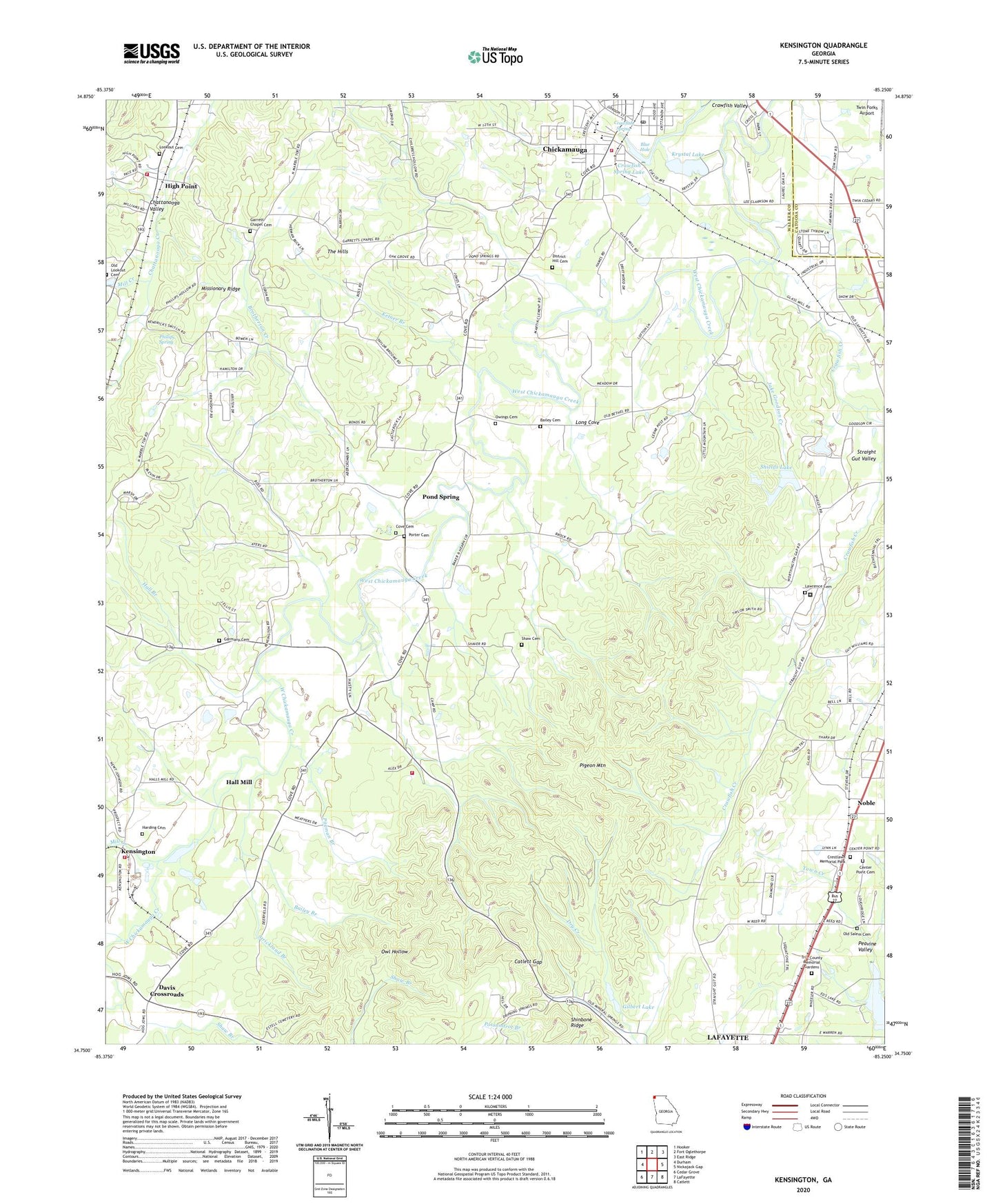
Kensington Georgia US Topo Map
Couldn't load pickup availability
2024 topographic map quadrangle Kensington in the state of Georgia. Scale: 1:24000. Based on the newly updated USGS 7.5' US Topo map series, this map is in the following counties: Walker, Catoosa. The map contains contour data, water features, and other items you are used to seeing on USGS maps, but also has updated roads and other features. This is the next generation of topographic maps. Printed on high-quality waterproof paper with UV fade-resistant inks.
Quads adjacent to this one:
West: Durham
Northwest: Hooker
North: Fort Oglethorpe
Northeast: East Ridge
East: Nickajack Gap
Southeast: Catlett
South: LaFayette
Southwest: Cedar Grove
This map covers the same area as the classic USGS quad with code o34085g3.
Contains the following named places: Bailey Branch, Bailey Cemetery, Barwick Mill Dam One, Bethel Church, Bethlehem Church, Blue Hole, Brotherton Creek, Catlett Gap, Center Point Cemetery, Center Point Church, Chickamauga, Chickamauga City Hall, Chickamauga Division, Chickamauga Elementary School, Chickamauga High School, Chickamauga Post Office, Chickamauga Public Library, Christian Home Church, Church of God, Coke Oven Branch, Cove Cemetery, Cove Church, Crawfish Creek, Crawfish Spring, Crawfish Spring Lake, Crawfish Valley, Crestlawn Memorial Park, Davis Crossroads, District Hill Cemetery, Elizabeth Lee United Methodist Church, Estelle Station, Fellowship Baptist Church, First Presbyterian Church, Friendship Church, Garmany Cemetery, Garrett Chapel Cemetery, Garrett Church, Garrett School, Gilbert Lake, Glass Mill, Gordon Lee High School, Gordon Lee Middle School, Hall Branch, Hall Mill, Harding Cemetery, High Point, Howard Lake, Jake Goodson Creek, Kendrick, Kensington, Kensington School, Kensington United Methodist Church, Ketner Branch, Krystal Lake, Krystal Lake Dam, Lawrence Cemetery, Long Cove, Lookout Cemetery, Lookout Church, Mill Creek, New Friendship Church, Noble, Oak Grove Church, Oak Grove School, Old Bethel Church, Old Lookout Cemetery, Old Salem Cemetery, Owings Cemetery, Phillips Spring, Pittman Branch, Pond Spring, Pond Spring Elementary School, Pond Springs School, Porter Cemetery, Salem, Shaw Branch, Shaw Cemetery, Shields Lake, Shields Lake Dam, Strickland Branch, The Hills, Tri - County Memorial Gardens, Walker County Emergency Services Fire Station 19, Walker County Emergency Services Fire Station 6, Walker County Emergency Services Fire Station 9, Walker State Prison, Warren School, Warrens, Wright Mineral Spring, ZIP Code: 30707