MyTopo
Livingston Georgia US Topo Map
Couldn't load pickup availability
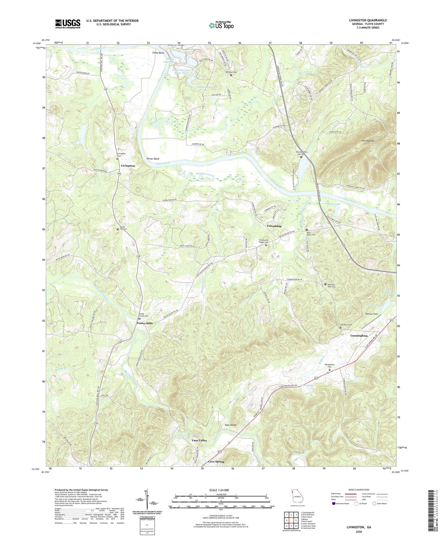
2024 topographic map quadrangle Livingston in the state of Georgia. Scale: 1:24000. Based on the newly updated USGS 7.5' US Topo map series, this map is in the following counties: Floyd. The map contains contour data, water features, and other items you are used to seeing on USGS maps, but also has updated roads and other features. This is the next generation of topographic maps. Printed on high-quality waterproof paper with UV fade-resistant inks.
Quads adjacent to this one:
West: Melson
Northwest: Chattoogaville
North: Rock Mountain
Northeast: Rome North
East: Rome South
Southeast: Cedartown East
South: Cedartown West
Southwest: Indian Mountain
This map covers the same area as the classic USGS quad with code o34085b3.
Contains the following named places: Alto Park Recreation Center, Beech Creek, Bellview School, Bush Arbor Cemetery, Bush Arbor Church, Camp Bend, Cave Spring Division, Cedar Creek Cemetery, Cedar Creek Church, Cherokee Country Club, Community Chapel Baptist Church, Community Chapel Cemetery, Cress Spring, Cunningham, Dawson Field, Dry Creek, Flat Rock Cemetery, Flat Rock Church, Floyd County Recreation Area, Foster Mills, Friendship, Hamilton Creek, Heavy Liquor Pond, Heavy Liquor Pond Dam, Jones Lake, Jones Lake Dam, Jones Lakes, Kraft Industrial Waste Pond, Kraft Industrial Waste Pond Dam, Landers, Little Cedar Creek, Live Oak Church, Livingston, Livingston Cemetery, Matthew Baptist Church, Matthew Cemetery, Mayo Bar Dam, Mill Race, Milner Lake, Montgomery Cemetery, Mountain End Lake, Mountain End Lake Cemetery, Mountain End Lake Dam, Mountain View Cemetery, Mountain View Church, Neals Ferry, Payne School, Round Hill Cemetery, Saint Lukes Church, Simpson Lake, Simpson Lake Dam, Simpson Lakes, Turner Bend, Valley Grove Church, Vans Valley, Webb Creek, Yancey, ZIP Code: 30124