MyTopo
Louisville South Georgia US Topo Map
Couldn't load pickup availability
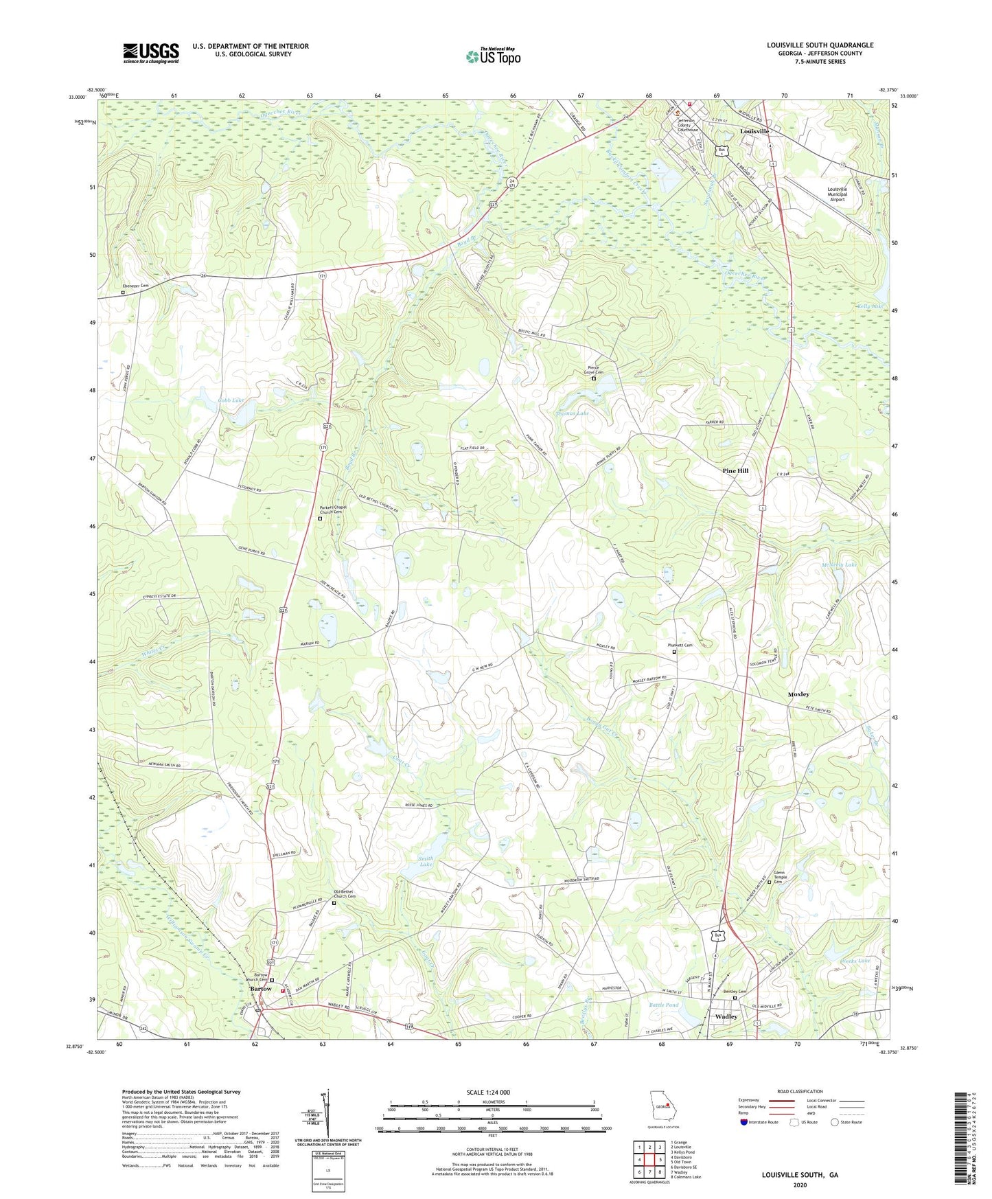
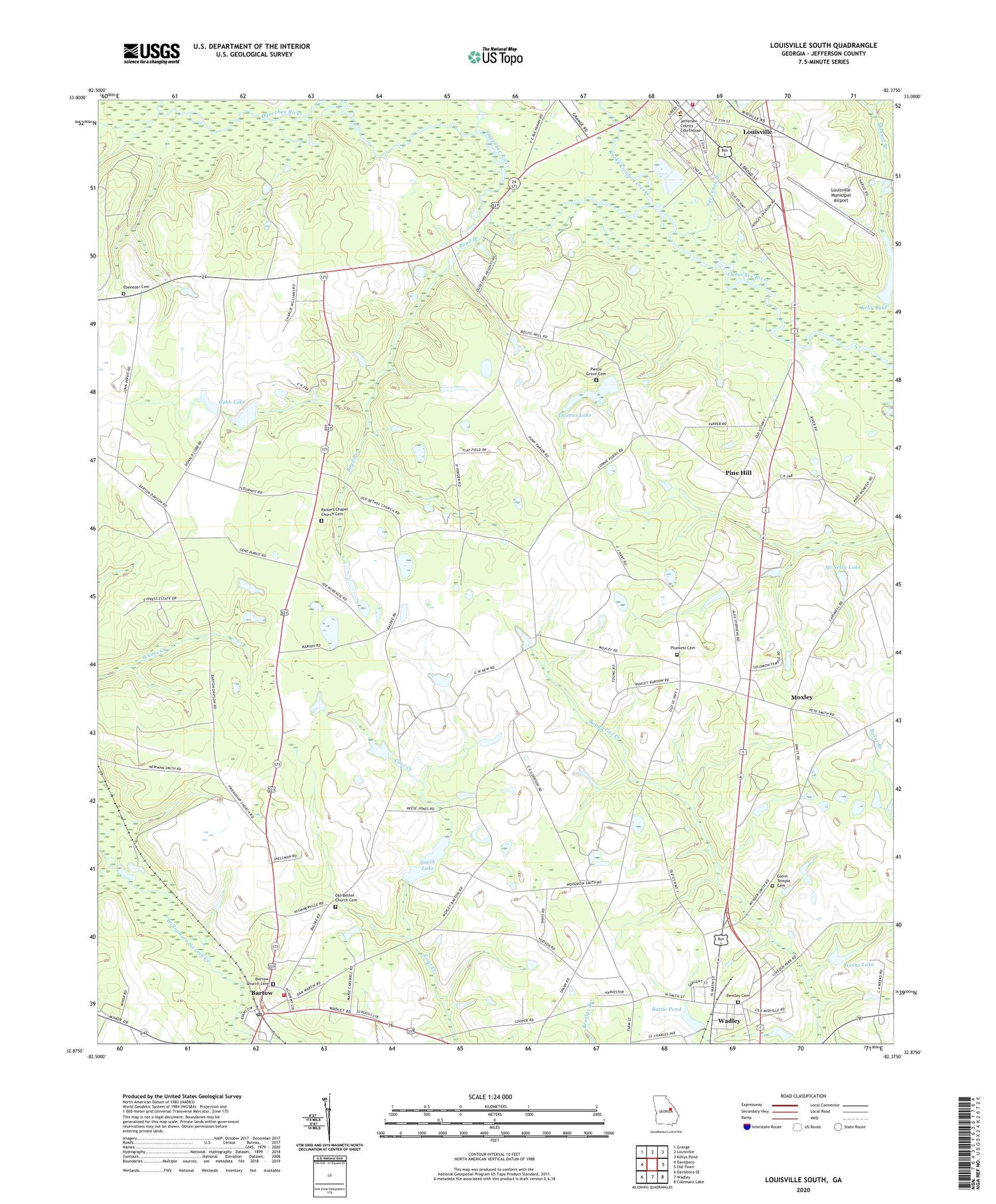
2024 topographic map quadrangle Louisville South in the state of Georgia. Scale: 1:24000. Based on the newly updated USGS 7.5' US Topo map series, this map is in the following counties: Jefferson. The map contains contour data, water features, and other items you are used to seeing on USGS maps, but also has updated roads and other features. This is the next generation of topographic maps. Printed on high-quality waterproof paper with UV fade-resistant inks.
Quads adjacent to this one:
West: Davisboro
Northwest: Grange
North: Louisville
Northeast: Kellys Pond
East: Old Town
Southeast: Colemans Lake
South: Wadley
Southwest: Davisboro SE
This map covers the same area as the classic USGS quad with code o32082h4.
Contains the following named places: Aldreds, Apostolic Church, Bartow, Bartow Church Cemetery, Bartow High School, Bartow Police Department, Bartow Post Office, Bartow Volunteer Fire Department, Battle Pond, Battle Pond Dam, Bentley Cemetery, Boyd Branch, City of Louisville, Cobb Lake, Cobb Lake Dam, Ebenezer Cemetery, Ebenezer Church, Glenn Temple Cemetery, Jefferson County Courthouse, Jefferson County Training School, Jefferson Lookout Tower, Kelly Lake, Kelly Lake Dam, Lewis Grove School, Louisville Municipal Airport, Louisville Volunteer Fire Department, Manson Branch, McNeely Lake, McNeely Lake Dam, Mount Pleasant Church, Moxley, Moxley Church Cemetery, Moxley Junior High School, Old Bethel Church, Old Bethel Church Cemetery, Parkers Chapel Church Cemetery, Parkers Church, Pervis Grove Church, Pierce Grove Cemetery, Pierce Grove Church, Pierce Grove Church Cemetery, Pine Hill, Plunkett Cemetery, Rocky Comfort Creek, Salter Branch, Savannah Branch, Smith Lake, Smith Lake Dam, Thomas Lake, Thomas Lake Dam, Town of Bartow, Trinity Church, Weeks Lake, Weeks Lake Dam