MyTopo
Old Town Georgia US Topo Map
Couldn't load pickup availability
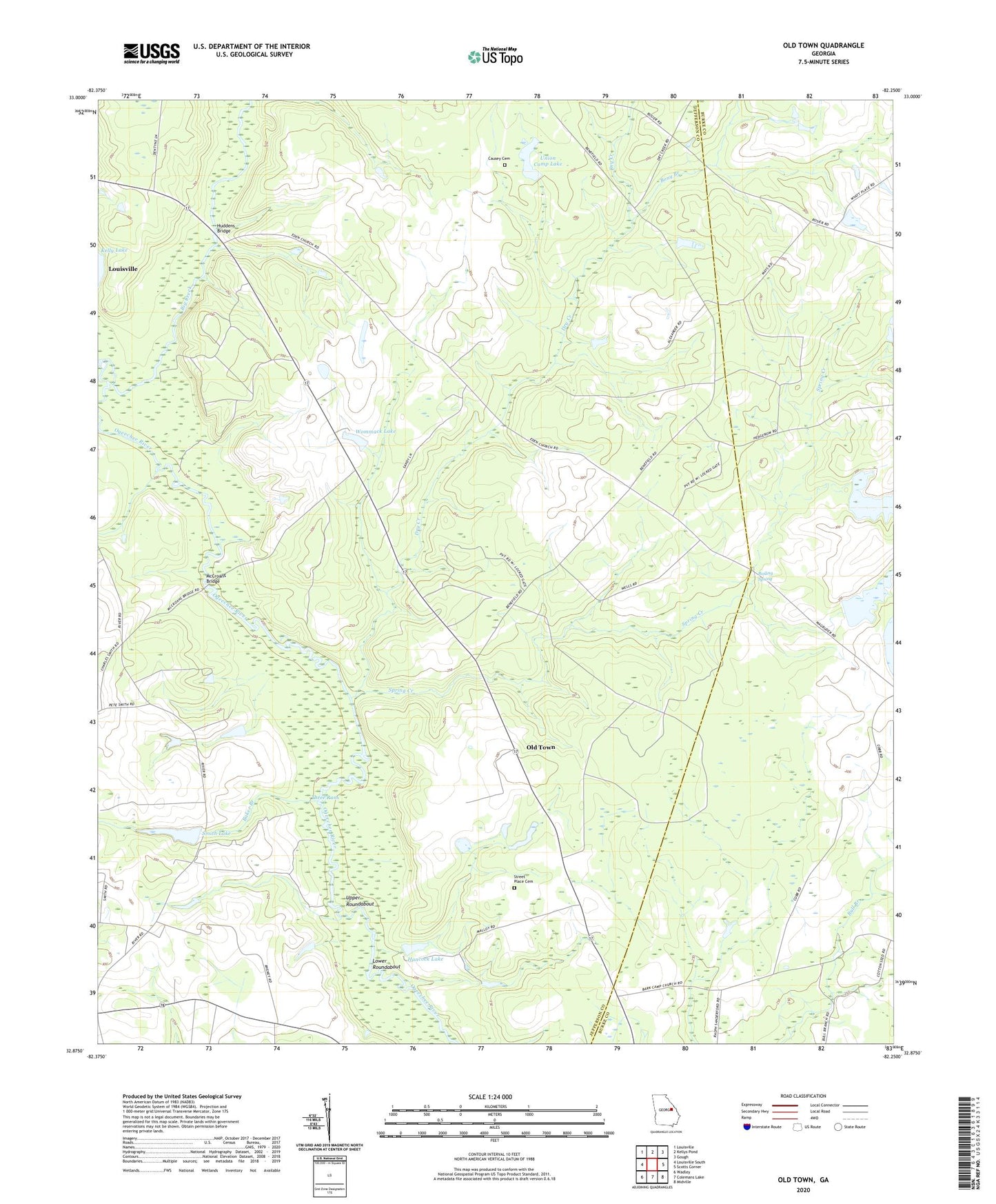
2024 topographic map quadrangle Old Town in the state of Georgia. Scale: 1:24000. Based on the newly updated USGS 7.5' US Topo map series, this map is in the following counties: Jefferson, Burke. The map contains contour data, water features, and other items you are used to seeing on USGS maps, but also has updated roads and other features. This is the next generation of topographic maps. Printed on high-quality waterproof paper with UV fade-resistant inks.
Quads adjacent to this one:
West: Louisville South
Northwest: Louisville
North: Kellys Pond
Northeast: Gough
East: Scotts Corner
Southeast: Midville
South: Colemans Lake
Southwest: Wadley
This map covers the same area as the classic USGS quad with code o32082h3.
Contains the following named places: Baker Branch, Big Creek, Boiling Spring, Bony Branch, Bony Branch Church, Causey Cemetery, Dry Creek, Eden Church, Farmer Grove Church, Farmers Grove School, Hancock Lake, Hancock Lake Dam, Huddens Bridge, Lower Roundabout, Magruder Farms Lake, Magruder Farms Lake Dam West, McCroans Bridge, Mount Olive Church, Old Town, Saint Johns Church, San Clair Church, Smith Lake, Smith Lake Dam, Spring Creek, Straight Gate Church, Street Place Cemetery, Three Runs, Turkey Pond Dam, Union Bethel Church, Union Camp Corporation Lake Dam, Union Camp Lake, Upper Roundabout, Walton Grove Church, Wommack Lake, Wommack Lake Dam