MyTopo
Nashville East Georgia US Topo Map
Couldn't load pickup availability
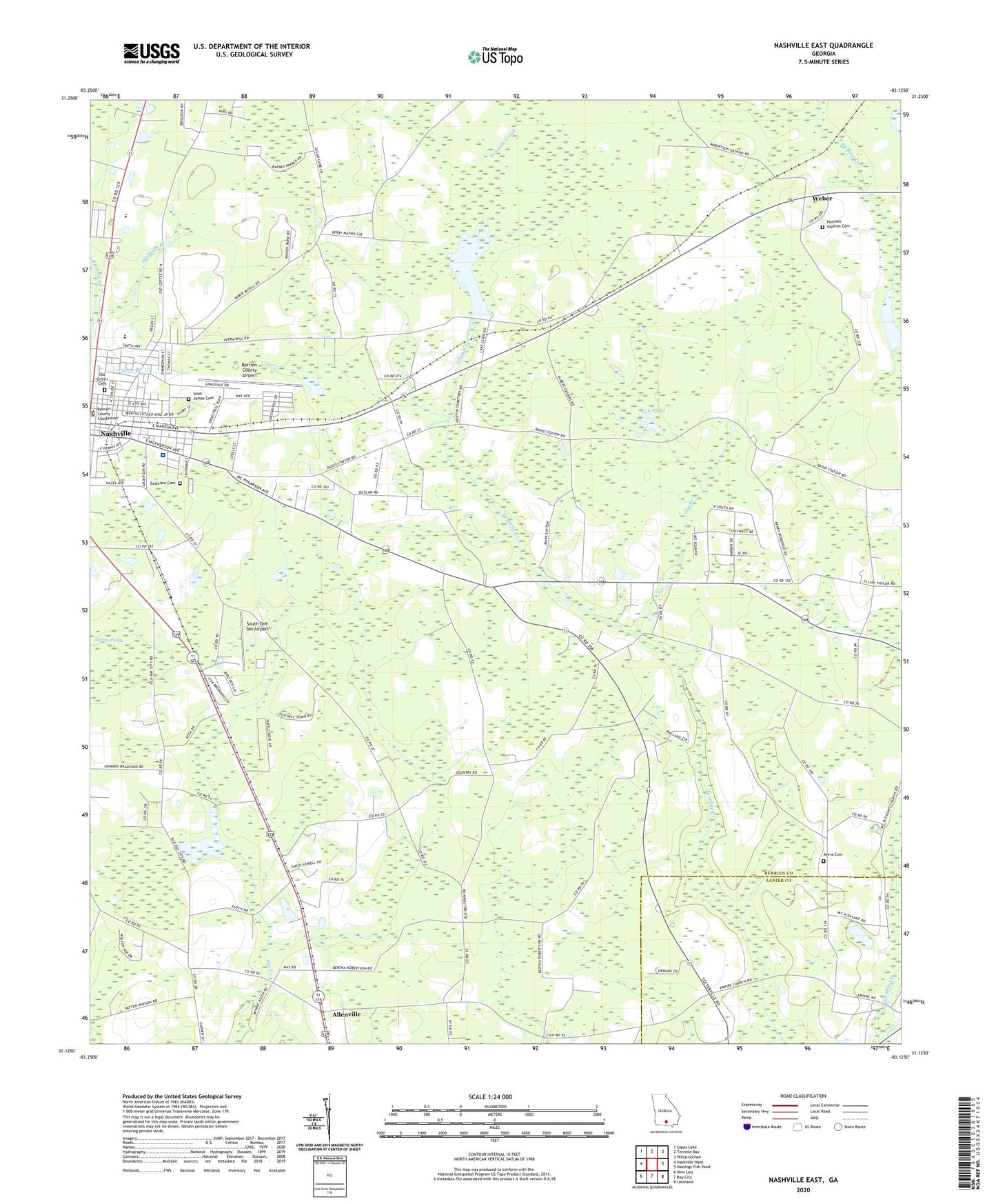
2024 topographic map quadrangle Nashville East in the state of Georgia. Scale: 1:24000. Based on the newly updated USGS 7.5' US Topo map series, this map is in the following counties: Berrien, Lanier. The map contains contour data, water features, and other items you are used to seeing on USGS maps, but also has updated roads and other features. This is the next generation of topographic maps. Printed on high-quality waterproof paper with UV fade-resistant inks.
Quads adjacent to this one:
West: Nashville West
Northwest: Sapps Lake
North: Tenmile Bay
Northeast: Willacoochee
East: Hastings Fish Pond
Southeast: Lakeland
South: Ray City
Southwest: New Lois
This map covers the same area as the classic USGS quad with code o31083b2.
Contains the following named places: Allenville, Avera Cemetery, Avera Mill, Averys Millpond, Baker Chapel, Beetree Recreation Area, Berrien County Airport, Berrien County Courthouse, Berrien County High School, Bristol Temple, Call to Faith Tabernacle, Carter Park, Christian Church of God, Church of God, City of Nashville, Eastview Cemetery, Empire Church, Forrester Church, Full Gospel Chapel, Gaskins Lake, Gin Branch, Gin Pond, Grahams Chapel, Harmon Gaskins Cemetery, Heritage Park, Holiness Church, Immanuel Baptist Church, Immanuel Church, Irene Church, Jesus Name Church, Mathis Chapel Holiness Baptist Church, Mount Pleasant Church, Nashville Church of the Nazarene, Nashville Division, Nashville Holiness Deliverance Church, Nashville Middle School, Nashville Mission, New Bethel Baptist Church, Northside Park, Old Griner Cemetery, Saint James Cemetery, Saint James Methodist Church, Saint Marys Catholic Church, South Georgia Medical Center Berrien Campus, South One Ten Airport, United Pentecostal Church, Weber, WNGA-AM (Nashville), Wolfpen Branch, Zion Wall Freewall Baptist Church, ZIP Code: 31639