MyTopo
New Lois Georgia US Topo Map
Couldn't load pickup availability
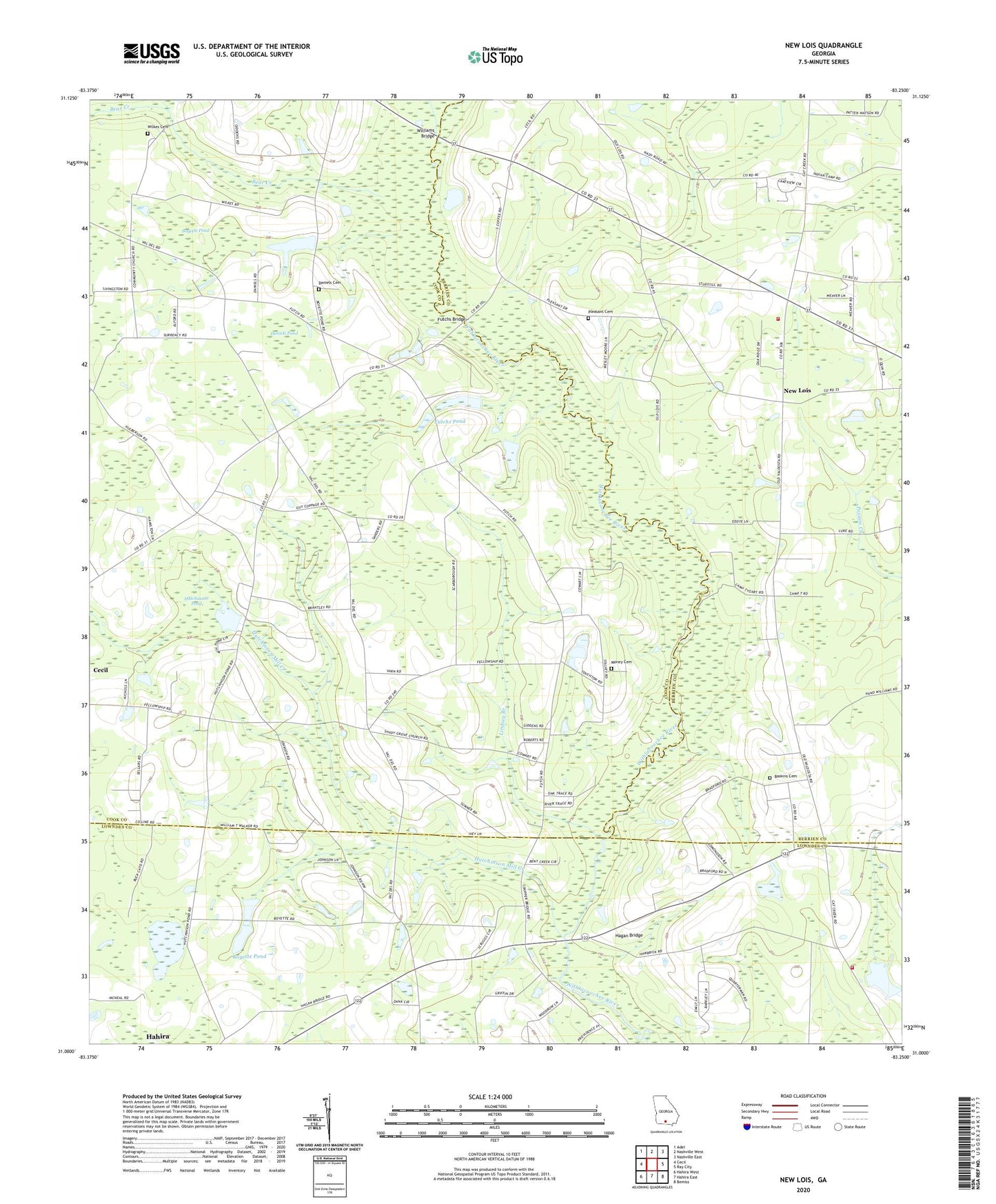
2024 topographic map quadrangle New Lois in the state of Georgia. Scale: 1:24000. Based on the newly updated USGS 7.5' US Topo map series, this map is in the following counties: Cook, Berrien, Lowndes. The map contains contour data, water features, and other items you are used to seeing on USGS maps, but also has updated roads and other features. This is the next generation of topographic maps. Printed on high-quality waterproof paper with UV fade-resistant inks.
Quads adjacent to this one:
West: Cecil
Northwest: Adel
North: Nashville West
Northeast: Nashville East
East: Ray City
Southeast: Bemiss
South: Hahira East
Southwest: Hahira West
This map covers the same area as the classic USGS quad with code o31083a3.
Contains the following named places: Baskins Cemetery, Bear Creek, Bemiss Barretts Volunteer Fire Department Station 5A, Boyette Pond, Boyette Pond Dam, Boys Ranch, Camp Tygart, Community Church, County Line Church, Daniels Cemetery, Daniels Pond, Fellowship, Fellowship Church, Futchs Bridge, Futchs Pond, Hagan Bridge, Hutchinson Mill Creek, Hutchinson Pond, Indian Trail Branch, Kings Chapel, Lindsey Branch, Money Cemetery, Mount Olive Church, New Lois, New Lois Volunteer Fire Department, Pleasant Cemetery, Pleasant Church, Shady Grove Church, Spirit Led Tabernacle, Wilkes Cemetery, Williams Bridge, Youngs Mill Creek