
MyTopo
Ocilla East Georgia US Topo Map
Couldn't load pickup availability
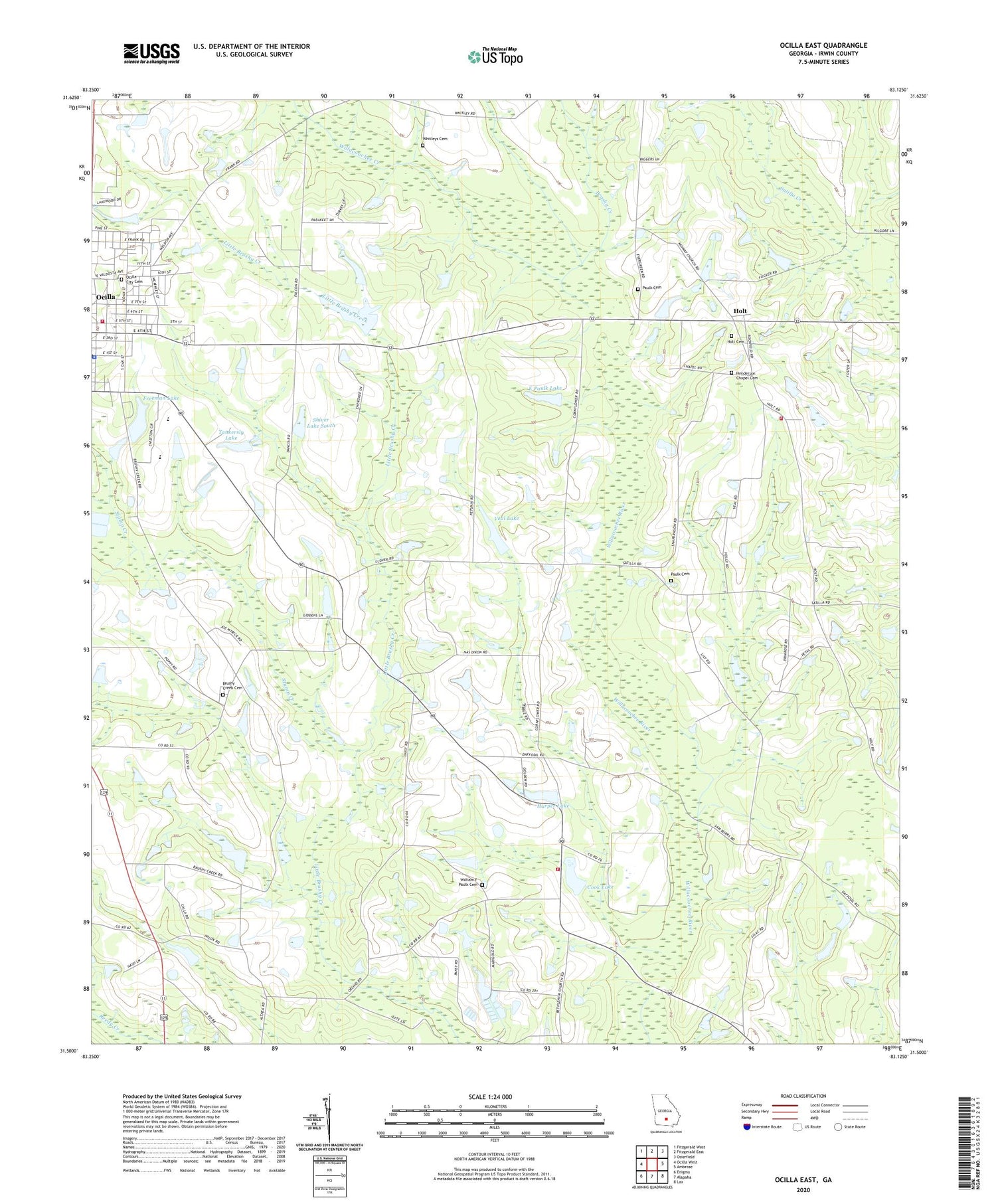
2024 topographic map quadrangle Ocilla East in the state of Georgia. Scale: 1:24000. Based on the newly updated USGS 7.5' US Topo map series, this map is in the following counties: Irwin. The map contains contour data, water features, and other items you are used to seeing on USGS maps, but also has updated roads and other features. This is the next generation of topographic maps. Printed on high-quality waterproof paper with UV fade-resistant inks.
Quads adjacent to this one:
West: Ocilla West
Northwest: Fitzgerald West
North: Fitzgerald East
Northeast: Osierfield
East: Ambrose
Southeast: Lax
South: Alapaha
Southwest: Enigma
This map covers the same area as the classic USGS quad with code o31083e2.
Contains the following named places: Bethel Church, Broaches Chapel Christian Methodist Episcopal Church, Brushy Creek, Brushy Creek Cemetery, Brushy Creek Church, City of Ocilla, Cook Lake, Cook Lake Dam, E Paulk Lake, E Paulk Lake Dam, Freeman Lake, Freeman Lake Dam, Harper Lake, Harper Lake Dam, Henderson Chapel, Henderson Chapel Cemetery, Holt, Holt Baptist Church, Holt Cemetery, Holt Volunteer Fire Department, Irwin County Middle School, Mathis Chapel, Midway Church, Mount Olive African Methodist Episcopal Church, Ocilla Chapel Baptist Church, Ocilla City Cemetery, Ocilla Fire Department, Ocilla Police Department, Ocilla-Holt Division, Paulk Cemetery, Pine Hill Church, Pleasant Grove Baptist Church, Reedy Creek, Second Baptist Church, Shiver Lake Dam South, Shiver Lake South, Stump Creek, Tankersly Lake, Tankersly Lake Dam, Third Baptist Church, Tucker Volunteer Fire Department, Veal Lake, Veal Lake Dam, Whitleys Cemetery, Willacoochee Creek, William F Paulk Cemetery, WSIZ-FM (Ocilla)


