MyTopo
Ocilla West Georgia US Topo Map
Couldn't load pickup availability
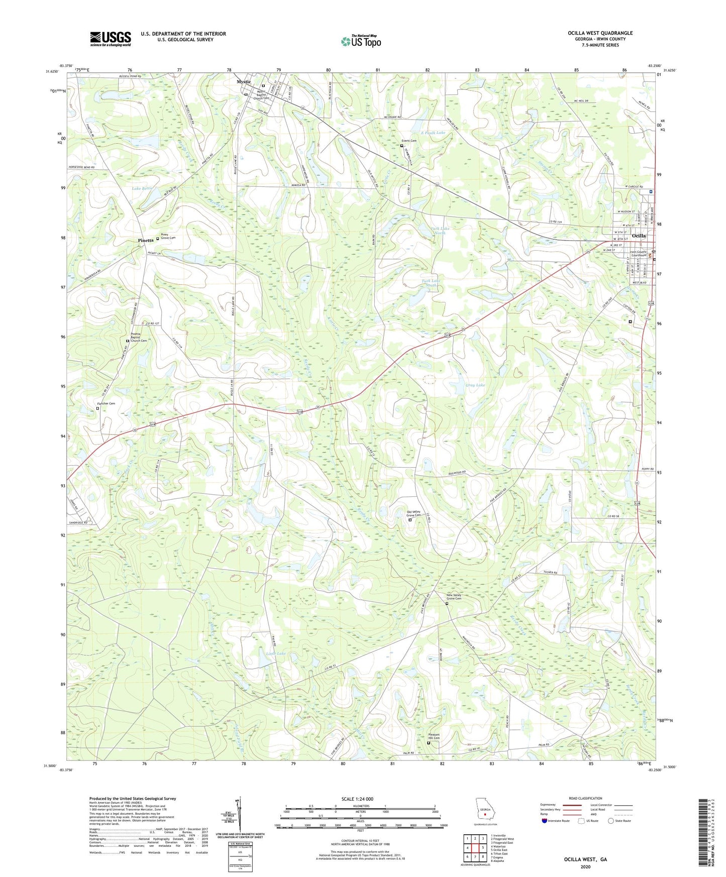
2024 topographic map quadrangle Ocilla West in the state of Georgia. Scale: 1:24000. Based on the newly updated USGS 7.5' US Topo map series, this map is in the following counties: Irwin. The map contains contour data, water features, and other items you are used to seeing on USGS maps, but also has updated roads and other features. This is the next generation of topographic maps. Printed on high-quality waterproof paper with UV fade-resistant inks.
Quads adjacent to this one:
West: Waterloo
Northwest: Irwinville
North: Fitzgerald West
Northeast: Fitzgerald East
East: Ocilla East
Southeast: Alapaha
South: Enigma
Southwest: Tifton East
This map covers the same area as the classic USGS quad with code o31083e3.
Contains the following named places: Cedar Grove Church, Cumbee Park, Duren Lake Dam, E Paulk Lake, E Paulk Lake Dam, Evertt Cemetery, First Methodist Church, Fletcher Cemetery, Gray Lake, Gray Lake Dam, Irwin Academy, Irwin County, Irwin County Courthouse, Irwin County Detention Center, Irwin County Elementary School, Irwin County High School, Irwin County Hospital, Irwin County Jail, Irwin County Library, Irwin County Sheriff's Department and Jail, Lake Bettie, Little Creek, Little Lake, Little Lake Dam, Mystic, Mystic Baptist Church Cemetery, Mystic Post Office, New Valley Grove Cemetery, New Valley Grove Church, Ocilla, Ocilla Baptist Church, Ocilla City Hall, Ocilla Country Club, Ocilla Division, Ocilla Hospital, Ocilla Post Office, Old Valley Grove Cemetery, Old Valley Grove Church, Pinetta, Pinetta Baptist Church Cemetery, Pinetta Church, Piney Grove Cemetery, Piney Grove Church, Pleasant Hill Cemetery, Pleasant Hill Church, Royal Singing Tabernacle, Turk Lake North, Turk Lake North Dam, Turk Lake South, Turk Lake South Dam, WKAA-FM (Ocilla), ZIP Code: 31774