MyTopo
Rutledge South Georgia US Topo Map
Couldn't load pickup availability
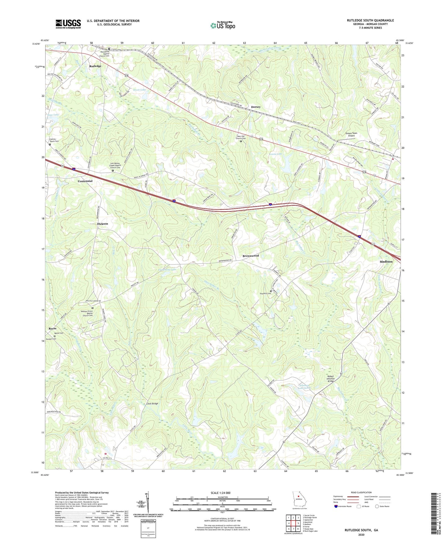
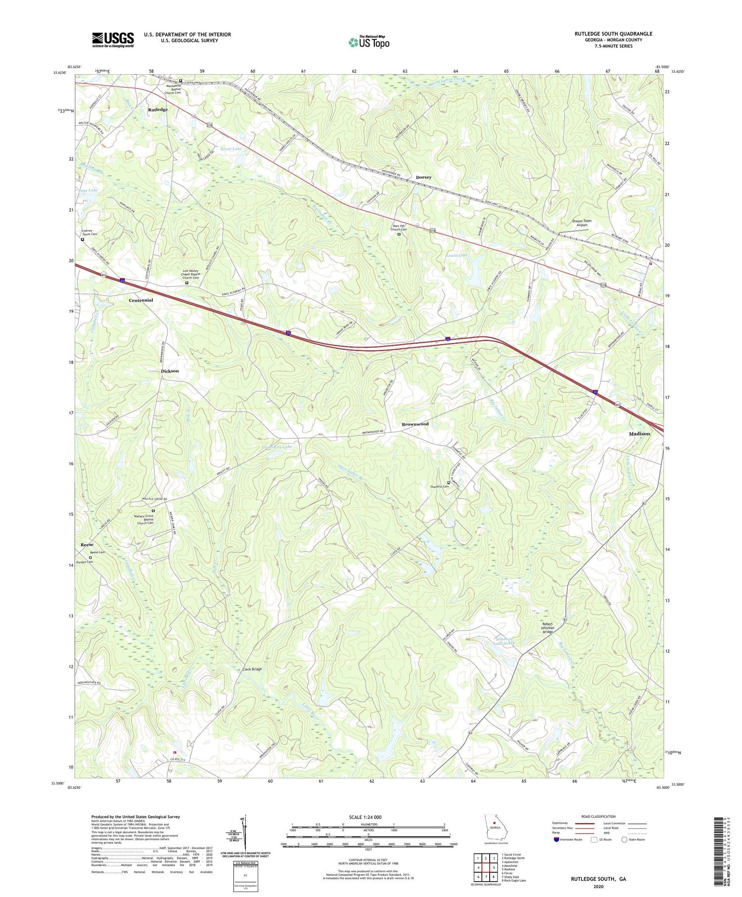
2024 topographic map quadrangle Rutledge South in the state of Georgia. Scale: 1:24000. Based on the newly updated USGS 7.5' US Topo map series, this map is in the following counties: Morgan. The map contains contour data, water features, and other items you are used to seeing on USGS maps, but also has updated roads and other features. This is the next generation of topographic maps. Printed on high-quality waterproof paper with UV fade-resistant inks.
Quads adjacent to this one:
West: Mansfield
Northwest: Social Circle
North: Rutledge North
Northeast: Apalachee
East: Madison
Southeast: Rock Eagle Lake
South: Shady Dale
Southwest: Farrar
This map covers the same area as the classic USGS quad with code o33083e5.
Contains the following named places: Brownwood, Brownwood Baptist Church Cemetery, Campbell Creek, Centennial, Centennial Church, Cheney - Towns Cemetery, Clack Bridge, Clacks Chapel, Dickson, Dorsey, Dream Team Airport, Ervin Dam, Ervin Lake, Greenway Lake, Greenway Lake Dam, Hilsman Lake North, Hilsman Lake North Dam, Indian Creek Baptist Church, Indian Creek Church Cemetery, Indian Creek School, Lewis Lake, Lewis Lake Dam, Low Mosley Chapel Baptist Church Cemetery, Macedonia Baptist Church Cemetery, Macedonia Church, Mars Hill Church, Mars Hill Church Cemetery, Morgan County Fire Rescue Department Station 2, Morgan County Fire Rescue Department Station 7, Mosleys Chapel, Pole Creek, Rawlings Branch, Reese, Reese Cemetery, Rice Creek, Robert Hillsman Bridge, Rutledge Division, Saye Dam, Saye Lake, Shoemaker Branch, Thankful Baptist Church, Thankful Cemetery, Union Mill, Wallace Grove Baptist Church, Wallace Grove Baptist Church Cemetery, ZIP Code: 30663