MyTopo
Soperton South Georgia US Topo Map
Couldn't load pickup availability
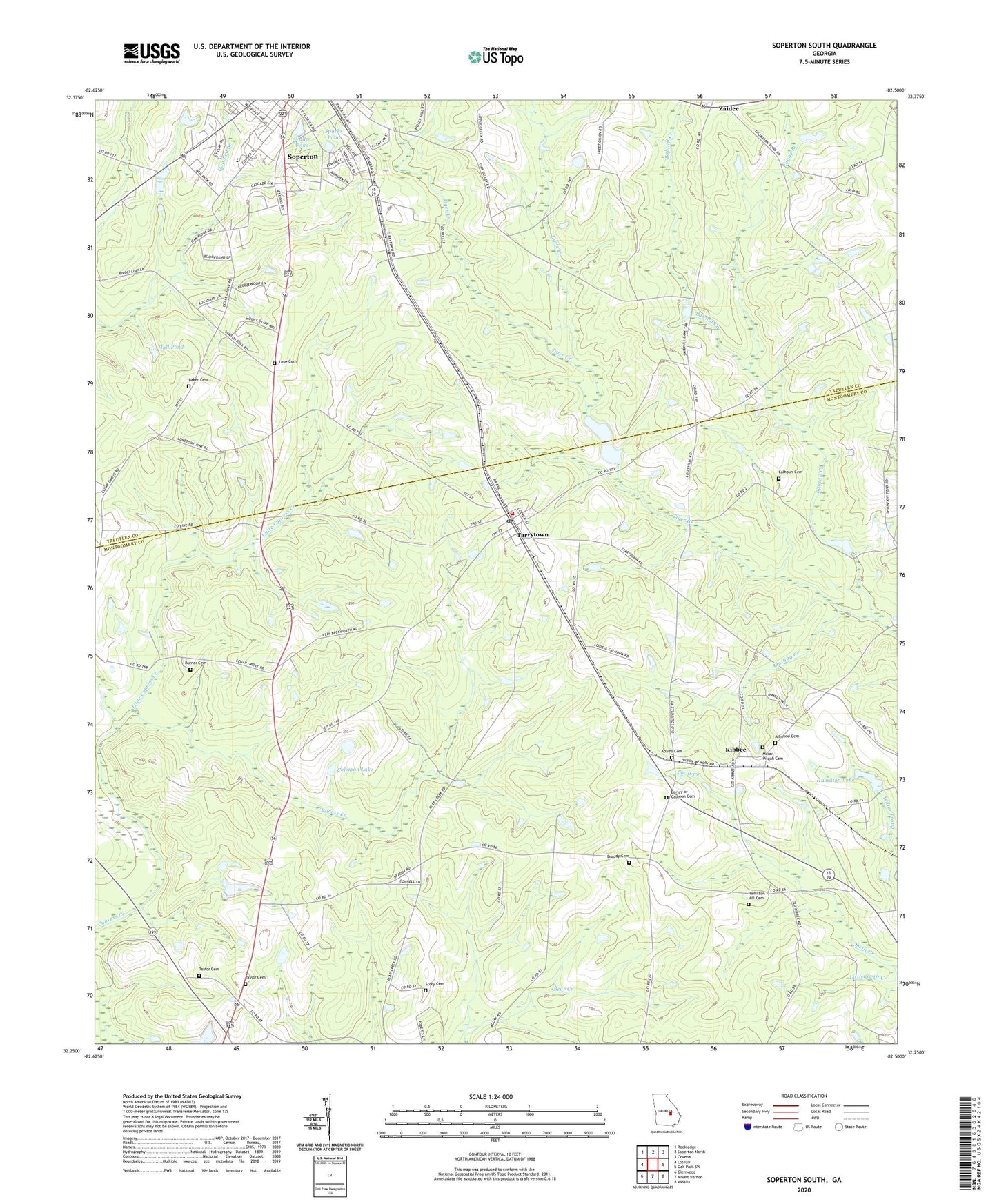
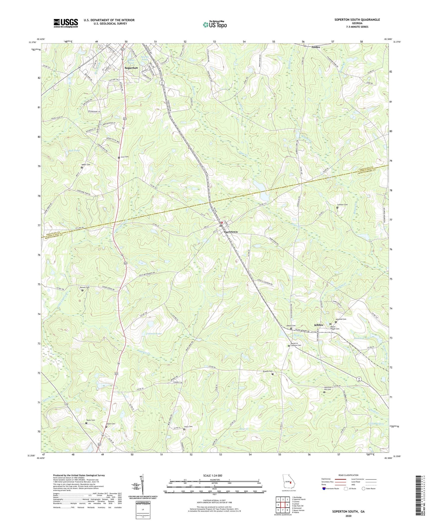
2024 topographic map quadrangle Soperton South in the state of Georgia. Scale: 1:24000. Based on the newly updated USGS 7.5' US Topo map series, this map is in the following counties: Montgomery, Treutlen. The map contains contour data, water features, and other items you are used to seeing on USGS maps, but also has updated roads and other features. This is the next generation of topographic maps. Printed on high-quality waterproof paper with UV fade-resistant inks.
Quads adjacent to this one:
West: Lothair
Northwest: Rockledge
North: Soperton North
Northeast: Covena
East: Oak Park SW
Southeast: Vidalia
South: Mount Vernon
Southwest: Glenwood
This map covers the same area as the classic USGS quad with code o32082c5.
Contains the following named places: Adams Cemetery, Allmond Cemetery, Baker Cemetery, Bobtail Creek, Boggy Branch, Braddy Cemetery, Brown Pond, Burner Cemetery, Calhoun Cemetery, Central Church, Coleman Lake, Coleman Lake Dam, Cypress Creek, Darley or Calhoun Cemetery, Gillis Mill Pond, Hall Pond, Hamilton Dam, Hamilton Hill Cemetery, Hamilton Lake, Hog Bed Branch, Kibbee, Little Creek, Little Cypress Creek, Little Swift Creek, Love Cemetery, Mount Nebo Church, Mount Olive Church, Mount Pisgah Cemetery, Mount Pisgah Church, Shotbag Creek, Simons Chapel, Soperton Division, Sparks Pond, Story Cemetery, Tarrytown, Tarrytown Baptist Church, Tarrytown Division, Tarrytown Post Office, Tarrytown Volunteer Fire Department, Taylor Cemetery, Taylor Cemetery Number 2, Town of Tarrytown, Treutlen County Jail, Treutlen County Sheriff's Office, Treutlen High School, Treutlen Primary School, Treutlen Probation Detention Center, Waller Pond, Warnock Pond, Warnocks Pond Dam, WJHH-AM (Soperton), Zaidee, ZIP Code: 30470