MyTopo
Summertown Georgia US Topo Map
Couldn't load pickup availability
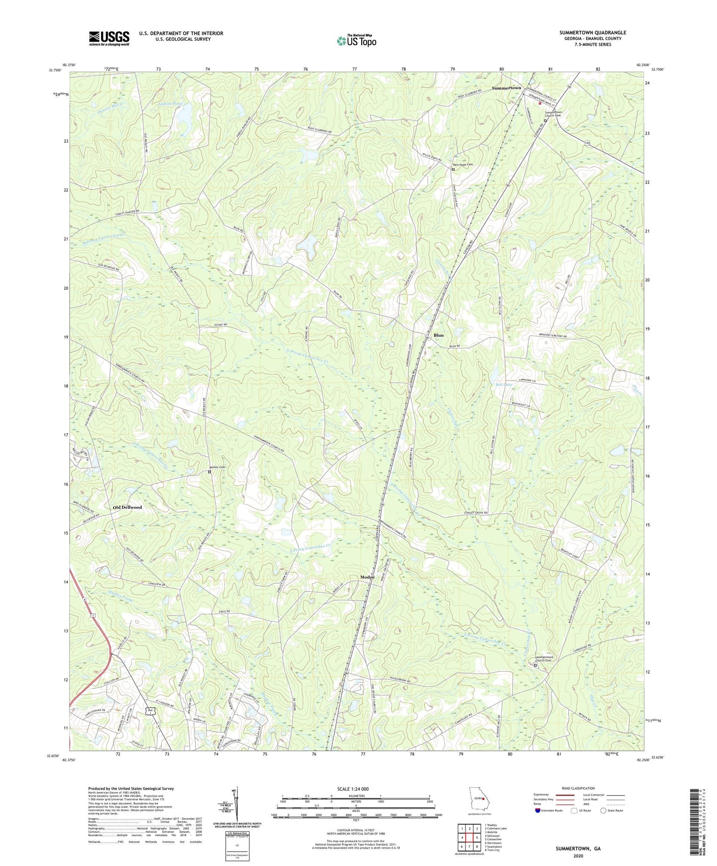
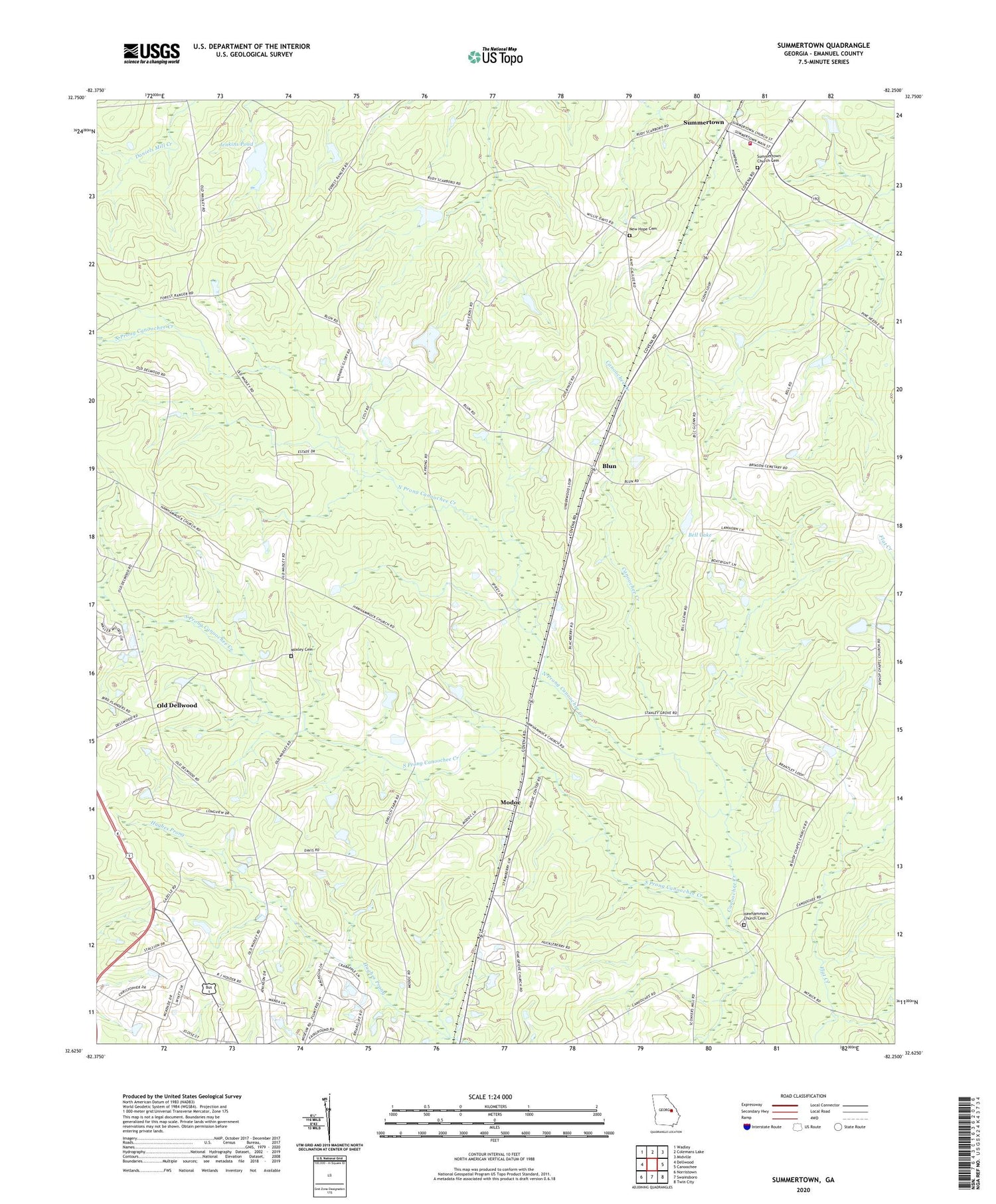
2024 topographic map quadrangle Summertown in the state of Georgia. Scale: 1:24000. Based on the newly updated USGS 7.5' US Topo map series, this map is in the following counties: Emanuel. The map contains contour data, water features, and other items you are used to seeing on USGS maps, but also has updated roads and other features. This is the next generation of topographic maps. Printed on high-quality waterproof paper with UV fade-resistant inks.
Quads adjacent to this one:
West: Dellwood
Northwest: Wadley
North: Colemans Lake
Northeast: Midville
East: Canoochee
Southeast: Twin City
South: Swainsboro
Southwest: Norristown
This map covers the same area as the classic USGS quad with code o32082f3.
Contains the following named places: Bell Lake, Bell Lake Dam, Blun, City of Summertown, Dellwood Church, Emanuel County Volunteer Fire Department Summertown Station, Georgia State Patrol Troop F Post 19, Hawhammock Church, Hawhammock Church Cemetery, Jenkins Pond, Jenkins Pond Dam, Modoc, Moxley Cemetery, New Hope Cemetery, New Hope Church, North Prong Canoochee Creek, Oak Grove Church, Old Dellwood, Second Union Church, South Prong Canoochee Creek, Stanley Grove Church, Summertown, Summertown Church Cemetery, Summertown Division, Summertown Elementary School, Summertown United Methodist Church, Summertown Volunteer Fire Department