
MyTopo
Norristown Georgia US Topo Map
Couldn't load pickup availability
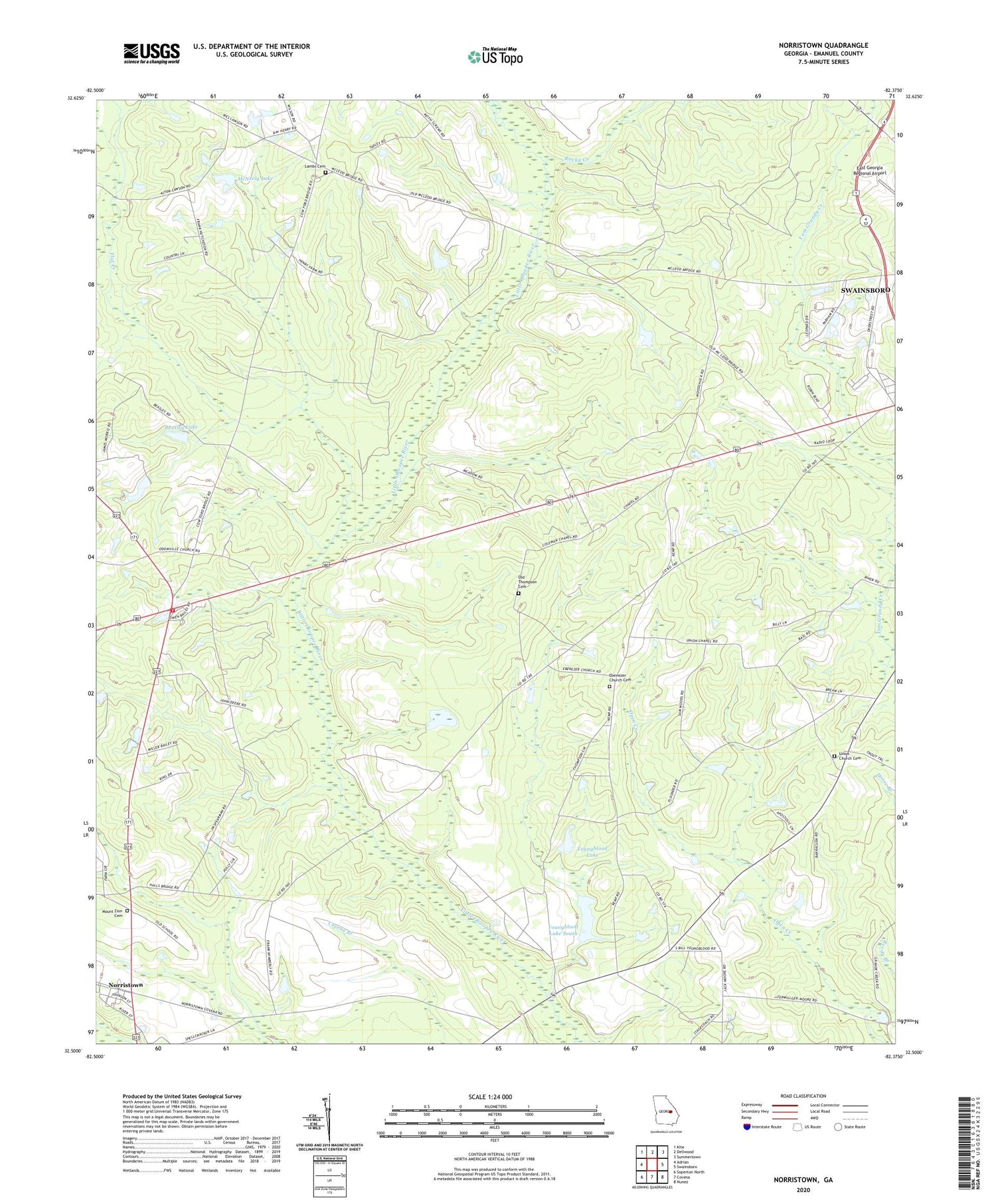
2024 topographic map quadrangle Norristown in the state of Georgia. Scale: 1:24000. Based on the newly updated USGS 7.5' US Topo map series, this map is in the following counties: Emanuel. The map contains contour data, water features, and other items you are used to seeing on USGS maps, but also has updated roads and other features. This is the next generation of topographic maps. Printed on high-quality waterproof paper with UV fade-resistant inks.
Quads adjacent to this one:
West: Adrian
Northwest: Kite
North: Dellwood
Northeast: Summertown
East: Swainsboro
Southeast: Nunez
South: Covena
Southwest: Soperton North
This map covers the same area as the classic USGS quad with code o32082e4.
Contains the following named places: Beasley Lake, Beasley Lake Dam, Colman Chapel, Ebenezer Church, Ebenezer Church Cemetery, Emanuel County Volunteer Fire Department Station 3, Flat Creek, Hebron Church, Lambs Cemetery, McNeely Lake, McNeely Lake Dam, Mount Zion Cemetery, Mount Zion Church, Norristown, Norristown Census Designated Place, Norristown Junction, Old Thompson Cemetery, Pine Hill Church, Rocky Creek, Union Church, Union Church Cemetery, WXRS-FM (Swainsboro), Youngblood Lake, Youngblood Lake Dam, Youngblood Lake South, Youngblood Lake South Dam


