MyTopo
Talking Rock Georgia US Topo Map
Couldn't load pickup availability
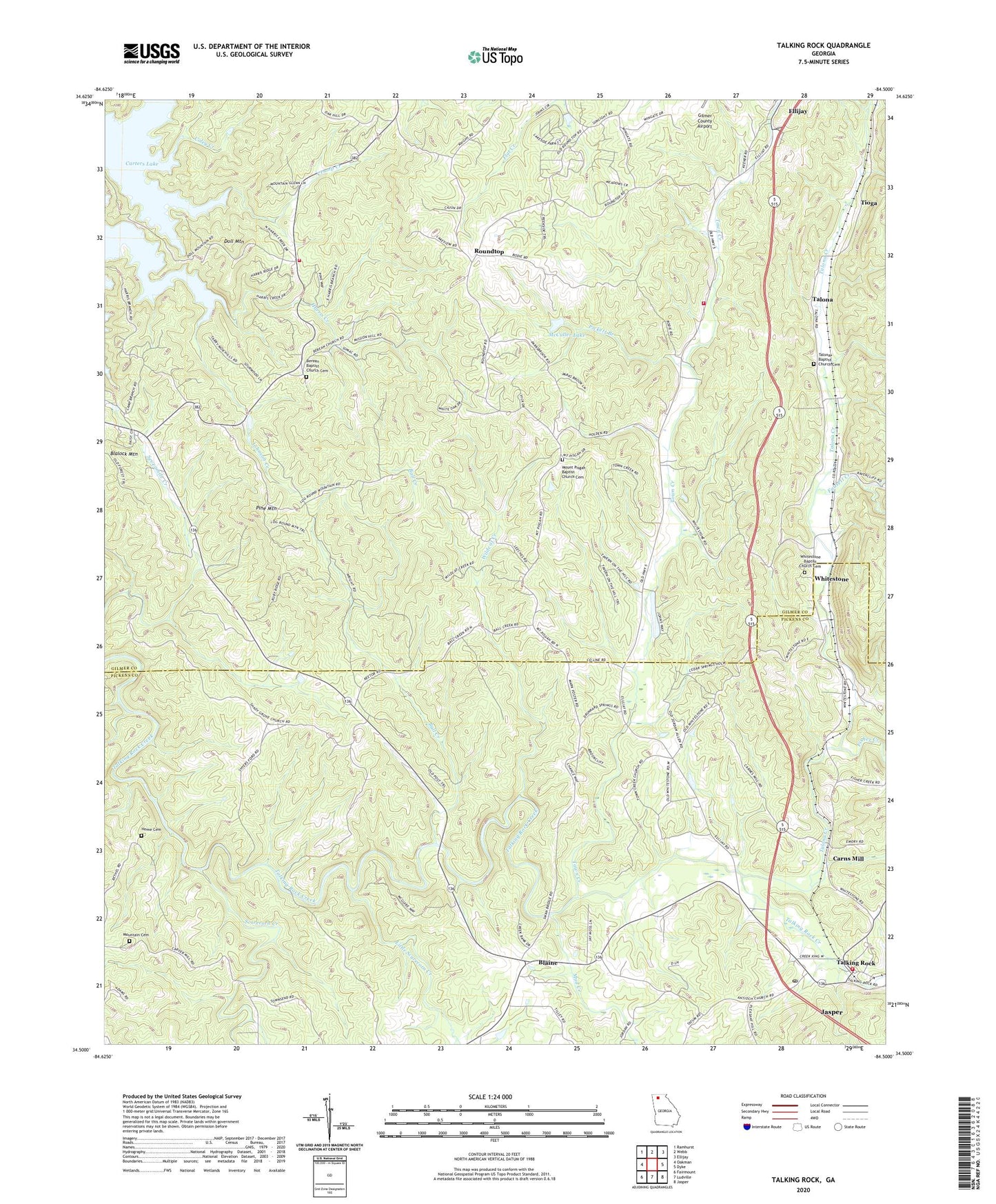
2024 topographic map quadrangle Talking Rock in the state of Georgia. Scale: 1:24000. Based on the newly updated USGS 7.5' US Topo map series, this map is in the following counties: Gilmer, Pickens. The map contains contour data, water features, and other items you are used to seeing on USGS maps, but also has updated roads and other features. This is the next generation of topographic maps. Printed on high-quality waterproof paper with UV fade-resistant inks.
Quads adjacent to this one:
West: Oakman
Northwest: Ramhurst
North: Webb
Northeast: Ellijay
East: Dyke
Southeast: Jasper
South: Ludville
Southwest: Fairmount
This map covers the same area as the classic USGS quad with code o34084e5.
Contains the following named places: Antioch Church, Ball Creek, Ball Creek Church, Ball Creek Ford, Ball Creek School, Berean Baptist Church Cemetery, Berean Church, Blaine, Blalock Mountain, Carlisle, Carns Mill, Carters Lake Division, Clipper, Coley Creek, Corinth Church, Crump Creek, Doll Mountain, Doll Mountain Church, Doll Mountain Recreation Area, Fausett Creek, Fisher Creek, Gartrell, Gilmer County Fire Department Station 7, Home Cemetery, Johnson Creek, Keasley, Lebanon Presbyterian Church, Little Scarecorn Creek, McCuller Lake, McCuller Lake Dam, Mount Pisgah Baptist Church Cemetery, Mount Pisgah Church, Mount Pisgah School, Mountain Cemetery, Mud Creek, Oak Hill School, Pickens County Fire and Rescue Department Station 7, Pickett Branch, Pine Mountain, Rober, Roundtop, Scarecorn, Scarecorn Creek, Shyers Ford, Southwestern School, Talking Rock, Talking Rock Baptist Church, Talking Rock Division, Talking Rock Post Office, Talona, Talona Baptist Church Cemetery, Talona Church, Talona Creek, Timber Lake, Timber Lake Dam, Tioga, Town Creek, Town Creek Church, Town Creek School, Whitestone, Whitestone Baptist Church Cemetery, Wildcat Creek, ZIP Code: 30175