MyTopo
Oakman Georgia US Topo Map
Couldn't load pickup availability
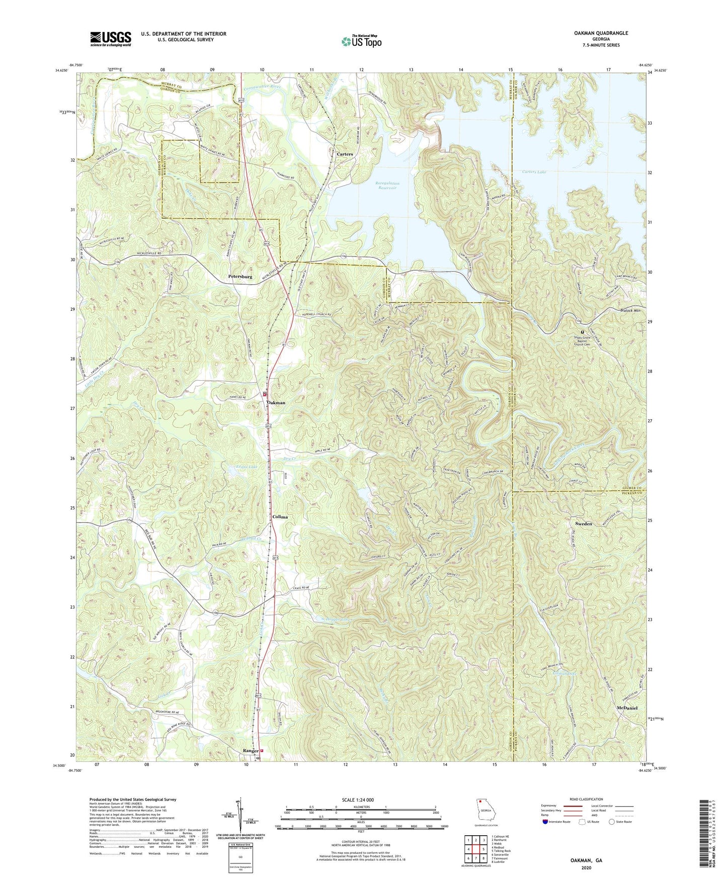
2024 topographic map quadrangle Oakman in the state of Georgia. Scale: 1:24000. Based on the newly updated USGS 7.5' US Topo map series, this map is in the following counties: Gordon, Murray, Gilmer, Pickens. The map contains contour data, water features, and other items you are used to seeing on USGS maps, but also has updated roads and other features. This is the next generation of topographic maps. Printed on high-quality waterproof paper with UV fade-resistant inks.
Quads adjacent to this one:
West: Redbud
Northwest: Calhoun NE
North: Ramhurst
Northeast: Webb
East: Talking Rock
Southeast: Ludville
South: Fairmount
Southwest: Sonoraville
This map covers the same area as the classic USGS quad with code o34084e6.
Contains the following named places: Banks Chapel, Bethel Church, Camp Branch, Carters, Carters Dam, Carters Lake, Carters Reregulation Dam, Colima, Damsite Overlook, Damsite Recreation Area, Duke Creek, Evans Lake, Evans Lake Dam, Fair View Church, Fisher Creek, Goble Branch, Gordon County Fire / Rescue Department Station 10 Ranger, Gordon County Fire and Rescue Department Station 9, Harris Branch Recreation Area, Harris Creek, Hopewell Baptist Church, Hopper Lake, Lewis Branch, Liberty Church, Liberty School, Long Branch, Macedonia Church, McDaniel, Mineral Springs Branch, New Hope Church, Oakman, Oakman Post Office, Oakman School, Petersburg, Raccoon Branch, Ranger, Ranger Post Office, Reregulation Dam Recreation Area, Reregulation Pool, Reregulation Reservoir, Rock Springs Branch, Sallacoa Creek Watershed Dam Number 77, Sevenmile Creek, Shady Grove Baptist Church Cemetery, Shady Grove Church, Sugar Creek, Sweden, Talking Rock Creek, Talking Rock Wildlife Management Area, Tillman Lake, Tillman Lake Dam, Town of Ranger, Wheeler, White Graves Church, Willbanks Branch, Wolf Branch, Woodridge Branch Recreation Area, Woodring Branch, Wurley Creek, ZIP Code: 30734