MyTopo
Tarversville Georgia US Topo Map
Couldn't load pickup availability
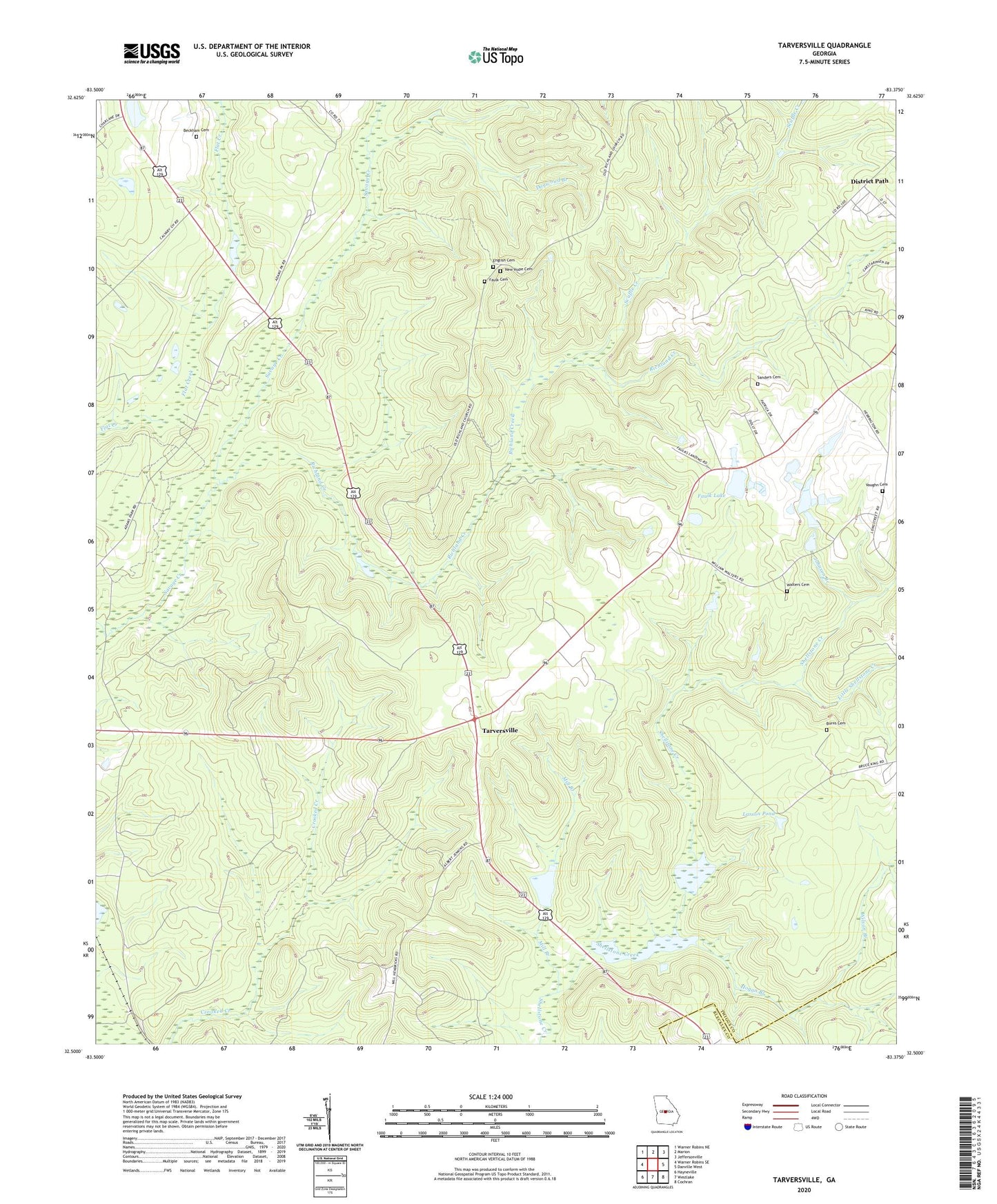
2024 topographic map quadrangle Tarversville in the state of Georgia. Scale: 1:24000. Based on the newly updated USGS 7.5' US Topo map series, this map is in the following counties: Twiggs, Bleckley. The map contains contour data, water features, and other items you are used to seeing on USGS maps, but also has updated roads and other features. This is the next generation of topographic maps. Printed on high-quality waterproof paper with UV fade-resistant inks.
Quads adjacent to this one:
West: Warner Robins SE
Northwest: Warner Robins NE
North: Marion
Northeast: Jeffersonville
East: Danville West
Southeast: Cochran
South: Westlake
Southwest: Hayneville
This map covers the same area as the classic USGS quad with code o32083e4.
Contains the following named places: Beckham Cemetery, Burns Cemetery, District Path, Dogwood Branch, English Cemetery, Faulk Cemetery, Faulk Lake, Faulk Lake Dam, Greater New Hope Church, Hendrick Pond, Hendricks Lake Dam, Hogan Branch, Johnson Branch, Larson Pond, Little Shellstone Creek, Mill Branch, Mount Calvary, Mount Olive, Mount Olive Church, New Hope Cemetery, New Hope Church, New Richland Baptist Church, Richland Creek, Sanders Cemetery, Scuffle Creek, Shiloh Church, Shiloh School, South Twiggs Division, Tarversville, Vaughn Cemetery, Walters Cemetery, Wilson Branch