
MyTopo
Marion Georgia US Topo Map
Couldn't load pickup availability
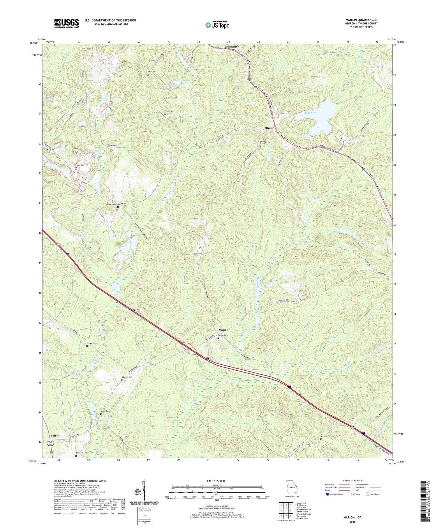
2024 topographic map quadrangle Marion in the state of Georgia. Scale: 1:24000. Based on the newly updated USGS 7.5' US Topo map series, this map is in the following counties: Twiggs. The map contains contour data, water features, and other items you are used to seeing on USGS maps, but also has updated roads and other features. This is the next generation of topographic maps. Printed on high-quality waterproof paper with UV fade-resistant inks.
Quads adjacent to this one:
West: Warner Robins NE
Northwest: Macon East
North: Dry Branch
Northeast: Massey Hill
East: Jeffersonville
Southeast: Danville West
South: Tarversville
Southwest: Warner Robins SE
This map covers the same area as the classic USGS quad with code o32083f4.
Contains the following named places: Beckham Cemetery, Beech Spring Academy, Beech Spring Cemetery, Beech Spring Church, Buck Branch, Bullard, Bullard School, Finch Cemetery, Fitzpatrick, Glover Cemetery, Jones - Denson Cemetery, Land Cemetery, Lanier Lake, Lanier Lake Dam, Linda Melton Late Cemetery, Mallory Lake, Mallory Lake Dam, Marion, Marion Cemetery, Marion School, Mount Zion Church, Mount Zion School, New Mount Zion Church, North Twiggs Division, O'Daniel Cemetery, Old Marion Church, Pearce Cemetery, Richland Cemetery, Richland Church, Richland School, Ripley, Rosebud Church, Shiloh Church, State of Georgia, Stone Lake, Stone Lake Dam, Turvin Creek, Twiggs County, Wall Cemetery, White Spring Church, White Springs School, WWST-FM (Jeffersonville), ZIP Codes: 31020, 31044


