MyTopo
Twin City SE Georgia US Topo Map
Couldn't load pickup availability
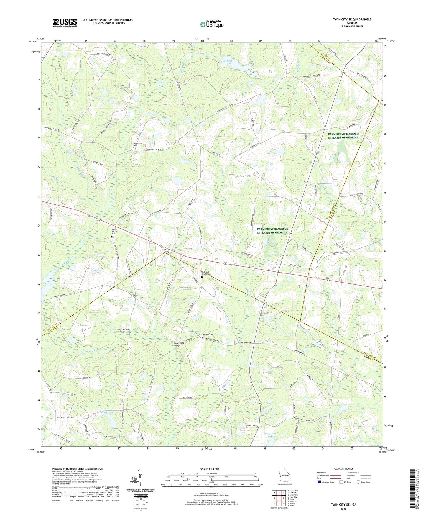
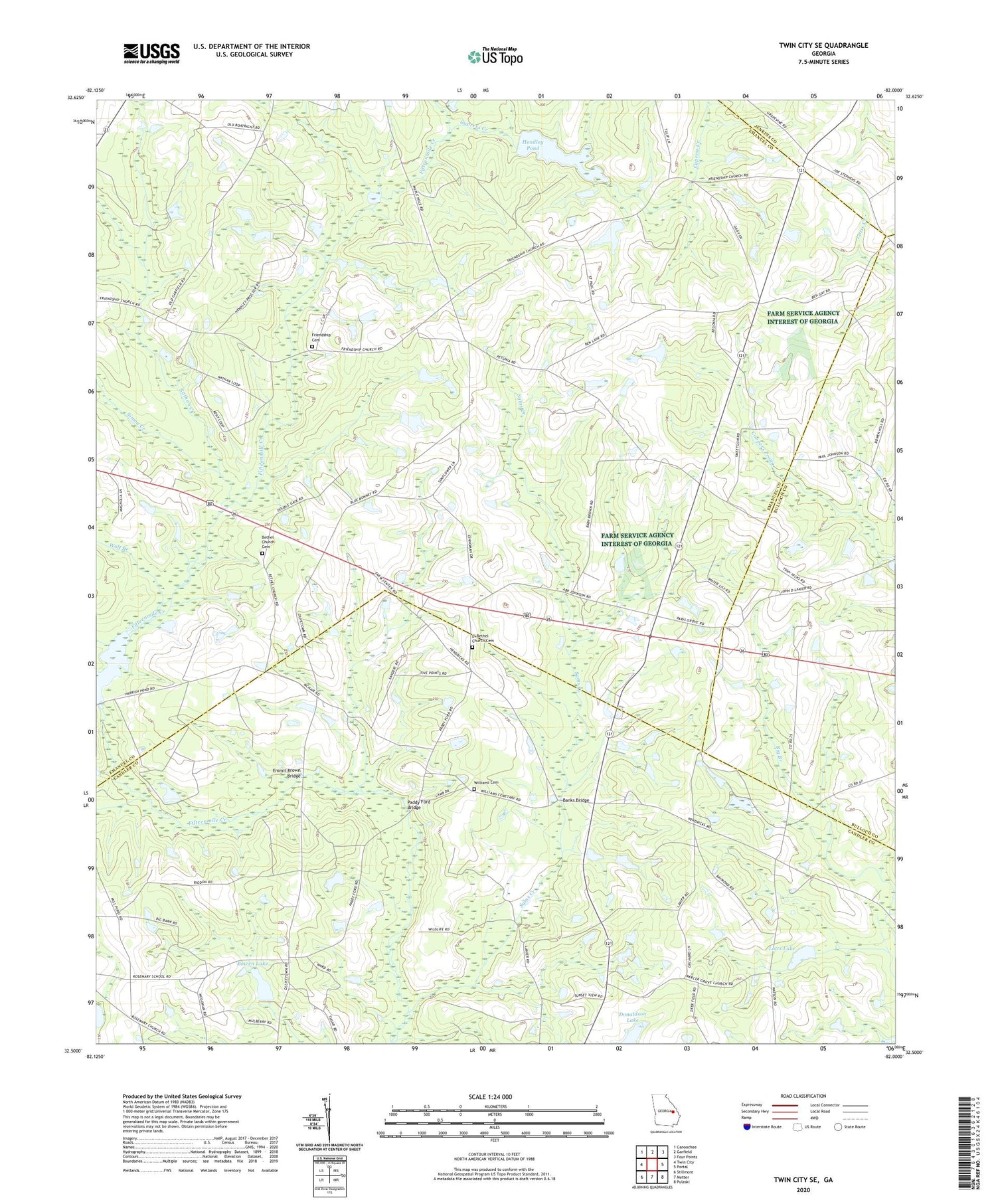
2024 topographic map quadrangle Twin City SE in the state of Georgia. Scale: 1:24000. Based on the newly updated USGS 7.5' US Topo map series, this map is in the following counties: Emanuel, Candler, Bulloch, Jenkins. The map contains contour data, water features, and other items you are used to seeing on USGS maps, but also has updated roads and other features. This is the next generation of topographic maps. Printed on high-quality waterproof paper with UV fade-resistant inks.
Quads adjacent to this one:
West: Twin City
Northwest: Canoochee
North: Garfield
Northeast: Four Points
East: Portal
Southeast: Pulaski
South: Metter
Southwest: Stillmore
This map covers the same area as the classic USGS quad with code o32082e1.
Contains the following named places: Banks Bridge, Bethel Church, Bethel Church Cemetery, Bowen Lake, Bowen Lake Dam, Cypress Creek, Donaldson Lake, Donaldson Lake Dam, Donaldson North Dam, El Bethel Church, El Bethel Church Cemetery, Emmit Brown Bridge, Friendship Cemetery, Friendship Church, George L Smith II State Park, Hendley Pond, Hendley Pond Dam, Lotts Lake, Lotts Lake Dam, Mercer Grove Church, Nathan Creek, New Beulah Church, Paddy Ford Bridge, Paris Grove Church Cemetery, Parris Grove Church, Piney Grove Church, Rosemary School, Saint Pauls Church, Sams Creek, Simon Creek, Watson Pond, Watson Pond Dam, Williams Cemetery, Wolf Branch