
MyTopo
Stillmore Georgia US Topo Map
Couldn't load pickup availability
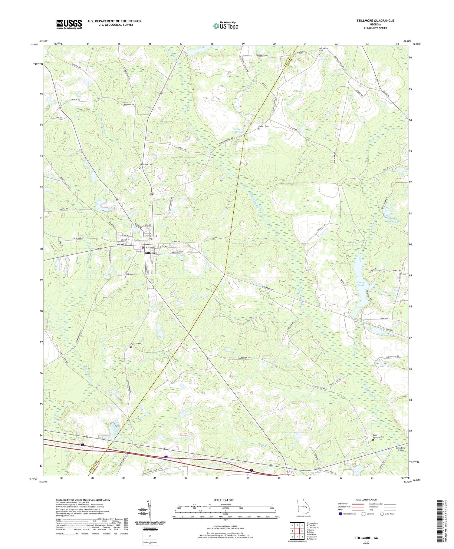
2024 topographic map quadrangle Stillmore in the state of Georgia. Scale: 1:24000. Based on the newly updated USGS 7.5' US Topo map series, this map is in the following counties: Candler, Emanuel. The map contains contour data, water features, and other items you are used to seeing on USGS maps, but also has updated roads and other features. This is the next generation of topographic maps. Printed on high-quality waterproof paper with UV fade-resistant inks.
Quads adjacent to this one:
West: Nunez
Northwest: Swainsboro
North: Twin City
Northeast: Twin City SE
East: Metter
Southeast: Metter SE
South: Cobbtown
Southwest: Oak Park
This map covers the same area as the classic USGS quad with code o32082d2.
Contains the following named places: Brantley Trapnell Lake, Brantley Trapnell Lake Dam, Canoe, Canoe Pond, Canoe Pond Dam, City of Stillmore, Cooper Lake, Cooper Lake Dam, Cowart Cemetery, Cowarts Mill Pond, Durden Pond, Durdens Pond Dam, Emanuel County Volunteer Fire Department Stillmore Station, Emmit Bridge, Lewis Lake, Lewis Lake Dam, McCullough Creek, Mill Creek, Oak Grove Cemetery, Old Beulah Cemetery, Reedy Creek, Saint Marys Church, Saint Matthew Cemetery, Stillmore, Stillmore Cemetery, Stillmore Fire Department, Stillmore Police Department Headquarters, Stillmore Post Office, Strawfield Bridge, Warren Cemetery, ZIP Code: 30464


