MyTopo
Wassaw Sound Georgia US Topo Map
Couldn't load pickup availability
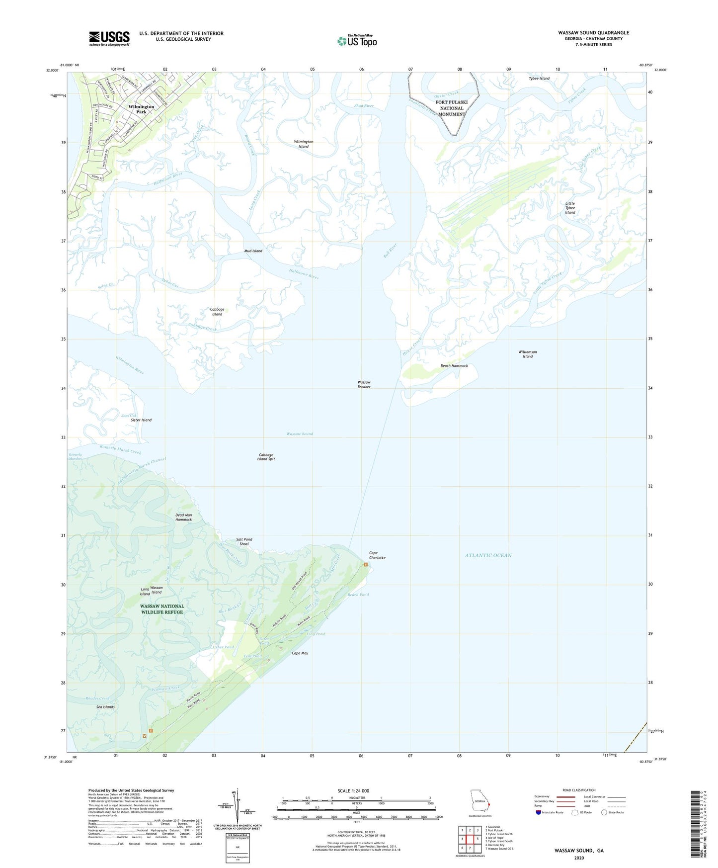
2024 topographic map quadrangle Wassaw Sound in the state of Georgia. Scale: 1:24000. Based on the newly updated USGS 7.5' US Topo map series, this map is in the following counties: Chatham. The map contains contour data, water features, and other items you are used to seeing on USGS maps, but also has updated roads and other features. This is the next generation of topographic maps. Printed on high-quality waterproof paper with UV fade-resistant inks.
Quads adjacent to this one:
West: Isle of Hope
Northwest: Savannah
East: Tybee Island South
South: Wassaw Sound OE S
Southwest: Raccoon Key
This map covers the same area as the classic USGS quad with code o31080h8.
Contains the following named places: Beach Hammock, Beach Pond, Beard Creek, Blue Bank Creek, Bull River, Cabbage Creek, Cabbage Island, Cabbage Island Spit, Cape Charlotte, Cape May, Carter Creek, Crooked Creek, Dead Man Hammock, Flag Pond, Halfmoon River, House Creek, Joes Cut, Little Tybee Creek, Little Tybee Island, Long Creek, Long Island, Mill Creek, Mud Island, National Wassaw Wildlife Refuge, New Cut, North Otter Pond, Old Romerly Marsh Channel, Otter Pond, Oyster Creek, Palmetto Pond, Rhodes Creek, Romerly Marsh Creek, Salt Pond Shoal, Seine Creek, Sheepshead Creek, Sister Island, South Pond, Teal Pond, Tom Creek, Tybee Cut, Tybee Island-Wilmington Island Division, Usher Pond, Wassaw Breaker, Wassaw Island, Wassaw National Wildlife Refuge, Wassaw Sound, Williamson Island, Wilmington, Wilmington Park, Wilmington River