MyTopo
Waverly Hall Georgia US Topo Map
Couldn't load pickup availability
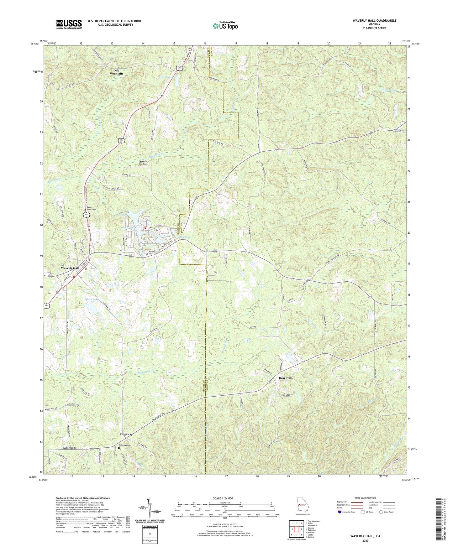
2024 topographic map quadrangle Waverly Hall in the state of Georgia. Scale: 1:24000. Based on the newly updated USGS 7.5' US Topo map series, this map is in the following counties: Harris, Talbot. The map contains contour data, water features, and other items you are used to seeing on USGS maps, but also has updated roads and other features. This is the next generation of topographic maps. Printed on high-quality waterproof paper with UV fade-resistant inks.
Quads adjacent to this one:
West: Cataula
Northwest: Pine Mountain
North: Shiloh
Northeast: Manchester
East: Talbotton
Southeast: Geneva
South: Upatoi
Southwest: Midland
This map covers the same area as the classic USGS quad with code o32084f6.
Contains the following named places: Baughville, Bluff Spring Church, Favors Dam, Favors Lake, Flatrock Church, Humble Zion Church, Laney School, Long Lake, Long Lake Dam, Mathews Chapel, Melody Lake Volunteer Fire Department, Mount McCatherine Church, Mount Zion Church, Oak Mountain, Peeds Lakes, Pine Grove Church, Pitts Memorial Church, Ridgeway, Ridgeway Cemetery, Rockcola Church, Saint Johns Cemetery, Silver Lake, Silver Lake Dam, Ski Lake, Ski Lake Dam, Sparks Creek, Springfield Church, Storey Dam, Storey Lake, Town of Waverly Hall, Waverly Hall, Waverly Hall Cemetery, Waverly Hall Elementary School, Waverly Hall Police Department, Waverly Hall Post Office, Waverly Hall Volunteer Fire Department, Waverly Landing, Whispering Pines Lake, Whispering Pines Lake Dam, ZIP Code: 31831