MyTopo
Manchester Georgia US Topo Map
Couldn't load pickup availability
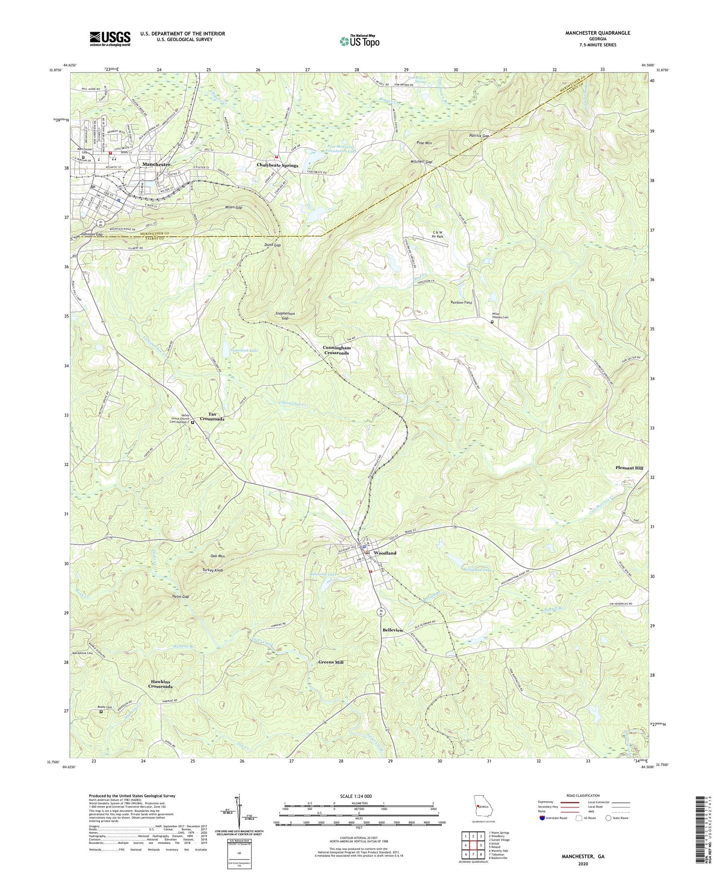
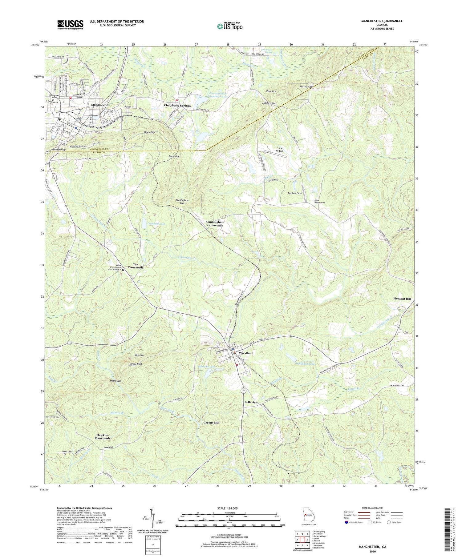
2024 topographic map quadrangle Manchester in the state of Georgia. Scale: 1:24000. Based on the newly updated USGS 7.5' US Topo map series, this map is in the following counties: Talbot, Meriwether. The map contains contour data, water features, and other items you are used to seeing on USGS maps, but also has updated roads and other features. This is the next generation of topographic maps. Printed on high-quality waterproof paper with UV fade-resistant inks.
Quads adjacent to this one:
West: Shiloh
Northwest: Warm Springs
North: Woodbury
Northeast: Sunset Village
East: Roland
Southeast: Baldwinville
South: Talbotton
Southwest: Waverly Hall
This map covers the same area as the classic USGS quad with code o32084g5.
Contains the following named places: Belleview, C & W Air Park, Callaway Public School, Calvary Baptist Church, Chalybeate Springs, Church of Christ, Church of God, Church of the Nazarene, City of Woodland, Concord Church, Concord Church Cemetery, Copeland Lake, Copeland Lake Dam, Cunningham Crossroads, Dunn Gap, Evans Chapel, Fifth Avenue Shopping Center, First Methodist Church, First Presbyterian Church, Franklin Academy, Friendship Church Cemetery, Georgia State Patrol Troop D Post 34 Manchester, Gin Creek, Greens Mill, Hawkins Crossroads, Helm Gap, Hurricane Branch, Johnson Gap, Lazy Acres Plantation, Macedonia Baptist Church Cemetery, Mahone Branch, Manchester, Manchester Baptist Church, Manchester Cemetery, Manchester Christian Academy, Manchester Elementary School, Manchester Fire Department, Manchester Grade School, Manchester High School, Manchester Middle School, Manchester Police Department, Manchester Post Office, Manchester Public School, Meriwether County Training School, Meriwether County Volunteer Fire Department Station 11, Milen Gap, Miller - Holmes Cemetery, Mitchell Gap, Mount Sinai Christian Methodist Episcopal Church, New Directions Alternative School, New Hope Church Cemetery, Northside Baptist Church, Patrick Gap, Pine Mountain Foundation Dam, Pine Mountain Foundation Lake, Pine Mountain Regional Library, Rainbow Field, Ransome Lake, Reedy Cemetery, Rocky Shoals Ford, Rush Creek, Saint James Methodist Church, Stephenson Gap, Talbot County Fire Department Woodland Station, Tax Crossroads, Tom Brown Branch, Tom Brown Spring, Turkey Knob, Valley Grove Academy, Valley Grove Baptist Church Cemetery, Valley Grove Church, Valley Grove Church Cemetery Number 1, Woodall School, Woodland, Woodland Academy, Woodland Division, Woodland Lake, Woodland Lake Dam, Woodland Lookout Tower, Woodland Memorial Cemetery, Woodland Police Department, Woodland Post Office, Woodland Presbyterian Cemetery, Woodland School, WVFJ-FM (Manchester), ZIP Code: 31836