MyTopo
Woodlawn Georgia US Topo Map
Couldn't load pickup availability
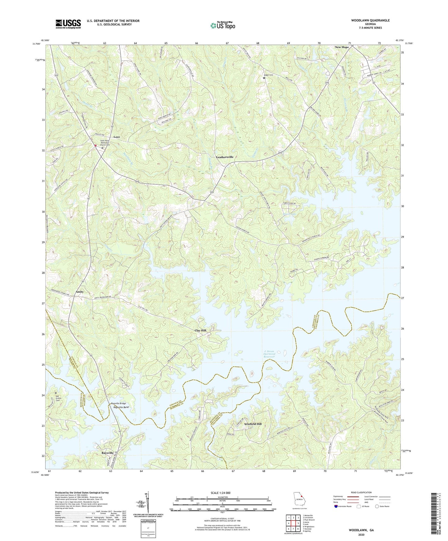
2024 topographic map quadrangle Woodlawn in the state of Georgia. Scale: 1:24000. Based on the newly updated USGS 7.5' US Topo map series, this map is in the following counties: Lincoln, Columbia, McDuffie, Wilkes. The map contains contour data, water features, and other items you are used to seeing on USGS maps, but also has updated roads and other features. This is the next generation of topographic maps. Printed on high-quality waterproof paper with UV fade-resistant inks.
Quads adjacent to this one:
West: Aonia
Northwest: Metasville
North: Lincolnton
Northeast: Plum Branch
East: Leah
Southeast: Appling
South: Winfield
Southwest: Wrightsboro
This map covers the same area as the classic USGS quad with code o33082f4.
Contains the following named places: Agnes, Agnes School, Amity, Antioch Church, Arimathea Church, Big Creek, Cade Mill, Clay Hill, Clay Hill School, Dozier Branch, Forest Lake, Forest Lake Estates Dam, Germany Creek, Grays Creek, Hamburg Branch, Hogan Cemetery, J. Strom Thurmond Reservoir, Jones Academy, Knoblick Branch, Leathersville, Liberty Hill School, Liberty School, Little Creek, Lloyd Creek, Loce, Loco Church, Loco Holiness Church, Loco Volunteer Fire Department, Mistletoe Corners, Mount Zion Church, New Hope, Old Griffin Cemetery, Raysville Bend, Raysville Bridge, Rock Hill Methodist Church, Rousseau Creek, Saint Pauls Church, Saint Pauls Methodist Church Cemetery, Salem, Salem Baptist Church, South Lincoln Division, Tabernacle Church, Winfield Campsites, Winfield Hill, Woodlawn, Woodlawn School, Zion School