MyTopo
Wrightsboro Georgia US Topo Map
Couldn't load pickup availability
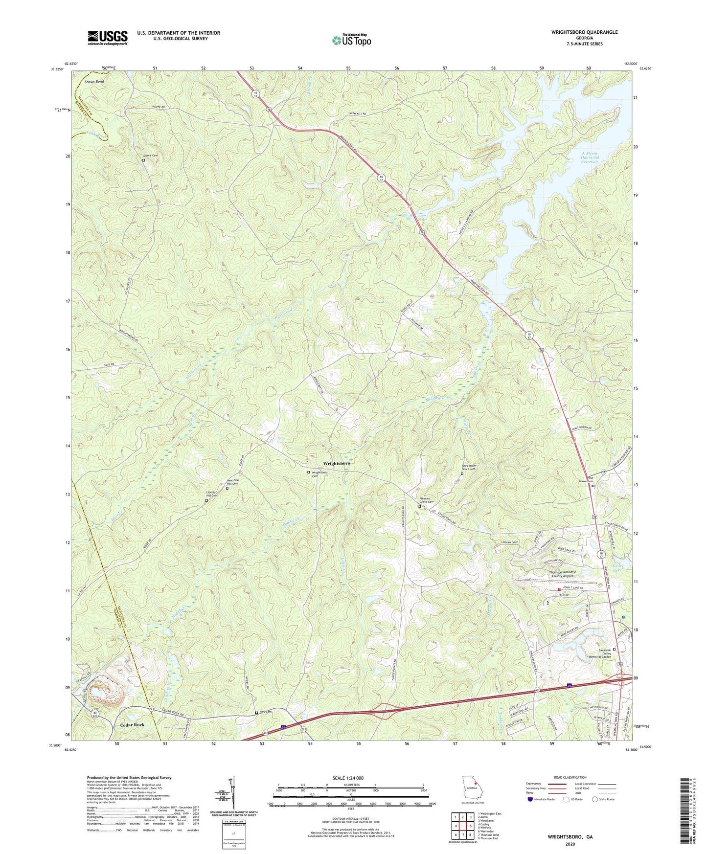
2024 topographic map quadrangle Wrightsboro in the state of Georgia. Scale: 1:24000. Based on the newly updated USGS 7.5' US Topo map series, this map is in the following counties: McDuffie, Warren, Wilkes. The map contains contour data, water features, and other items you are used to seeing on USGS maps, but also has updated roads and other features. This is the next generation of topographic maps. Printed on high-quality waterproof paper with UV fade-resistant inks.
Quads adjacent to this one:
West: Cadley
Northwest: Washington East
North: Aonia
Northeast: Woodlawn
East: Winfield
Southeast: Thomson East
South: Thomson West
Southwest: Warrenton
This map covers the same area as the classic USGS quad with code o33082e5.
Contains the following named places: Anthony Crossroads, Belle Meade Country Club, Brinkley Chapel, Cedar Rock, Childers Creek, Columbia Mine, Factory Creek, Georgia State Patrol Thomson, Green Branch Church, Hart Creek, Ivey Cemetery, Knox Lake, Knox Lake Dam, Liberty Hill Cemetery, Liberty Hill Church, Liberty Hill School, Little Creek, Mattox Creek, McDuffie County Fire Department Station 2, Middle Creek, Moore Cemetery, New Zion Hill Cemetery, New Zion Hill Church, Pine Grove Cemetery, Pine Grove Church, Pleasant Grove Cemetery, Pleasant Grove Church, Rees-Wade-Short Cemetery, Savannah Valley Memorial Garden, Shaws Bend, Tatham Mines, Thomson Division, Thomson-McDuffie County Airport, Three Points, Todds Branch, Wrightsboro, Wrightsboro Cemetery, Wrightsboro Methodist Church, ZIP Code: 30824