MyTopo
Kaunene Hawaii US Topo Map
Couldn't load pickup availability
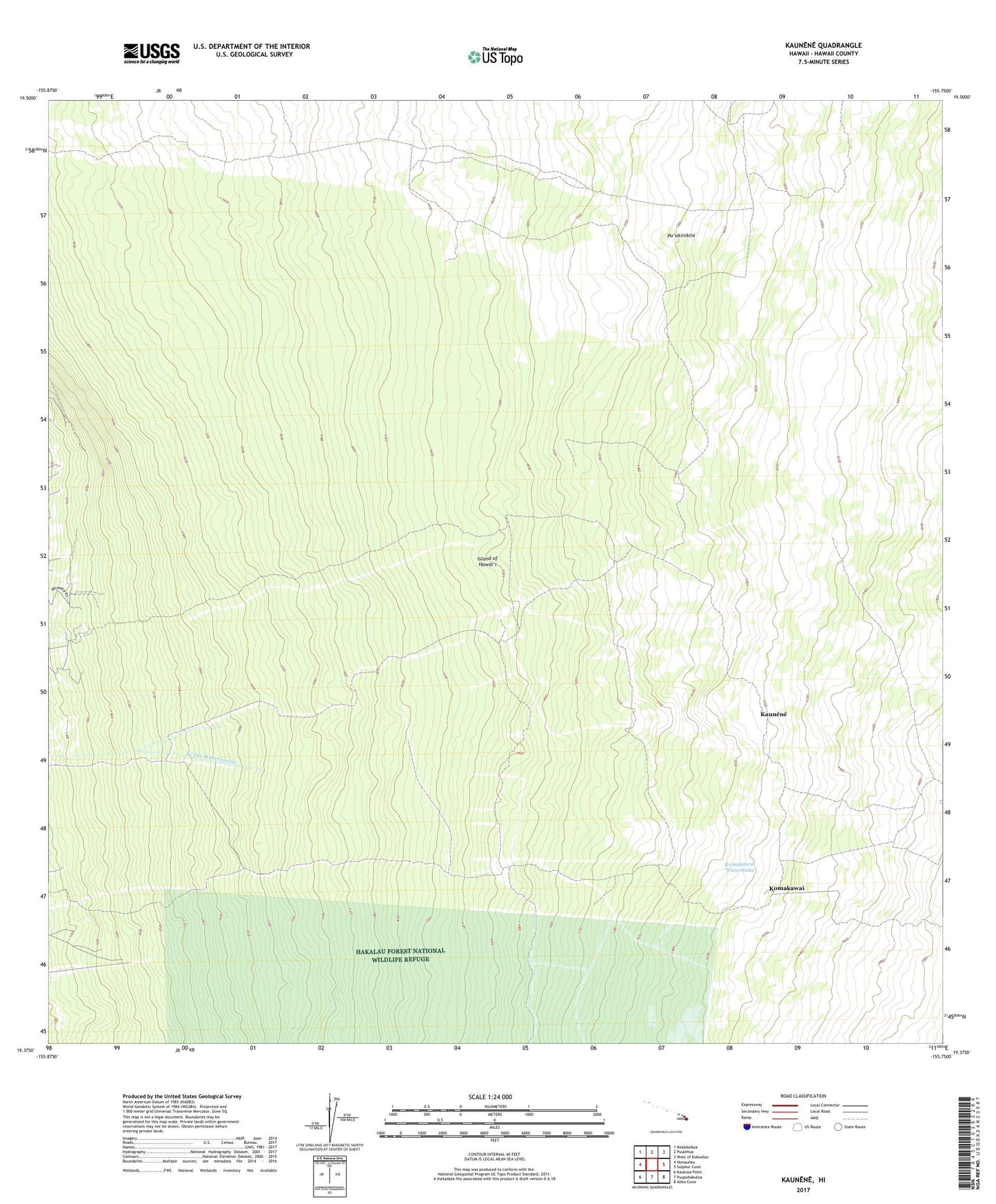
2024 topographic map quadrangle Kaunene in the state of Hawaii. Scale: 1:24000. Based on the newly updated USGS 7.5' US Topo map series, this map is in the following counties: Hawaii. The map contains contour data, water features, and other items you are used to seeing on USGS maps, but also has updated roads and other features. This is the next generation of topographic maps. Printed on high-quality waterproof paper with UV fade-resistant inks.
Quads adjacent to this one:
West: Honaunau
Northwest: Kealakekua
North: Puulehua
Northeast: West of Kokoolau
East: Sulphur Cone
Southeast: Alika Cone
South: Puupohakuloa
Southwest: Kauluoa Point
This map covers the same area as the classic USGS quad with code o19155d7.
Contains the following named places: Big Hill Camp, Gaspars Dairy, Hapu'u Camp, Honaunau, Honaunau Forest Reserve, Honaunau-Napoopoo Census Designated Place, Ho'okena, Kalahiki, Kaunene, Kealia, Kealia 1, Kealia 2, Keanapa'akai, Ke'ei 1-2, Keokea, Ki'ilae, Komakawai, Komakawai Waterholes, Pu'ukinikini, South Kona District, ZIP Code: 96726