MyTopo
Alika Cone Hawaii US Topo Map
Couldn't load pickup availability
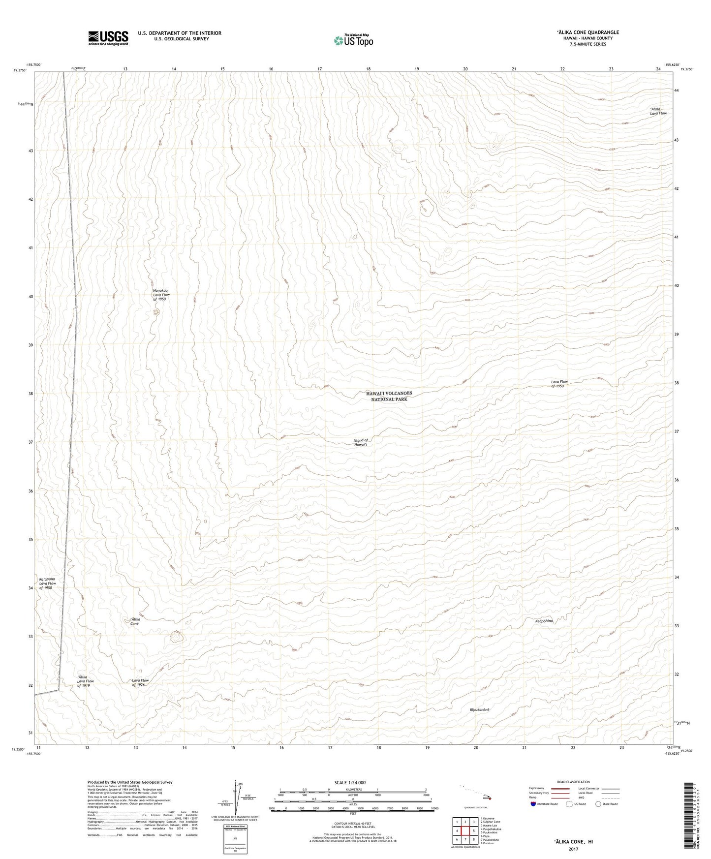
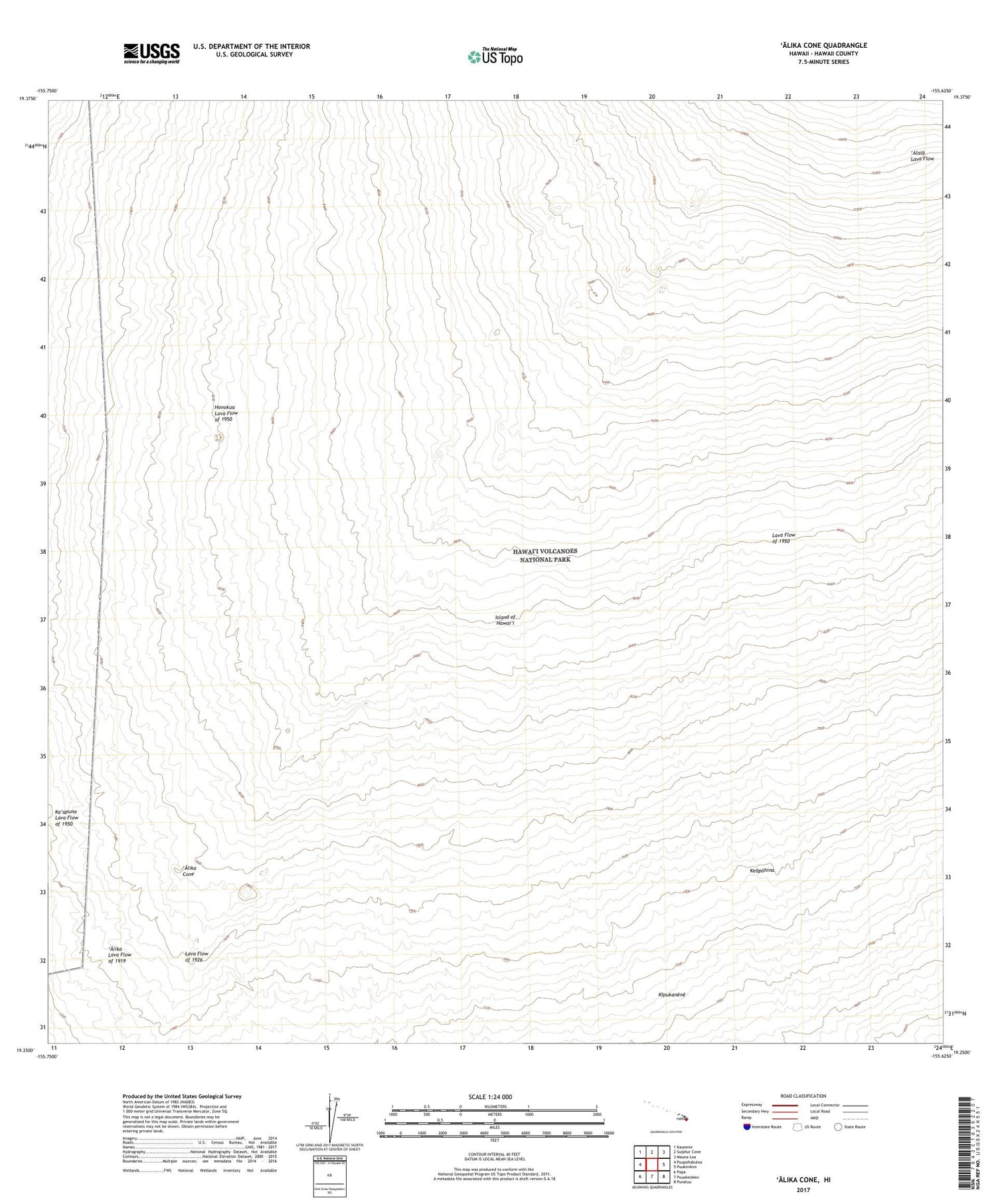
2024 topographic map quadrangle Alika Cone in the state of Hawaii. Scale: 1:24000. Based on the newly updated USGS 7.5' US Topo map series, this map is in the following counties: Hawaii. The map contains contour data, water features, and other items you are used to seeing on USGS maps, but also has updated roads and other features. This is the next generation of topographic maps. Printed on high-quality waterproof paper with UV fade-resistant inks.
Quads adjacent to this one:
West: Puupohakuloa
Northwest: Kaunene
North: Sulphur Cone
Northeast: Mauna Loa
East: Puukinikini
Southeast: Punaluu
South: Puuokeokeo
Southwest: Papa
This map covers the same area as the classic USGS quad with code o19155c6.
Contains the following named places: Alala Lava Flow, 'Alika Cone, Keapohina, Kipukanene, Lava Flow of 1950, Old Hawaiian Trail