
MyTopo
Appendicitis Hill Idaho US Topo Map
Couldn't load pickup availability
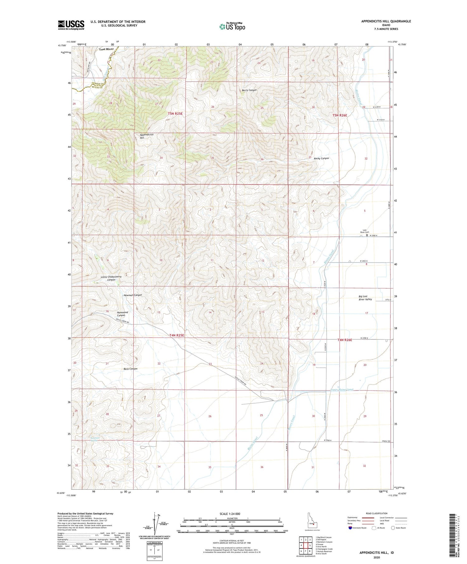
2023 topographic map quadrangle Appendicitis Hill in the state of Idaho. Scale: 1:24000. Based on the newly updated USGS 7.5' US Topo map series, this map is in the following counties: Butte, Custer. The map contains contour data, water features, and other items you are used to seeing on USGS maps, but also has updated roads and other features. This is the next generation of topographic maps. Printed on high-quality waterproof paper with UV fade-resistant inks.
Quads adjacent to this one:
West: Grouse
Northwest: Big Blind Canyon
North: Darlington
Northeast: Ramshorn Canyon
East: Arco North
Southeast: Arco South
South: Nichols Reservoir
Southwest: Champagne Creek
This map covers the same area as the classic USGS quad with code o43113f4.
Contains the following named places: Antelope Creek Access Area, Appendicitis Hill, Beck Canyon, Blaine Canal, Hammond Canyon, Little Chokecherry Canyon, Lost River Cemetery, Lower Blaine Canal, Moore Canal, Newman Canyon, Rocky Canyon, Sorenson Spring


