
MyTopo
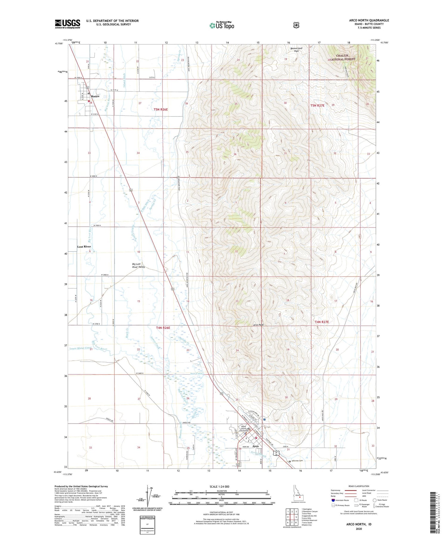
Arco North Idaho US Topo Map
Couldn't load pickup availability
Also explore the Arco North Forest Service Topo of this same quad for updated USFS data
2023 topographic map quadrangle Arco North in the state of Idaho. Scale: 1:24000. Based on the newly updated USGS 7.5' US Topo map series, this map is in the following counties: Butte. The map contains contour data, water features, and other items you are used to seeing on USGS maps, but also has updated roads and other features. This is the next generation of topographic maps. Printed on high-quality waterproof paper with UV fade-resistant inks.
Quads adjacent to this one:
West: Appendicitis Hill
Northwest: Darlington
North: Ramshorn Canyon
Northeast: Arco Pass
East: Arco Hills
Southeast: Butte City
South: Arco South
Southwest: Nichols Reservoir
This map covers the same area as the classic USGS quad with code o43113f3.
Contains the following named places: Arco, Arco Elementary School, Arco Fire Department Business Office, Arco Peak, Arco Post Office, Beaverland Pass, Big Lost River Valley, Bottolfsen Park, Boyle Creek, Butte County High School, Butte County Middle School, Butte County Sheriff's Office, City of Arco, City of Moore, East Side Ditch, Hillcrest Cemetery, Island Ditch, James Creek, Lost River, Lost River Fire Protection District, Lost Rivers Medical Center, Moore, Moore Post Office, Spring Creek


