MyTopo
Bear Trap Cave Idaho US Topo Map
Couldn't load pickup availability
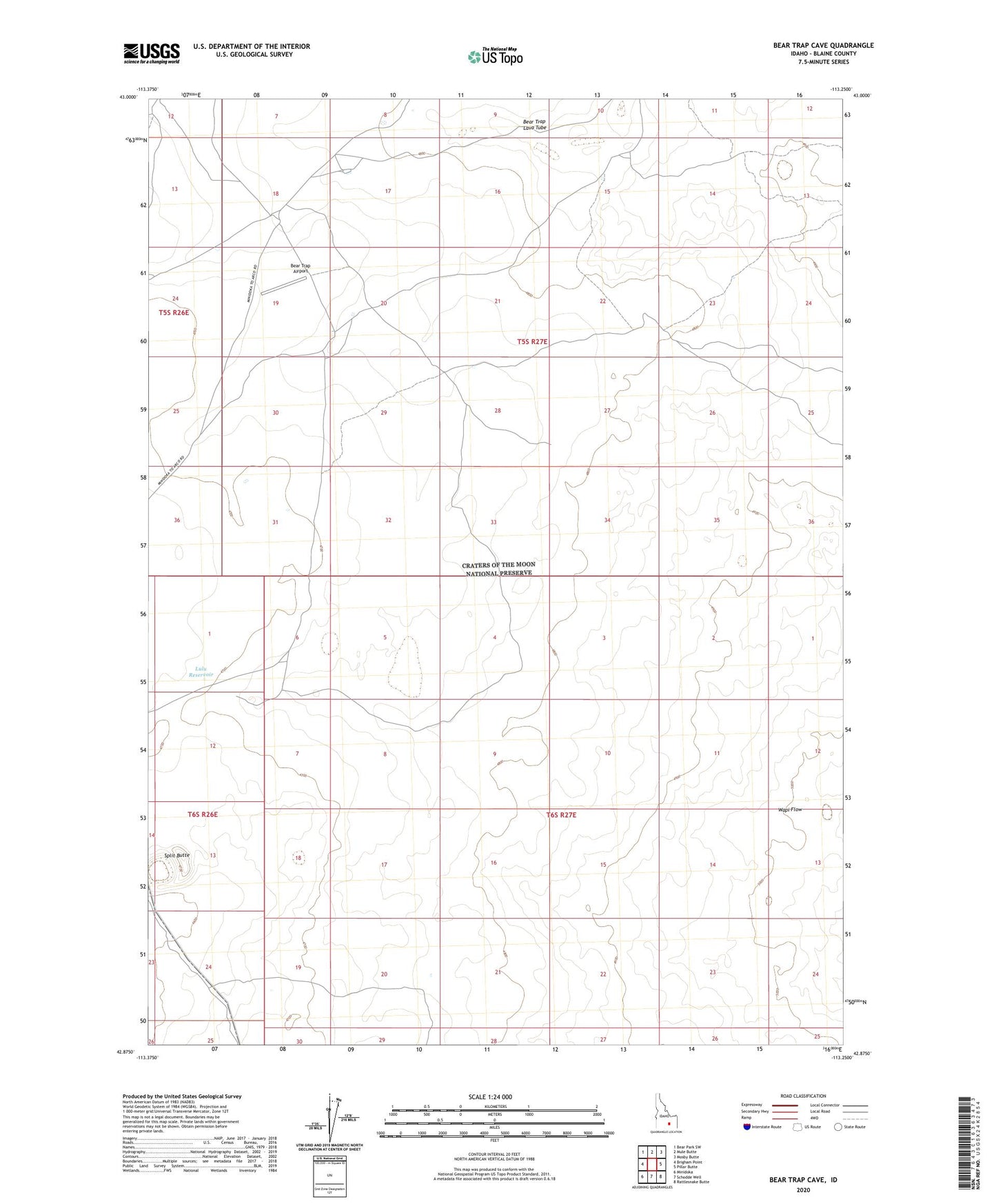
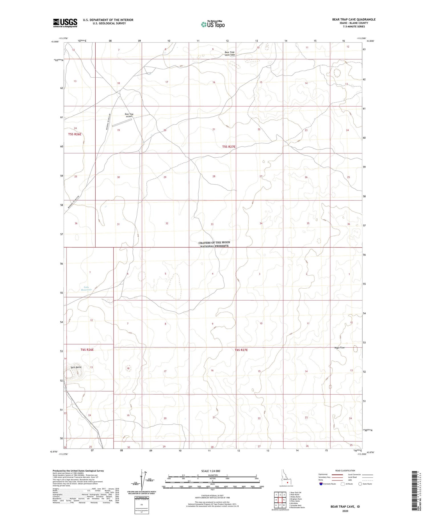
2023 topographic map quadrangle Bear Trap Cave in the state of Idaho. Scale: 1:24000. Based on the newly updated USGS 7.5' US Topo map series, this map is in the following counties: Blaine. The map contains contour data, water features, and other items you are used to seeing on USGS maps, but also has updated roads and other features. This is the next generation of topographic maps. Printed on high-quality waterproof paper with UV fade-resistant inks.
Quads adjacent to this one:
West: Brigham Point
Northwest: Bear Park SW
North: Mule Butte
Northeast: Mosby Butte
East: Pillar Butte
Southeast: Rattlesnake Butte
South: Schodde Well
Southwest: Minidoka
This map covers the same area as the classic USGS quad with code o42113h3.
Contains the following named places: Bear Trap Airport, Lulu Reservoir, Split Butte