MyTopo
Minidoka Idaho US Topo Map
Couldn't load pickup availability
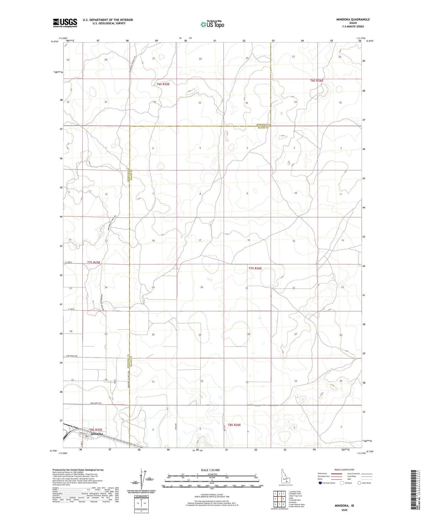
2023 topographic map quadrangle Minidoka in the state of Idaho. Scale: 1:24000. Based on the newly updated USGS 7.5' US Topo map series, this map is in the following counties: Blaine, Minidoka. The map contains contour data, water features, and other items you are used to seeing on USGS maps, but also has updated roads and other features. This is the next generation of topographic maps. Printed on high-quality waterproof paper with UV fade-resistant inks.
Quads adjacent to this one:
West: Max
Northwest: Larkspur Park
North: Brigham Point
Northeast: Bear Trap Cave
East: Schodde Well
Southeast: Lake Walcott East
South: Lake Walcott West
Southwest: Acequia
This map covers the same area as the classic USGS quad with code o42113g4.
Contains the following named places: City of Minidoka, Minidoka, Minidoka Post Office, Sikes Act Wildlife Habitat Area