
MyTopo
Blackbird Mountain Idaho US Topo Map
Couldn't load pickup availability
Also explore the Blackbird Mountain Forest Service Topo of this same quad for updated USFS data
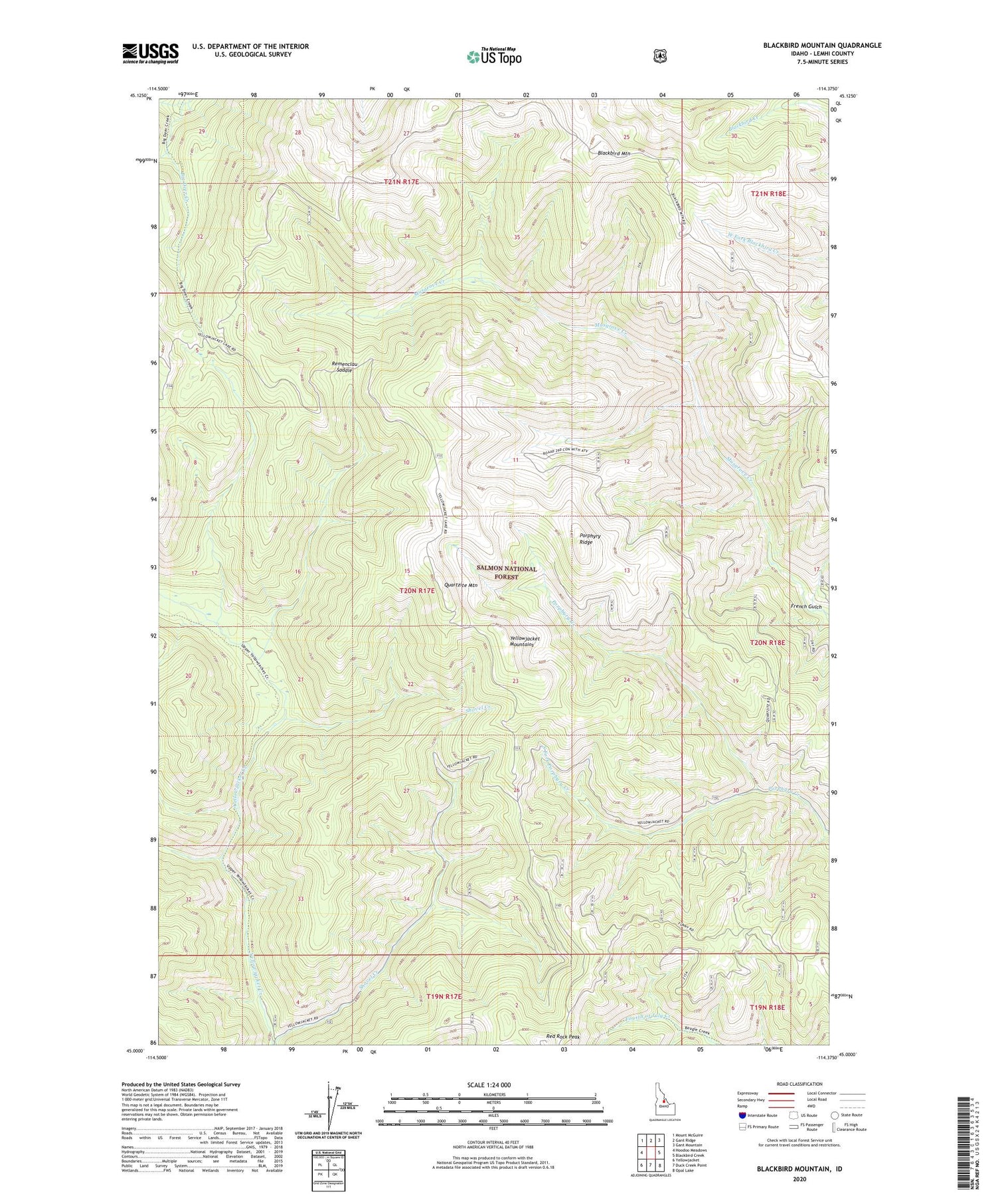
2024 topographic map quadrangle Blackbird Mountain in the state of Idaho. Scale: 1:24000. Based on the newly updated USGS 7.5' US Topo map series, this map is in the following counties: Lemhi. The map contains contour data, water features, and other items you are used to seeing on USGS maps, but also has updated roads and other features. This is the next generation of topographic maps. Printed on high-quality waterproof paper with UV fade-resistant inks.
Quads adjacent to this one:
West: Hoodoo Meadows
Northwest: Mount McGuire
North: Gant Ridge
Northeast: Gant Mountain
East: Blackbird Creek
Southeast: Opal Lake
South: Duck Creek Point
Southwest: Yellowjacket
This map covers the same area as the classic USGS quad with code o45114a4.
Contains the following named places: Blackbird Mountain, Forney Division, French Gulch, Meadow Creek, Porphyry Ridge, Quartzite Mountain, Red Rock Peak, Remenclau Saddle, Shovel Creek, South Fork Porphyry Creek, West Fork Yellowjacket Creek, Yellowjacket Ranger Station


