MyTopo
Bridge Idaho US Topo Map
Couldn't load pickup availability
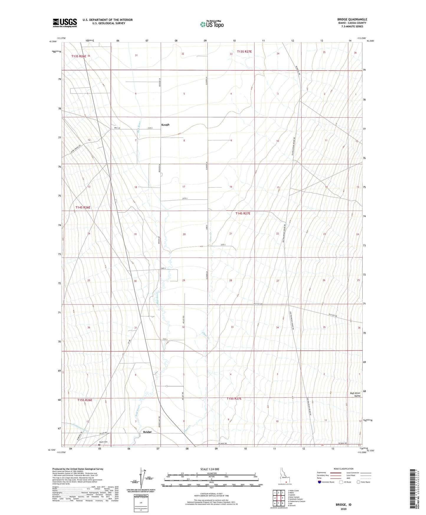
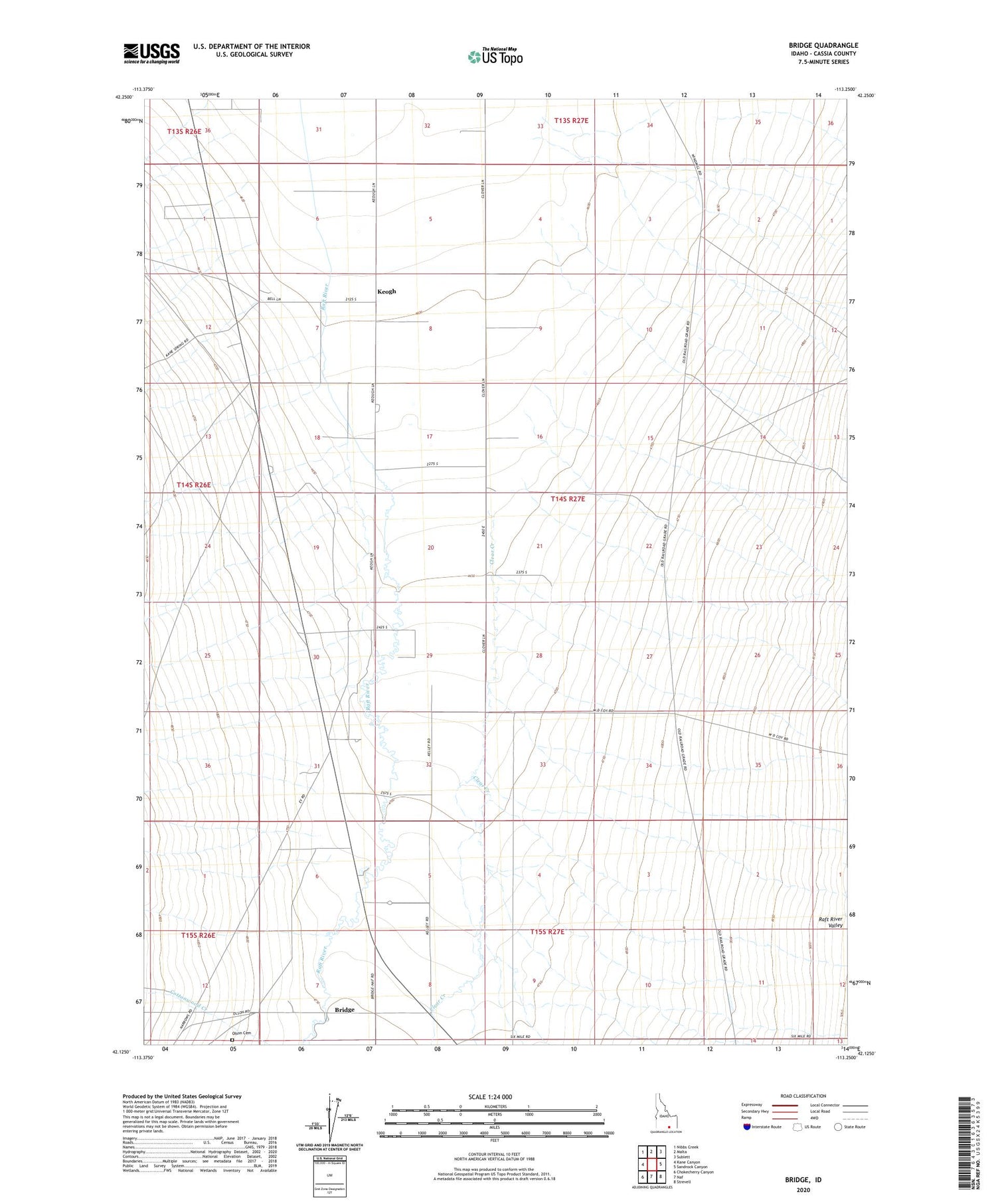
2023 topographic map quadrangle Bridge in the state of Idaho. Scale: 1:24000. Based on the newly updated USGS 7.5' US Topo map series, this map is in the following counties: Cassia. The map contains contour data, water features, and other items you are used to seeing on USGS maps, but also has updated roads and other features. This is the next generation of topographic maps. Printed on high-quality waterproof paper with UV fade-resistant inks.
Quads adjacent to this one:
West: Kane Canyon
Northwest: Nibbs Creek
North: Malta
Northeast: Sublett
East: Sandrock Canyon
Southeast: Strevell
South: Naf
Southwest: Chokecherry Canyon
This map covers the same area as the classic USGS quad with code o42113b3.
Contains the following named places: Bridge, Clear Creek, Cottonwood Creek, Keogh, Olson Cemetery, ZIP Code: 83342